Sanborn map, Oct. 1914. Library of Congress, Geography and Map Division, Sanborn Maps Collection
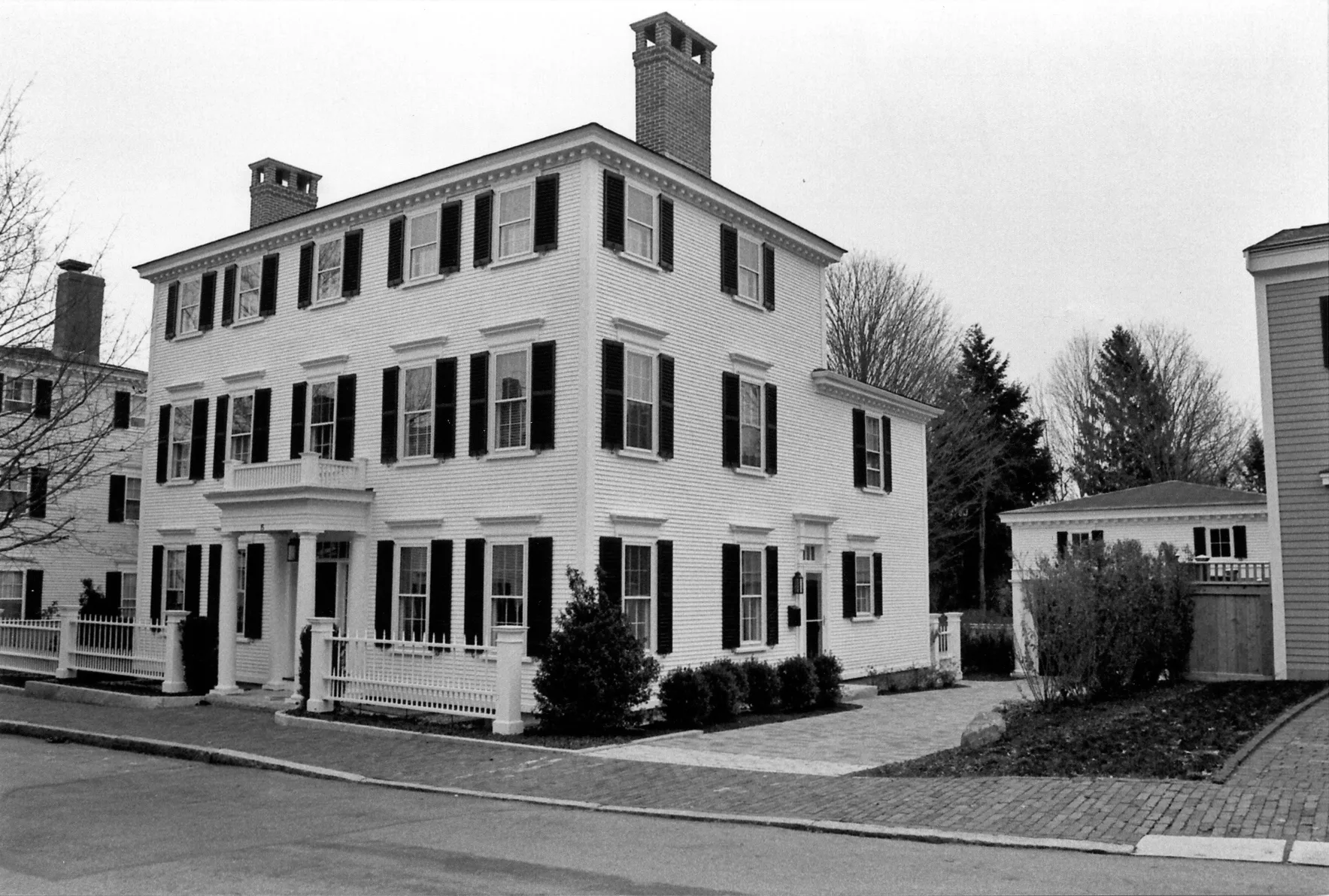
- Built, per inventory
- c. 1960
- Use, per inventory
- Single Family Dwelling House
- Neighborhood
- Ocean Mills District
- MACRIS
- NWB.1324 ↗
Not yet researched
Nobody has looked into this building for oldnbpt.com yet. What this page shows is the Massachusetts Historical Commission's inventory record, whose dates are estimates that cluster on round years; the map above places it on the newest fire-insurance map that covers its block.
Know something about this building: who built it, when, or what stood here before? Send a note to @newburyportarchitecture, or read the full inventory form at MACRIS ↗.
Planning work on this building?
Reviews that may apply
Newburyport Historic District (National Register, listed 1984), not contributing (built after 1930) in the 1984 nomination · Demolition Control Overlay District (DCOD) · Parcel 53-57 · Zone R2
Zoning Board of Appeals not involved
In the DCOD, but listed as an intrusion (built after 1930) in the 1984 nomination, so the DCOD special permit for demolition does not apply. The demolition delay ordinance still does, on the age test below.
Newburyport Historical Commission usually not involved
Built c. 1960, so under 75 years old until 2035. The demolition delay ordinance applies only if part of the building is 75 or more years old (100 for an accessory structure), it is listed on the National Register, or the Commission has designated it significant.
Code of Ordinances ch. 5 art. X, §§5-307–5-308 (June 2026) ↗
Zoning Administrator first stop
Every project starts with a zoning determination from the Zoning Administrator, which says which of these reviews apply and whether the work also needs zoning relief (a special permit for a non-conformity, or a variance). Fees, forms and filing deadlines are on the City’s site.
Not legal advice, not an official City publication, and not the position of the Historical Commission or any board. Says what the ordinances say as of September 30, 2026; the Zoning Administrator decides what applies. Boundaries: Merrimack Valley Planning Commission / City of Newburyport GIS (MIMAP); 1984 status from the National Register nomination's district data sheets. City's quick guide to the DCOD and demolition delay ↗ · Do I need approval? Project by project →
Researched houses built Since 1945
Sources
- Massachusetts Cultural Resource Information System, NWB.1324 (MassGIS copy of the inventory: name, date, style, use and location)