- Built
- c. 1890
- Style
- Gothic Revival Gothic Revival
- MACRIS
- NWB.1186 ↗
History
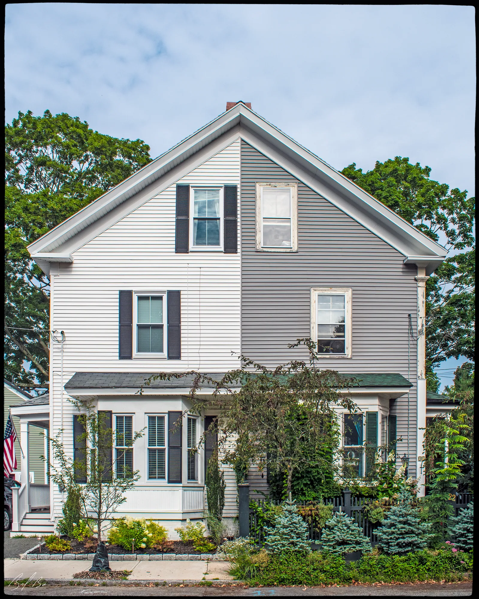
21 Chapel Street is a modest 1½-story wood-frame cottage that displays characteristics of late-19th-century vernacular housing in Newburyport’s West End. The dwelling rests on a brick foundation and is clad in wood clapboards with simple cornerboards. Its form is defined by a front-gabled main block with a steeply pitched roof and a small cross-gable on the side elevation. A jerkinhead, or clipped-gable, dormer projects from the side roof slope.
Windows are a notable, unifying decorative feature. All window openings are trimmed with broad flat casings with applied backband moldings and are surmounted by a consistent projecting hood mold with corbel stops.
Historical Narrative
In 1870, Susan A. Bray and Edward P. Bray conveyed a series of house lots bounded by Chapel, Maple, and Forrester Streets to Eliza A. Manuel. These lots correspond to those on a recorded plan prepared by Henry W. Moulton, a Newburyport land speculator active in the 1860s and 1870s.
Later in 1877, Manuel sold a set of these parcels to Edward P. Shaw. Shaw consolidated the land and, in 1889, formally laid out new building lots along Chapel and Magnolia Streets. Lot 6 of this plan became the site of the present house. By 1900, the dwelling was occupied by Frederick E. Condon and his family as renters. In 1903, Shaw conveyed Lot 6 to Condon, making him the first documented owner of the house after the subdivision. The 1910 Census shows the Condons occupied the property as owners under a mortgage, with Frederick employed as a coachman for a private family.
In 1924, Condon conveyed the property to George M. and Blanche W. Chrisenton. The property remained within the family for more than five decades. Blanche W. Chrisenton transferred the property to George M. Chrisenton, Jr., in 1979, and in 1983, George and Blanche conveyed it to Stephen H. and Dicsee B. Bridges. In 1985, the Bridges sold the property to Jeffrey E. Potter and Maureen M. A. Lake, who held it jointly with Steven M. Austerer; in 1987, Austerer acquired the entire interest in the property.
Planning work on this building?
Reviews that may apply
Newburyport Historic District (National Register, listed 1984) · Demolition Control Overlay District (DCOD) · Parcel 62-20-A/B · Zone R2
Zoning Board of Appeals may decide
In the DCOD. Whether removing more than 25% of the exterior walls needs a DCOD special permit depends on the building’s status in the 1984 National Register nomination, which this site has not matched for this lot yet; the Office of Planning and Development keeps the list.
Newburyport Historical Commission decides whether to impose a delay
Built c. 1890, so 75 or more years old: removing more than 25% of its exterior walls, changing the roofline (pitch, towers, cupolas, anything projecting above the roof), moving it, or adding a dormer that misses the setback and pitch rules is "demolition" under the demolition delay ordinance. The Commission holds a hearing within 30 days and may impose a delay of up to 18 months. Parts of the building documented as younger than 75 years are excluded on a written determination by the Zoning Administrator.
Code of Ordinances ch. 5 art. X, §§5-307–5-308 (June 2026) ↗
Zoning Administrator first stop
Every project starts with a zoning determination from the Zoning Administrator, which says which of these reviews apply and whether the work also needs zoning relief (a special permit for a non-conformity, or a variance). Fees, forms and filing deadlines are on the City’s site.
Not legal advice, not an official City publication, and not the position of the Historical Commission or any board. Says what the ordinances say as of September 30, 2026; the Zoning Administrator decides what applies. Boundaries: Merrimack Valley Planning Commission / City of Newburyport GIS (MIMAP); 1984 status from the National Register nomination's district data sheets. City's quick guide to the DCOD and demolition delay ↗ · Do I need approval? Project by project →
More photos
1 view · Biff Bouse
From the archive
4 items · maps, papers, old photographs
More built 1860–1900
Sources
- Massachusetts Cultural Resource Information System, NWB.1186
- “Newburyport, Essex County, Massachusetts.” Sanborn Map Company, Map. 1906.
- “Newburyport, Essex County, Massachusetts.” Sanborn Map Company, Map. 1914.
- Reverse Deed Search:
- 5/27/1987 – Essex South 8985/559
- Grantors: Jeffrey E. Potter, Maureen M.A. Lake, and Steven M. Austerer
- Grantee: Steven M. Austerer
- Note: Being Lot 6 on the Plan of Woodland Estate, owned by Edward P. Shaw, Newburyport, Mass., surveyed March 1889, J.M. Littlefield, Civil Engineer.
- 9/27/1985 – 7933/50
- Grantors: Stephen H. and Dicsee B. Bridges
- Grantees: Jeffrey E. Potter and Maureen M.A. Lake (husband and wife, joint tenants with right of survivorship), as tenants in common with Steven M. Austerer.
- 2/22/1983 – 7068/357
- Grantors: George and Blanche W. Chrisenton
- Grantees: Stephen H. and Dicsee B. Bridges
- 10/30/1979 – 6788/713
- Grantor: Blanche W. Chrisenton
- Grantee: George M. Chrisenton, Jr.
- 3/18/1924 – 2593/349
- Grantor: Frederick E. Condon
- Grantees: George M. and Blanche W. Chrisenton
- 4/3/1903 – 1715/515
- Grantor: Edward P. Shaw
- Grantee: Frederick E. Condon
- Description: A certain lot of land situated on Chapel and Magnolia Streets, being Lot 6 on the Plan of Woodland Estate, owned by Edward P. Shaw, Newburyport, Mass.
- 6/2/1877 – 978/19
- Grantor: Eliza A. Manuel
- Grantee: Edward P. Shaw
- Description: Multiple lots on Chapel Street as laid out on a plan offered for sale by Henry W. Moulton (Essex Deeds 668/221), including Lots 14, 15, 16, 18, 20, and 21, amounting to approximately 138.5 square rods. Part of the premises was conveyed to Manuel by Henry A. Folsom on May 5, 1877.
- 5/5/1877 – 978/17
- Grantor: Henry A. Folsom
- Grantee: Eliza A. Manuel
- Description: Lots bounded by Chapel, Maple, and Forrester Streets, as conveyed previously by Susan A. Bray and Edward P. Bray on 10/3/1870 (Essex Deeds 824/5).
- Includes Lots 14, 15, 16, 18, 20, 21, 33, 34, 35, and 36 on the plan recorded at Essex Deeds 668/221.
- Excludes one lot designated “No. 22,” containing 53 square rods with dwelling house and outbuildings, bounded westerly by Chapel Street, southerly by land of Henry W. Moulton, easterly by the Charles Wills estate, and northerly by land of Souli.
- 8/1/1872 – 863/9
- Grantor: Edward P. Bray
- Grantee: Eliza A. Manuel, wife of Cyrus Manuel
- Description: Lots bounded by Chapel, Maple, and Forrester Streets, as described in the Bray-to-Manuel deed of 10/3/1870 (Essex Deeds 824/5).
- 10/3/1870 – 824/5
- Grantors: Susan A. Bray and Edward P. Bray, of Elizabeth, New Jersey
- Grantee: Eliza A. Manuel, wife of Cyrus Manuel
- Consideration: $5,000
- Description: Lots on Chapel Street, Maple Street, and Forrester Street are shown on the plan recorded in Essex Deeds 668/221, including Lots 14, 15, and 16.
- Frederick Emerson Condon (1856-1935) Immigrated from Canada in 1885
- Honora Leary (1856 - ?) Born in County Cork, Ireland. Immigration to the United States in 1872.
- 1880 Census, Honora (Nora), 24, is living with her siblings and parents, Tim and Margaret Leary.
- 1900 Census, 21 Chapel Street: Frederick Condon (Blacksmith), 43; Nora, 43 (wife); Samuel, 15; Frederick, 13; Daniel, 11; Freman, 9; and Mary, 5. Owned or Rented: Rented.
- 1910 Census, 21 Chapel Street: Frederick Condon (Coachman for a Private Family), 53; Nora (wife), 53; Freeman (son), 17; Mary (daughter), 15; Ara (Father), 82. It says Frederick and Nora had 7 children, and 5 were living in 1910. Owned or Rented: Owned (Mortgage).