History
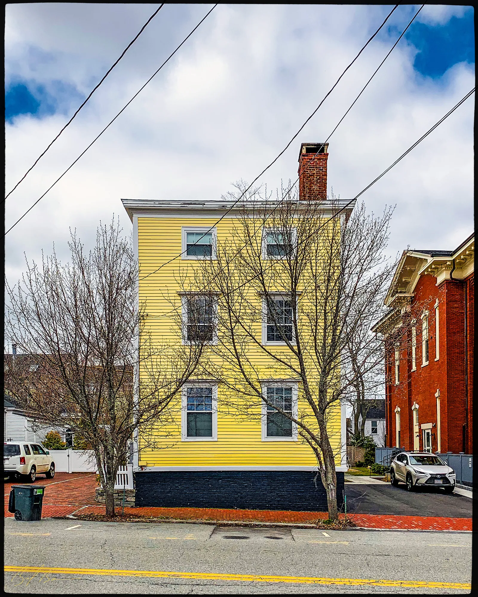
This house is an excellent example of the Federal-style single-family dwellings that proliferated in Newburyport in the early nineteenth century. The form of the house is typically Federal, of three stories with a hipped roof and decreasing window size in the upper stories.
The doorway does not exhibit the elements of the full-blown Federal style. Specifically, the fanlight over the door is missing. The entrance porch and entry are reminiscent of Georgian buildings built toward the end of the eighteenth century. The building has had several types of siding during the twentieth century. In the 1970s, asbestos siding was removed from the building, and the original clapboards were restored. In the spring of 1980, clapboards were again covered by aluminum siding and later vinyl siding.
This house was built during the most prosperous period in Newburyport's history. Although the original owner is unknown, it would be safe to assume that he was somehow associated with Newburyport's booming West India trade. In 1851, the house was owned by Jeremiah Carter. Carter was a butcher and operated his business in the Market House in Newburyport's Market Square. In 1872, the house was owned by Elipbalet Griffin, although he lived a block or so away at 275 High Street. Griffin had a dry goods store in Market Square during the 1850's. In 1886, he signed the articles of agreement to organize the Newburyport Society for the Relief of Aged Men. Griffin made several contributions to Society, including much land near the "Three Roads.” In 1896, Griffin constructed, at his expense, the foundation for a brick building for the Old Men's Home. Mr. Griffin died in 1899. The building was used as a rest home during the 1960s and has now been converted into an apartment building
Planning work on this building?
Reviews that may apply
Newburyport Historic District (National Register, listed 1984), contributing in the 1984 nomination · Demolition Control Overlay District (DCOD) · Parcel 56-16 · Zone R2
Zoning Board of Appeals decides
Listed as contributing in 1984, so removing more than 25% of its exterior walls, counted cumulatively since 2014 and including walls enclosed by an addition or openings filled in, needs a DCOD special permit; the Board may grant one only if the building retains no substantial remaining market value or reasonable use. The Historical Commission sends an advisory report. Replacing siding, or windows and doors in their openings, does not count.
Newburyport Historical Commission decides whether to impose a delay
Built c. 1800, so 75 or more years old: removing more than 25% of its exterior walls, changing the roofline (pitch, towers, cupolas, anything projecting above the roof), moving it, or adding a dormer that misses the setback and pitch rules is "demolition" under the demolition delay ordinance. The Commission holds a hearing within 30 days and may impose a delay of up to 18 months. In the DCOD the wall test goes to the Zoning Board instead; the Commission keeps roofline, roof pitch and dormer work. Parts of the building documented as younger than 75 years are excluded on a written determination by the Zoning Administrator.
Code of Ordinances ch. 5 art. X, §§5-307–5-308 (June 2026) ↗
Zoning Administrator first stop
Every project starts with a zoning determination from the Zoning Administrator, which says which of these reviews apply and whether the work also needs zoning relief (a special permit for a non-conformity, or a variance). Fees, forms and filing deadlines are on the City’s site.
Not legal advice, not an official City publication, and not the position of the Historical Commission or any board. Says what the ordinances say as of September 30, 2026; the Zoning Administrator decides what applies. Boundaries: Merrimack Valley Planning Commission / City of Newburyport GIS (MIMAP); 1984 status from the National Register nomination's district data sheets. City's quick guide to the DCOD and demolition delay ↗ · Do I need approval? Project by project →
From the archive
3 items · maps, papers, old photographs
More built 1775–1830
Sources
- Massachusetts Cultural Resource Information System, NWB.489
- McIntyre, H. (Henry). "Plan of Newburyport Mass. from an actual survey." Map. Philadelphia: H. McIntyre, 1851.
- Biff Bouse, Instagram post (@newburyportarchitecture), 2023-09-07
- 1914 Sanborn map, sheet 4 (Library of Congress, Geography and Map Division, Sanborn Maps Collection)