Walking tours · South End · 8 stops
Joppa: The Oldest Houses
A short, level loop of about a mile through the streets below Federal Street, where the first shipwrights and fishermen of the water side built their houses. Six of the eight stops are standing houses, most of them older than the town of Newburyport itself; the other two are a cotton mill of 1842 and the site of the biggest shipyard of the old South End, at the line where Joppa begins.
- Length
- About 1 mi, a loop
- Time
- About 40 min, with the reading
- Start and finish
- Federal Street at Water Street
Before you set off
Everything on this walk lies between two of the old lanes that ran from the country road, now High Street, down to the river: Chandler's lane, now Federal Street, and Cottle's lane, now Bromfield Street. John J. Currier's History of Newburyport, published in 1906, says that when Newburyport was set off from Newbury in 1764, "Cottle's lane, now Bromfield street, was made the southern limit of Newburyport," so these few blocks were the bottom end of the new town, and the fishing hamlet beyond the lane stayed in Newbury until 1851. Currier's History of Newbury of 1902 describes that hamlet: near the river between Rolfe's lane and Cottle's lane "the inhabitants of Newbury were mainly occupied in catching and curing fish, and that part of the town was called Joppa, and is still known by that name." Horace Hovey, in a discourse on the Old South meeting house in 1906, offers a guess at the name: the "New Lights" of the 1740s met for a while "at the house of one Simon by the sea-side," were nicknamed Joppaites, and the name may have stuck to the shore.
Sarah Anna Emery, who was born in 1787 and wrote her Reminiscences of a Nonagenarian at ninety, remembered Joppa as "an irregular collection of small low houses, forming the fishing hamlet of Joppa," where barefoot women in homespun helped carry the fish up from the wherries. Mrs. E. Vale Smith, walking down Water Street in her History of Newburyport of 1854, says "we find the shore lined with small boats and nets, which latter may often be seen drying in the sun," with fish-flakes on the vacant lots in late summer. But the streets you are about to walk were never only a fishing village. Emery says William Gerrish's shipyard reached from Bromfield Street back to Hancock Street, that Ralph Cross was building ships here by 1730, and that in the summer of 1766 seventy-two vessels were on the stocks along this river at once. The houses on this loop are the ones those men and their workmen lived in.
Numbers follow the walk. The line is the route along the streets, back to where you started.
Read it aloud as you go: each stop begins with where to walk and where to stand, then what the old histories say about the place. The sources are named as you read and listed in full at the end.
StartThe loop starts at the bottom of Federal Street, where it meets Water Street, a block in from the river and about half a mile downstream from Market Square. There is on-street parking along Water Street. Stand on the corner of Federal and Water Streets and look at the house on the corner, number 1 Federal Street. look: The pitched roof, and the spot where the inventory form says the chimney once stood in the centre of it.
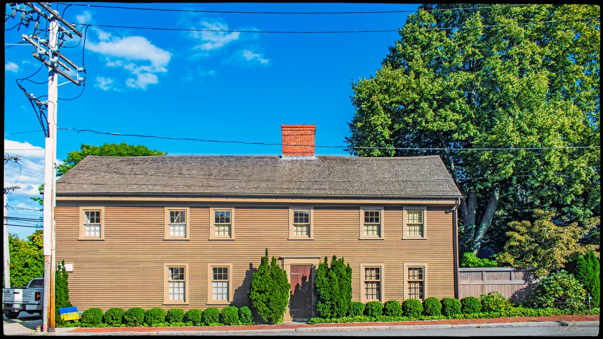
The state's historic inventory form calls this an old five-bay house, stretched with an addition on the left and much changed outside, and says the corner was a major crossroads for travellers of the day. It is one of the first corners in town. Currier's 1906 History says Chandler's lane, the street beside you, "was probably laid out by the inhabitants of Newbury as early as 1645," when the new town was settled along the river; it became King Street in 1726, and on March 10, 1789, the town "Voted that the street called and known by the name of King street be altered, and from and after this day be called and known by the name of Federal street."
Currier's History of Newbury puts an early fisherman here. In 1646 the freeholders granted Aquila Chase a house lot "on condition that he do goe to sea and do service in the towne with a boate for four years," and his house stood on the northeasterly corner of Chandler's lane and the way by the river, now Water Street. Before 1700, Currier adds, Daniel Pierce had malt-houses on the southeasterly corner and Caleb Moody built one on the northwesterly corner as early as 1673. Emery says the shipbuilder William Johnson, who died in 1741, left his homestead on the corner of Water and Federal Streets to his son Isaac, and the 1906 History says the frigate Boston was built for the state of Massachusetts in 1776 at the foot of this street, where Jonathan Greenleaf had been building small vessels. Which of those houses, if any, stood where number 1 stands now, the books do not say, and the inventory form names no first owner.
Sources: MACRIS inventory form · Currier, History of Newburyport, vol. 1 (1906), p. 336, p. 449 · Currier, History of Newbury (1902), p. 91, p. 261 · Emery, Reminiscences of a Nonagenarian (1879) · Coffin, Sketch of the History of Newbury (1845), p. 46
Walk · 240 yardsWalk the few steps down Federal Street to Water Street and turn right, downriver, with the river across the road on your left. After about 90 yards turn right into Ship Street and walk up it about 130 yards, about 250 yards in all. The house to find is the plain five-bay one with the massive chimney in the middle of its roof, numbers 20 and 22. look: The wooden shingles on the roof and the center chimney, both of which the inventory form says are original.
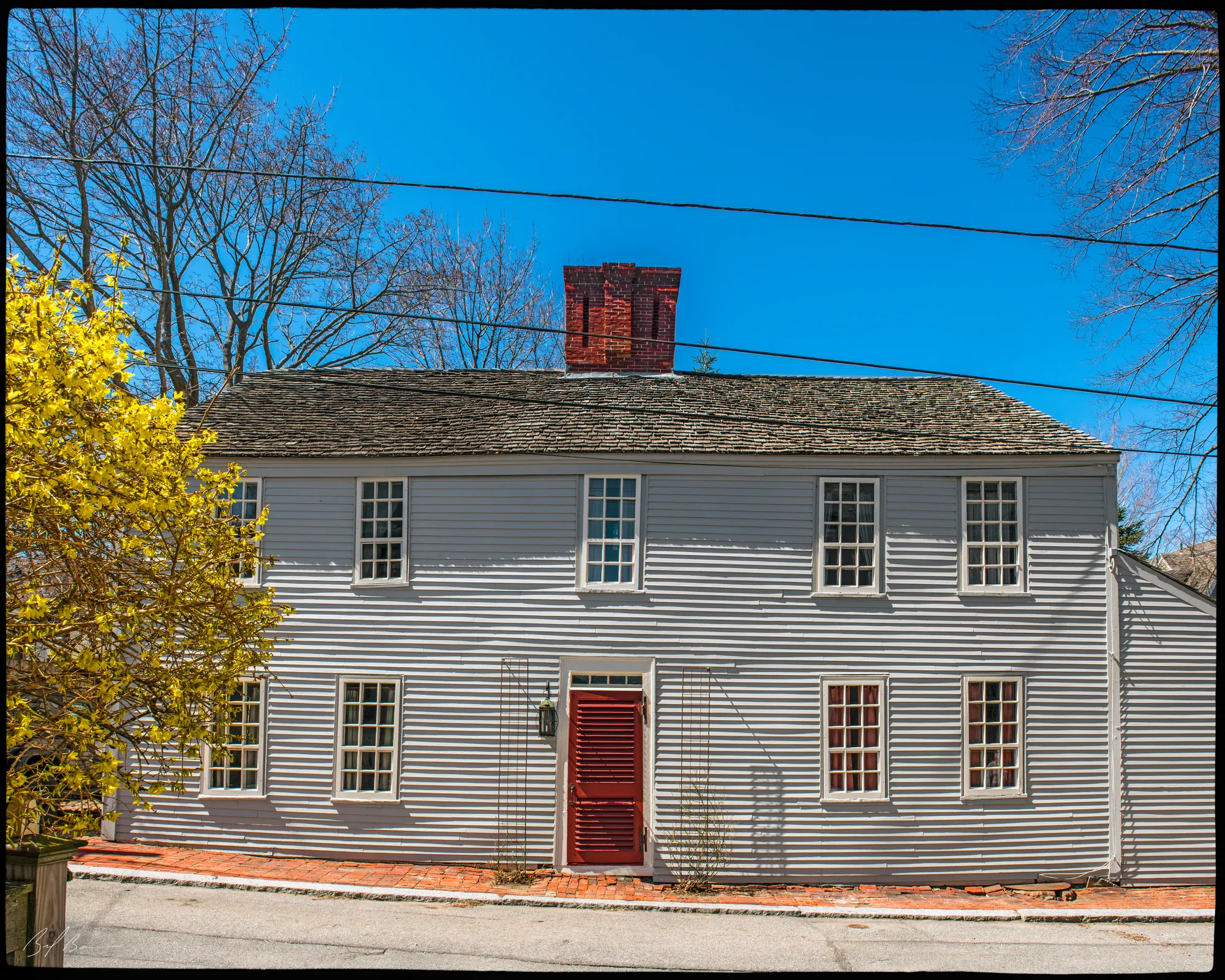
Currier's History of Newburyport says this was Pudding lane in 1775, running from Water Street up to Beck Street, "afterward called Ship lane, and is now known as Ship street," and the name is earned. Emery says Thomas Johnson, "amongst the earliest ship-builders on the Merrimack river," owned the yard at the bottom of the street and lived on the corner of Ship and Water Streets; William Johnson succeeded him, and in Emery's words "The ship carpenters were then one of the most influential classes in town, and William Johnson was at their head." When he died in 1741 he left the Ship Street house and half the yard to his son Eleazer. Currier's 1906 History carries the family's best story as a tradition. Eleazer Johnson told his workmen one day, "If any of you are ready to assist in an enterprise that requires courage and discretion, knock your adzes from their handles, shoulder the handles and follow me," and the ship-carpenters marched to the powder-house by Frog Pond, broke in, carried several hundred chests of tea to Market Square and burned them. Hurd's History of Essex County of 1888 calls the Johnson house near the foot of this street "probably the oldest on Water Street."
The inventory form dates this house to about 1750; its earliest known owners, from the 1851 plan, are John Porter and Mrs. Hannah Wyatt, who held number 20 until 1872. The second volume of Currier's History says Porter married Hannah Bartlet, daughter of the merchant William Bartlet, in 1811, and that Bartlet's brick mansion on Federal Street, with land running back to Beck and Ship Streets, came to her by his will. Mrs. Smith names Porter as treasurer of the Globe Steam Mill, and the inventory form thinks his half of this house was an investment: he lived on Federal Street, a garden away.
Sources: Currier, History of Newburyport, vol. 1 (1906), p. 354, p. 539 · Emery, Reminiscences of a Nonagenarian (1879), pp. 212–213 · Hurd, History of Essex County, vol. 2 (1888) · MACRIS inventory form · Currier, History of Newburyport, vol. 2 (1909), pp. 235–238 · Smith, History of Newburyport (1854), p. 287
Walk · 80 yardsContinue up Ship Street about 60 yards to the crossing with Beck Street and turn left. The steep-roofed house is only about 20 yards along, numbers 14 and 16. look: The pitch of the roof, far steeper than its neighbours', and the nine-over-six windows.
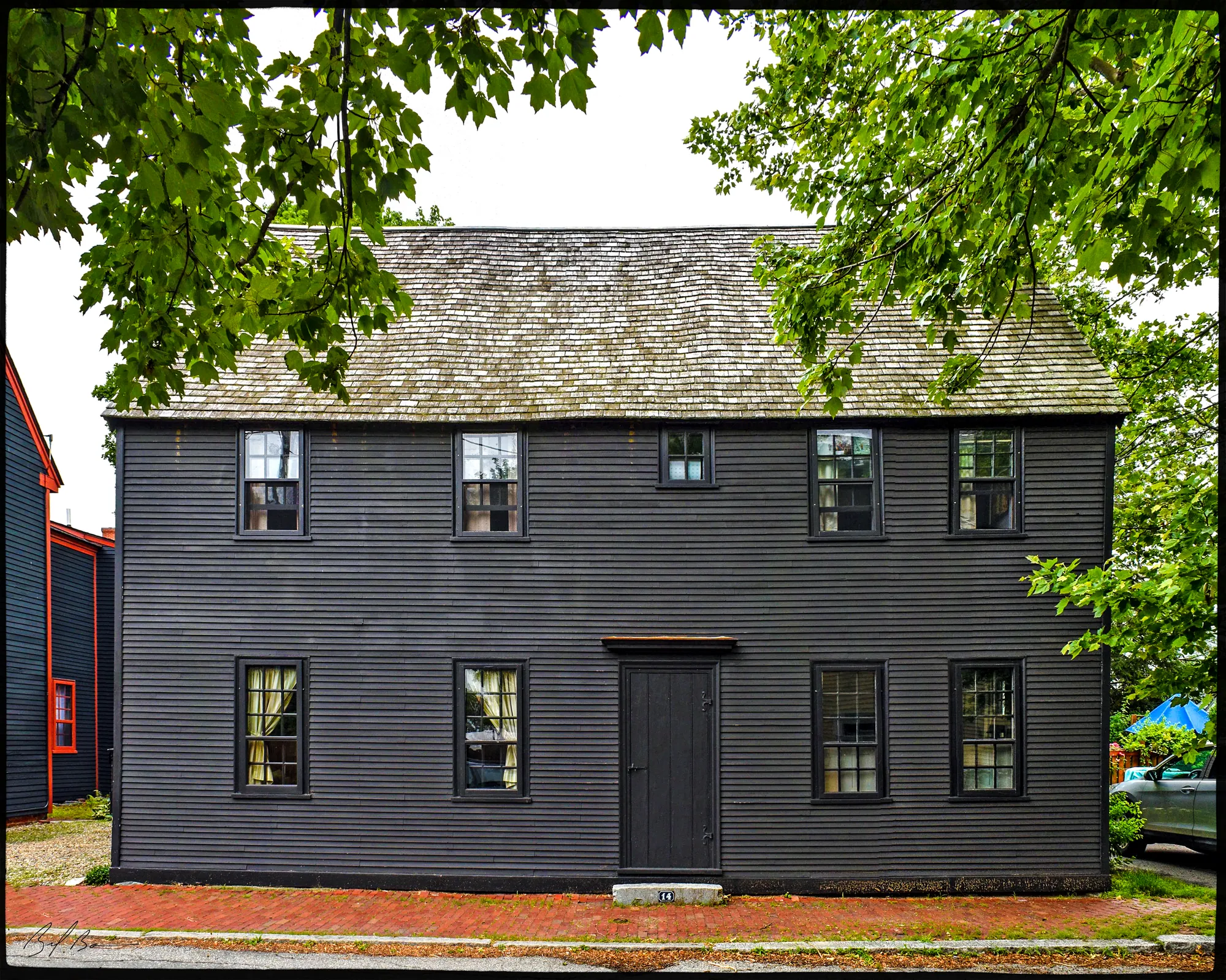
The state inventory form thinks this may be the oldest house on the walk. It dates the house to about 1725, but says the steep roof points to the early eighteenth or even the late seventeenth century, that the windows may once have been leaded casements, and that the house was brought up to date in the early Georgian years. The street is younger than the house. Currier's 1906 History says the town accepted a way from King Street to Pudding lane on March 9, 1775, a way "subsequently named Beck street," and that it was extended from Ship lane to Lime Street in 1796; the Old South's own Origin and Annals of 1896 says the street is named for Joshua Beck, who sold the church the land its meeting house stands on. Emery remembered a dingy brick chapel on the upper side of Beck Street where, in 1814, the Old South started one of the first Sunday schools in Massachusetts.
The owners come from the inventory form. Before 1851 the house belonged to the Todd family, and Elias Todd, a pump and block maker on Johnson's Wharf, lived here; Emery says that wharf is what became of the old Johnson shipyard at the foot of Ship Street, so Todd worked a few hundred feet from his door. By 1872 the house was William Todd's, of Todd and Brown, pump and block makers at 87 Water Street, though he boarded on Fair Street and another Todd probably lived here.
Sources: MACRIS inventory form · Currier, History of Newburyport, vol. 1 (1906), p. 354 · Origin and Annals of “The Old South” (1896), p. 171 · Emery, Reminiscences of a Nonagenarian (1879)
Walk · 150 yardsWalk on a few steps along Beck Street and turn left into Smith's Street, which runs back down toward the river. Follow it about 135 yards; the row of houses numbered 3 to 11 is on your way down.
Stop 4 · c. 1690
3–11 Smith's Street
The old histories have nothing to say about Smith's Street, so the state's inventory record is all we have on this one. It lists 3 to 11 Smith's Street as a multiple-family dwelling of about 1775, the year the town was accepting the little streets around it, and the whole street lies inside the Newburyport Historic District on the National Register. Take it as a sample of what the back streets of the South End looked like when the ship carpenters filled them.
Sources: MACRIS inventory form
Walk · 240 yardsCarry on down Smith's Street about 60 yards to Water Street and turn right, downriver again. After about 70 yards turn right into Lime Street and walk up it about 110 yards. The house is numbers 23 and 25.
Stop 5 · c. 1730
23–25 Lime Street
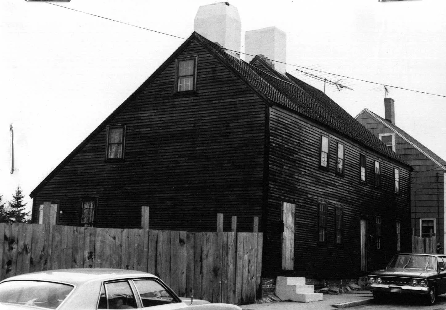
Charles Currier House
Photo: Massachusetts Historical Commission, MACRIS inventory
The inventory form dates this Colonial house to about 1730 and calls it the Charles Currier House, and that is all it says. The street, by Currier's 1906 History, was probably laid out soon after Newburyport was incorporated and was formally accepted from Milk Street to Water Street on October 12, 1797, so the house is older than the street it stands on. What makes the corner interesting is the shipyard that stood at the foot of it. Currier's "Ould Newbury," published in 1896, says Ralph Cross came to Newbury about 1728, bought land at the foot of Lime Street and set up as a shipbuilder, and that "His house was on the lower side of Water Street adjoining his building-yard." Elsewhere in the same book Currier cites the deed of April 7, 1733, by which Cross bought the lot on the river from the Mirricks of Nantucket. Cross died on January 4, 1788, at eighty-two, and is buried on Old Hill; his sons Stephen and Ralph took a yard of their own at the foot of Federal Street, where, the 1906 History says, they built the frigates Hancock in 1776 and Protector in 1779. After the old man's death, "Ould Newbury" says, Jacob Tucker, Elias Cook and others kept the Lime Street yard going for twenty-five or thirty years; by 1896 two small houses and Isaac Poor's grocery stood on its Water Street front.
Emery adds two neighbours. She says Dr. Humphrey Bradstreet built the second house ever put up at the water side, on the upper corner of Water and Lime Streets, by her day a store; and among the handsome houses of her girlhood she places Captain John Coombs on the corner of Water and Lime, with the Atwood house up at the corner of Atwood Street.
Sources: MACRIS inventory form · Currier, History of Newburyport, vol. 1 (1906), pp. 335–336, p. 449 · Currier, “Ould Newbury” (1896), ch. "Old Ship-Yards" · Currier, “Ould Newbury” (1896), p. 494 · Emery, Reminiscences of a Nonagenarian (1879)
Walk · 250 yardsGo back down Lime Street to Water Street, about 110 yards, and turn right. After about 65 yards turn right into Charles Street. The long brick mill filling the block between Charles and Salem Streets is the James Steam Mill, 1 Charles Street; stop about 75 yards up, where you can see the stair towers. look: The two stair and water towers on the main mill; the inventory form says the weather vane on one of them is made as a train of gears.
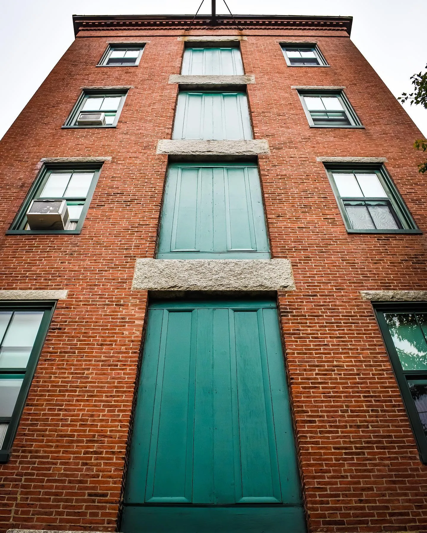
This is the only textile mill left standing in Newburyport, and it was a sensation when it opened. The second volume of Currier's History says Philip Johnson, Mark Symonds, Robert Bayley and Charles T. James were incorporated as the James Steam Mills on January 28, 1842, to make cotton cloth, and that "A four-story brick factory was erected between Charles and Salem streets, on land extending to Water street." Mrs. Smith, writing while it was new, gives the figures: 312 feet long, 17,000 spindles and 356 looms, two million yards of fine sheetings and shirtings a year, and "number of hands employed, 325, of whom two-thirds are females." The money, she says, came mostly from the south end of town, the heirs of William Bartlet taking half the first subscription. Before the looms went into the upper floors the weave room was the biggest hall in town, and she says Daniel Webster spoke to the citizens there before the election of November 1844, in a room that could seat five thousand. The 1902 History of Newbury describes the pipe laid in 1846 from a pond out on the turnpike, down State, High, Federal and Purchase Streets to Charles Street, sixty-four hundred feet of iron to feed the boilers.
Currier's second volume follows the owners: the company was dissolved in 1869, the property went to the Masconomet Mills in 1871 and became the Victoria Mills in 1876, making corset jeans, sateens and brown sheetings until 1897. The inventory form carries it on through the Bay State Cotton Corporation from 1907, the shutdown of the 1930s and apartments since 1984, and names the picker house, the boiler house of the 1880s and the storehouse of about 1890. Charles Street has one more story: Currier says the Old South's brick chapel from Beck Street was bought by the Catholics of the town in 1843 and moved to a lot here, their first church until the one on Green Street was built.
Sources: MACRIS inventory form · Currier, History of Newburyport, vol. 2 (1909), p. 151 · Smith, History of Newburyport (1854), p. 286 · Currier, History of Newburyport, vol. 1 (1906), p. 299, p. 436 · Currier, History of Newbury (1902), p. 303 · Origin and Annals of “The Old South” (1896), p. 53
Walk · 210 yardsWalk back down Charles Street to Water Street, about 80 yards, and turn right. Follow Water Street downriver for about 130 yards, with the river on your left, and stop just short of Bromfield Street, where the railroad later crossed Water Street. The river side here was the Gerrish yard.
Stop 7 · Lost
Gerrish Shipyard
Our own research for this site places here the shipyard of William Gerrish, who lived from 1730 to 1801 and was the wealthiest shipbuilder in eighteenth-century Joppa; nothing of the yard is left. The histories agree on the ground. Currier's "Ould Newbury" says, "At the foot of Bromfield Street, extending from Merrimack River to Hancock Street, was the yard where Mr. William Gerrish carried on the business of ship-building for many years," and Emery, remembering the yards of her girlhood, says "Mr. William Gerrish had an extensive yard reaching from South, now Bromfield street, to Somerby's court, and from the river back to Hancock street." That is a big piece of land, four blocks deep. Hurd's History of Essex County names Ralph Cross and William Gerrish as the leading builders before the Revolution, and Mrs. Smith heads her list of the port's other builders with William Gerrish. "Ould Newbury" says the next yard downstream, between Bromfield and Franklin Streets, was worked at the start of the nineteenth century by Coker, Atkinson, Hunt and Pierce.
The railroad came late. Currier's 1906 History says the Newburyport City Railroad was chartered in 1869 to run from the Eastern Railroad to tide water on this bank, was finished in July 1872 and leased to the Eastern; and that in 1873 the city was allowed to discontinue the old public landing places between the middle ship-yard and the lower end of Bromfield Street, which were filled with gravel and became part of its road-bed. The water side of this stop is that fill. Across Bromfield Street, Currier's History of Newbury says, began Joppa proper, the part of Newbury where the people lived by "catching and curing fish."
Sources: oldnbpt.com research · Currier, “Ould Newbury” (1896), ch. "Old Ship-Yards" · Emery, Reminiscences of a Nonagenarian (1879), p. 225 · Hurd, History of Essex County, vol. 2 (1888) · Smith, History of Newburyport (1854) · Currier, History of Newburyport, vol. 1 (1906), p. 365, p. 404 · Currier, History of Newbury (1902), p. 492
Walk · 100 yardsContinue along Water Street about 60 yards to Bromfield Street and turn right, away from the river. The house is about 40 yards up, number 8. look: The Georgian window sash that replaced the original casements; the inventory form says a fragment of one casement survives with the owner.
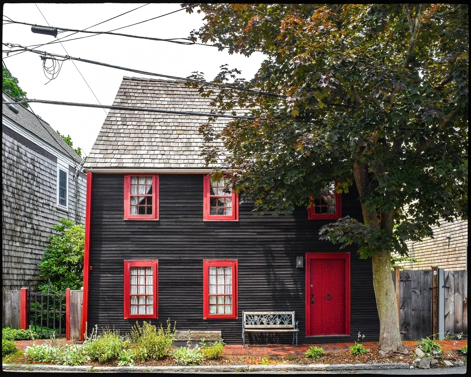
The state inventory form rates this a well-preserved First Period house, dated between 1670 and 1720 from its frame, with an exceptional scarf joint and a nine-foot kitchen fireplace. Currier's History of Newbury says Cottle's lane was laid out by the selectmen on March 6, 1718-19, "from High street, by Ezra Cottle's dwelling-house, to the dwelling-house of Joseph Knight, jr., on the highway near Merrimack river." In 1764 its easterly side became the town line and Newburyport called it South Street; the 1906 History says the city renamed it in 1852 for John Bromfield, who by his will "gave ten thousand dollars to the inhabitants of Newburyport, the income to be used for the purchase of shade trees and the improvement of sidewalks." Its most famous resident was a fortune teller: Emery says Madam Hooper came about 1760, kept a dame school at the south end and then told fortunes at her home on Cottle's lane, and Currier's second volume prints her death notice of 1798, "for many years a terror to weak and superstitious minds, who honored her with the appellation of witch." Where on the lane she lived, nobody says.
The first owner is not known. The inventory form takes the heirs of E. Pierce from the 1851 plan and identifies him as Enoch Pierce, who served under Ezra Lunt in the Revolution at twenty and claimed for the brig Minerva, taken by French privateers in 1798; by 1872 it was Captain Joseph Howard's, who kept a fish market on Huse Wharf. Currier's 1906 History bears this out: Enoch Pierce is a private on his roll of Ezra Lunt's company of 1775, and a claimant for the brig Minerva, valued at $3,424, in his table of French spoliation claims. Caleb Cushing's history of 1826 names an Enoch Pierce as captain of the Newburyport Artillery Company; whether that is the soldier of 1775 grown old or a son of the same name, the books do not say.
Sources: MACRIS inventory form · Currier, History of Newbury (1902), p. 426 · Currier, History of Newburyport, vol. 1 (1906), p. 335, p. 240, p. 546 · Emery, Reminiscences of a Nonagenarian (1879) · Currier, History of Newburyport, vol. 2 (1909), pp. 438–439 · Cushing, History and Present State of Newburyport (1826)
Back to the start · 550 yardsWalk back down Bromfield Street to Water Street, about 45 yards, and turn left. Follow Water Street upriver, with the river now on your right, for about a quarter of a mile, past Charles, Lime, Smith's and Ship Streets, and turn left into Federal Street; the corner where you started is about 550 yards from the house.
As you go back along Water Street, remember that this was the busy road of the eighteenth-century town. Emery says the wharves grew year after year down the river from the ship yards to Joppa until they made a continuous line, and Currier's History of Newburyport says the public landing places along this stretch were only given up in 1873. Most of the houses on the loop, by the inventory forms, were already standing when the yards at the foot of Lime, Ship and Federal Streets were building frigates for the Revolution; they are the houses the water side was made of.
Sources for this walk
The script paraphrases and quotes these works, all of them out of copyright, and names each one as it goes. Page numbers are from the editions linked here. Where the script says “our research for this site,” the facts are from the building page it links to.
- John J. Currier, History of Newburyport, Mass., 1764–1905, vol. 1 (Newburyport: the author, 1906). archive.org/details/historyofnewbury01curr
- John J. Currier, History of Newburyport, Mass., 1764–1905, vol. 2 (Newburyport: the author, 1909). archive.org/details/historyofnewbury04curr
- John J. Currier, “Ould Newbury”: Historical and Biographical Sketches (Boston: Damrell & Upham, 1896). archive.org/details/ouldnewburyhisto00curr
- John J. Currier, History of Newbury, Mass., 1635–1902 (Boston: Damrell & Upham, 1902). archive.org/details/historyofnewbury1902curr
- Joshua Coffin, A Sketch of the History of Newbury, Newburyport, and West Newbury, from 1635 to 1845 (Boston: Samuel G. Drake, 1845). archive.org/details/sketchofhistoryo00coff_0
- E. Vale Smith, History of Newburyport; from the Earliest Settlement of the Country to the Present Time (Newburyport, 1854). archive.org/details/historyofnewbury00blake
- Sarah Anna Emery, Reminiscences of a Nonagenarian (Newburyport: William H. Huse, 1879). archive.org/details/reminiscencesofn00emer
- Caleb Cushing, The History and Present State of the Town of Newburyport (Newburyport: E. W. Allen, 1826). archive.org/details/historypresentst00cush
- First Presbyterian Church, Origin and Annals of “The Old South,” First Presbyterian Church and Parish, in Newburyport, Mass., 1746–1896 (Boston: Damrell & Upham, 1896). archive.org/details/originannalsofth00firs
- D. Hamilton Hurd, comp., History of Essex County, Massachusetts, vol. 2 (Philadelphia: J. W. Lewis & Co., 1888). archive.org/details/historyofessexco02hurd
- Massachusetts Historical Commission, Massachusetts Cultural Resource Information System (MACRIS), Newburyport inventory forms. mhc-macris.net
- Biff Bouse, oldnbpt.com building pages (own research from deeds, Sanborn maps and newspapers). oldnbpt.com
More walks: State Street and Market Square · Green Street, Brown Square and Pleasant Street · High Street: Down Along and the Ridge · Federal, Spring and Middle Streets · The Water Street Waterfront · Joppa: The Fishing Village · Along the River: The North End Shipyards · The Rail Trail: Mills, Ropewalks and Old Hill · Newburyport in the Civil War · Churchyards and Burying Grounds