Walking tours · South of State Street · 36 stops
Federal, Spring and Middle Streets
A loop through the close-packed streets just south of State Street, where the shipmasters and merchants of the 1790s built their brick and clapboard houses a block back from the wharves. The walk takes in the Old South meeting house of 1756, the birthplace of William Lloyd Garrison, the houses of the Johnson shipbuilding family and of Colonel Edward Wigglesworth, and the church where Frederick Douglass spoke in 1841; about a mile and a half, mostly level, with thirty-six stops.
- Length
- About 1.5 mi, a loop
- Time
- About 110 min, with the reading
- Start and finish
- Middle Street at State Street
Before you set off
The spine of this walk is Federal Street, and it is older than the town. John J. Currier's History of Newburyport, published in 1906, says that “Chandler's lane, extending from High street to Merrimack river, was probably laid out by the inhabitants of Newbury as early as 1645.” Newbury renamed it King Street in 1726, and on March 10, 1789, the year the Constitution went into effect, Newburyport voted that it “be called and known by the name of Federal street.” The side streets came one by one as the water-side filled up: Currier's chapter on the streets dates Middle Street to a two-rod lane laid down by four landowners in 1724, Temple Street to 1774, Fair Street to 1782, Orange Street to 1783, Essex Street to 1796, Spring Street to 1797 and Milk Street to 1802. The foot of Federal Street was the town's first shipyard. Sarah Anna Emery, who was born in 1787 and wrote her Reminiscences of a Nonagenarian at ninety, says that “my great-grandfather Johnson's father had a shipyard as early as 1695, near the bottom of Chandler's lane, now Federal street, and the business was continued in the Johnson family for two or three generations.” The Johnsons' houses are still on the street, and so is the meeting house where George Whitefield was buried in 1770.
Two things shaped what you will see. Mrs. E. Vale Smith's History of Newburyport of 1854 says that in the great fire of May 1811 the flames reached Essex Street and then, “in Middle street, gathering fresh strength, the devouring element marched with giant strides the whole length of the street to Fair, on the north-east side,” which is why the lower end of Middle Street is brick. And Emery, remembering the town of her girlhood, lists the people who lived here: “Captains Eleazer and William P. Johnson, William Coombs, and William Bartlett, esq., occupied handsome houses on Federal street.”
Numbers follow the walk. The line is the route along the streets, back to where you started.
Read it aloud as you go: each stop begins with where to walk and where to stand, then what the old histories say about the place. The sources are named as you read and listed in full at the end.
StartThe loop begins at the corner of State and Middle Streets, a block below the Institution for Savings and about halfway between Market Square and High Street; there is on-street parking on State Street and public lots off Green Street and in Market Square. Walk down Middle Street, away from State Street, for about 100 yards. The three-storey brick building on your left, the river side of the street, is number 23. Stop on the opposite sidewalk so you can see the whole front. look: The doorway: a pediment over a semicircular fanlight, which the inventory form suspects is a later addition to a plain, partly commercial building.
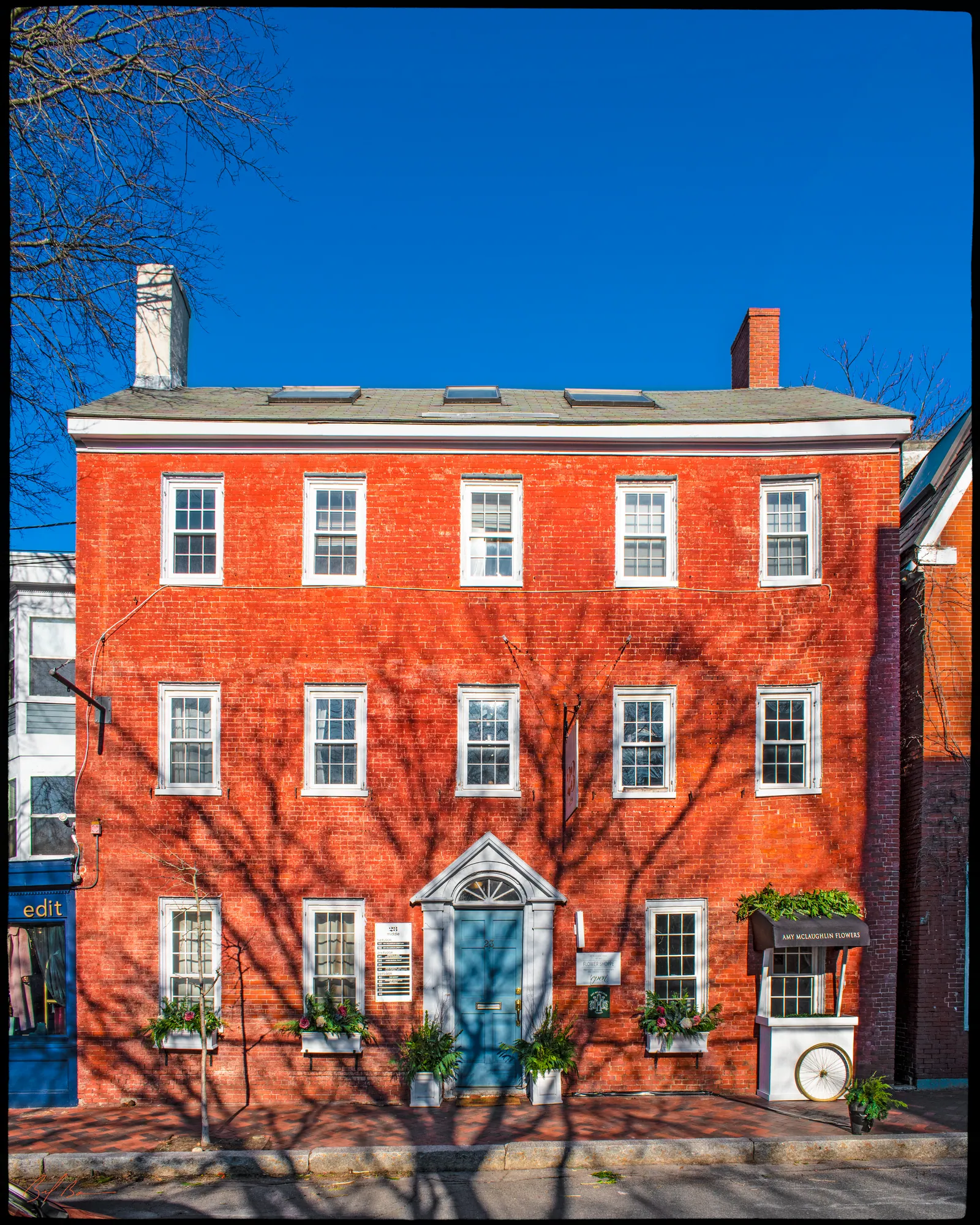
Everything you are standing among was burned in 1811. Currier's History of 1906 says the fire of May 31 destroyed nearly two hundred and fifty shops and houses “between State and Fair streets, and Middle street and Merrimack river,” and Mrs. Smith's account has it marching down Middle Street to Fair Street on this side. The state inventory form dates this building to about 1815 and says it resembles the brick blocks put up in Market Square after the fire, with a form that suggests part of it was built for business. The form's earliest named owner is Atkinson Stanwood, who lived here in 1851 and ran a soap and candle factory on Liberty Street. Currier's History knows him as a ship owner: he was one of the Newburyport part-owners of the schooner Enchantress, taken by the Confederate cruiser Jeff Davis in July 1861, who were paid for her loss under the Alabama claims. The inventory form adds that by 1872 the building belonged to Daniel C. Rogers, Stanwood's partner's partner, who may have kept the soap business going here. Middle Street itself, Currier's “Ould Newbury” of 1896 says, was the lane laid out in 1724 from Fish Street, now State Street, to Chandler's lane: “This lane is now known as Middle Street, extending from the foot of State Street to Federal Street.”
Sources: Currier, History of Newburyport, vol. 1 (1906), pp. 152, 235 · Smith, History of Newburyport (1854), p. 185 · Currier, “Ould Newbury” (1896), p. 629 · MACRIS inventory form
Walk · 140 yardsCarry on down Middle Street about 140 yards, keeping to the right-hand side. Just past Fair Street, which comes in from both sides, the two-storey clapboard house on your right, standing at an angle to the street, is number 62. look: The house is not square to Middle Street: the inventory form says the old maps show it facing the point where Fair and Middle Streets meet, as if it were built before the street was straightened.
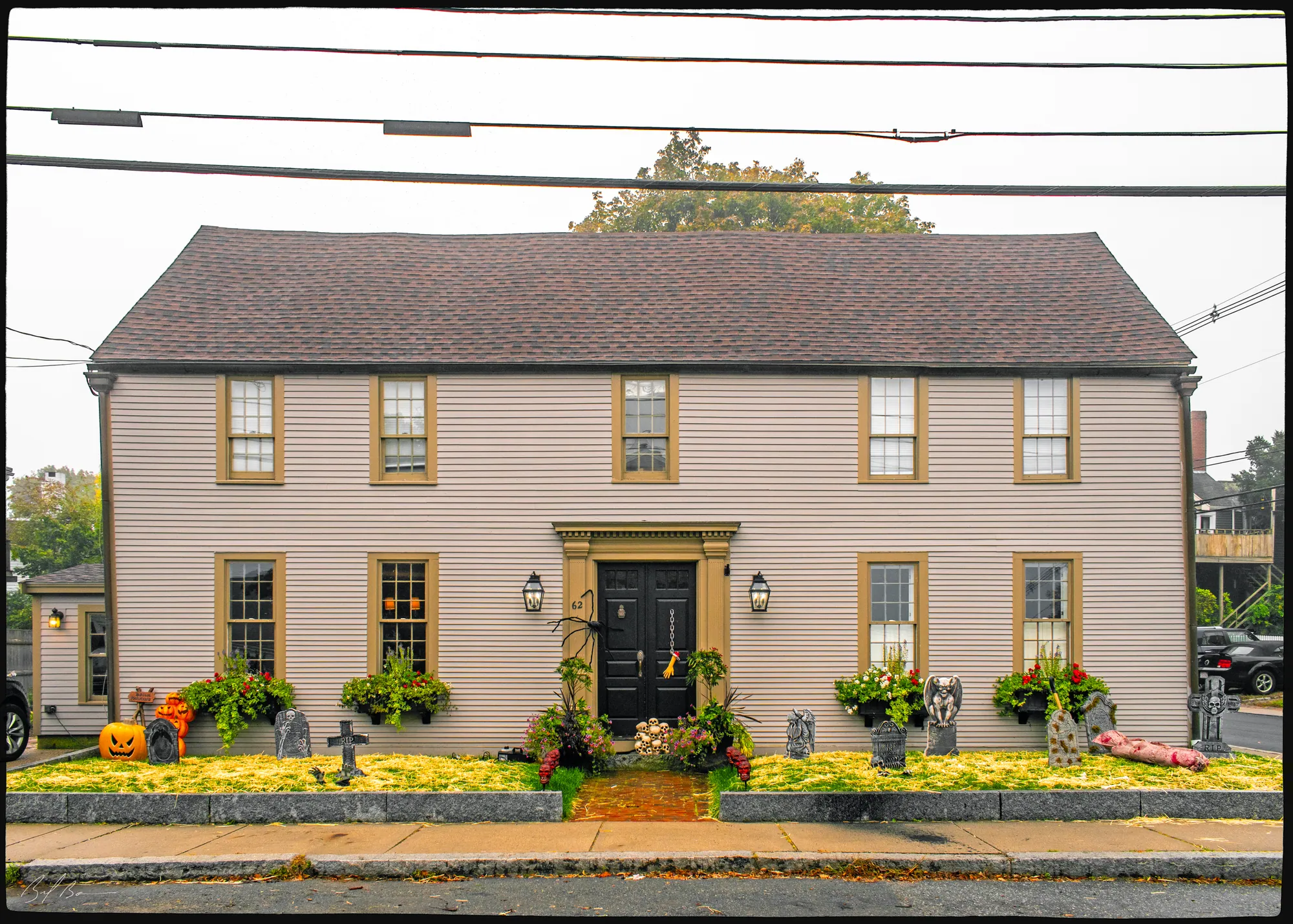
The inventory form calls this the Thomas C. Huse House, after the hatter who owned it in the 1870s and 1880s, but it says the frame is a first-period house with gunstock posts and a panelled fireplace wall, built about 1750 or earlier, with a Greek Revival doorway added in the 1800s. The corner it stands on has a long history in Currier's second volume, published in 1909. Captain Peter Le Breton, a shipmaster and ship owner, bought land on “new lane,” as Middle Street was then called, in 1777 and built a two-storey house: “When Fair street was laid out in 1782, the house was then standing on the northwesterly corner of that street and Middle street.” Currier also says Captain Benjamin Perkins, who led a company at Bunker Hill, owned a house on the corner of Fair and Middle Streets for many years before he built his brick house on Pleasant Street in 1795. Whether either of those is this house, the histories do not say. Across the corner stood the Universalist meeting house, which Joshua Coffin's Sketch of the History of Newbury of 1845 says was built in 1840; Currier records that the Reverend Daniel P. Pike bought it in 1879 for his Christian church, and that in 1889 Dodge Brothers “leased a larger building, on the corner of Fair and Middle streets, previously used as a meeting house by the Universalist society of Newburyport,” and made shoes in it.
Sources: MACRIS inventory form · Currier, History of Newburyport, vol. 2 (1909), p. 215 · Currier, History of Newburyport, vol. 2 (1909), p. 361 · Coffin, Sketch of the History of Newbury (1845), p. 374 · Currier, History of Newburyport, vol. 1 (1906), pp. 224, 299
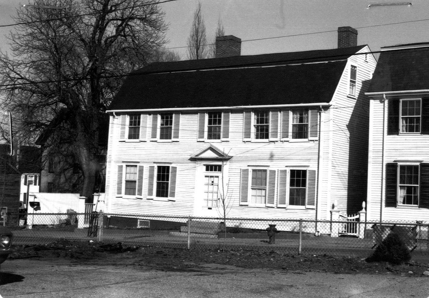
Walk · 70 yardsWalk back the few steps to Fair Street and turn left, away from the river, up the gentle rise. About 55 yards along, the Georgian house on your left is number 27.
Stop 3 · c. 1790
27 Fair Street
Dr. Richard S. Spofford House
Photo: Massachusetts Historical Commission, MACRIS inventory
The inventory form names this the Dr. Richard S. Spofford House and dates it to about 1790. Currier's second volume has the doctor: born in Rowley on May 24, 1787, the son of a physician, a Harvard graduate of 1812, who came to Newburyport to practise about 1816 and boarded at first at Mrs. Hale's on State Street. He married Mrs. Frances Maria Lord in 1829, and Currier says he lived on Titcomb Street for a year and then moved to Fair Street in 1830, where the list of physicians in the city in 1851 still puts him. “Ould Newbury” says that “for more than fifty years he was one of the leading physicians of the town,” and that he died on January 19, 1872. He was busy outside medicine too: Currier records him among the incorporators of the Wessacumcon Steam Mills in 1837, the first of the cotton mills, and of a health insurance company in 1848. His son Richard S. Spofford Jr., born in 1833, read law with Caleb Cushing, sat in the legislature and married the writer Harriet Prescott Spofford; the family later owned Deer Island in the river.
Sources: MACRIS inventory form · Currier, History of Newburyport, vol. 2 (1909), pp. 305, 309, 149, 284 · Currier, “Ould Newbury” (1896), p. 225
Walk · a few stepsNext door, also on your left, is 29–31 Fair Street.
Stop 4 · c. 1775
29–31 Fair Street
The state's historic inventory lists this as a two-family house dating from about 1775, and that is all we have on it: no page has been written yet. It shares the block with the Spofford house and, like it, was standing when William Coffin Little petitioned the town in 1782 to accept Fair Street, which Currier's History says was then described as “laid down from Temple street, fronting Col. Edward Wigglesworth's house and John Woodman's house to Cross street,” the old name for Middle Street.
Sources: MACRIS inventory form · Currier, History of Newburyport, vol. 1 (1906), p. 337
Walk · 130 yardsGo back down Fair Street to Middle Street, about 70 yards, and turn right. About 60 yards on, the three-storey brick building on your right is number 68.
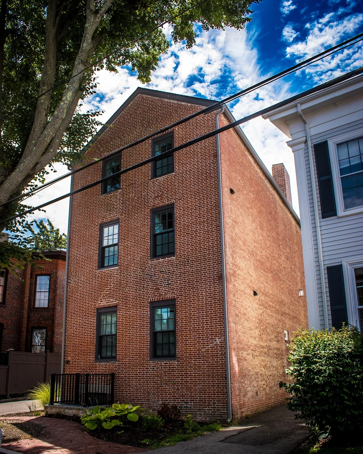
The inventory form says this was built about 1820, part house and part workshop like number 23 at the top of the street, and that in 1851 it belonged to William Dickinson, a loom and harness maker, who probably had his shop and his home under one roof. Mrs. Rebecca Bragdon owned it from before 1872 until her death in 1883. The histories have nothing more on it.
Sources: MACRIS inventory form
Walk · a few stepsNext door on your right is number 70, the brick house with the round bay. look: The cast-iron fence is original to the house, the inventory form says, and the circular bay, bracketed eaves and heavy window lintels are what make it the only brick Italianate house in the city.
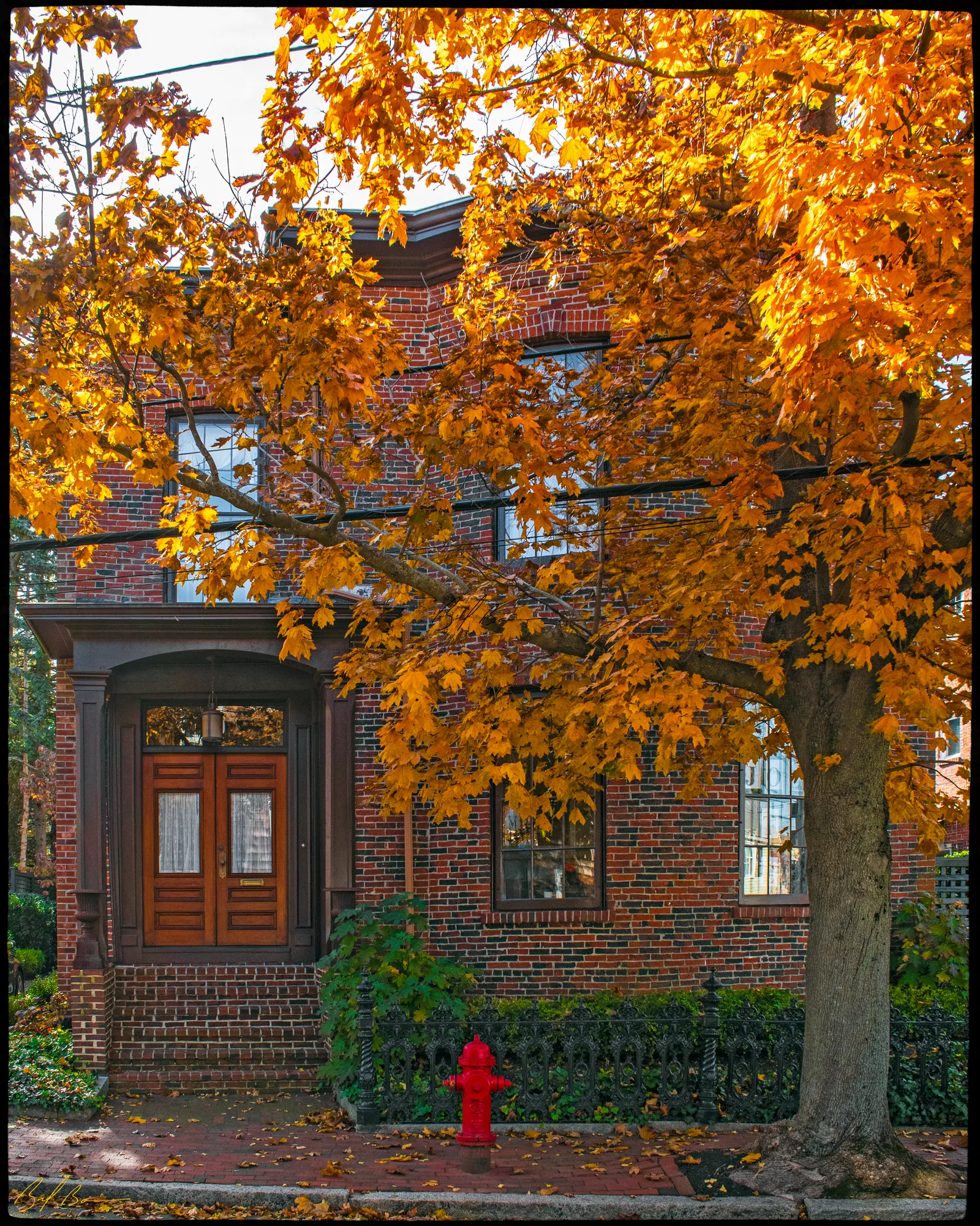
The inventory form dates this house to about 1850 and names Eben P. Goodwin as its probable builder: a partner in Clannin and Goodwin, sailmakers on Wood's Wharf, who made sails for many of the ships built on the river, including the schooner Envoy of 1863. Bayley and Jones's History of the Marine Society, published in 1906, records a Mr. Eben P. Goodwin giving the society's museum a picture of a boat in 1889. The form says the house passed before 1872 to John R. Stanwood of the soap and candle firm you met at number 23, who was also a part-owner of the ship Amazonian, and then to the Barrett family, who kept it into recent years.
Sources: MACRIS inventory form · Bayley and Jones, History of the Marine Society (1906), p. 295
Walk · a few stepsA few steps on, on your right, is 74 Middle Street.
Stop 7 · c. 1775
74 Middle Street
The inventory lists this as a single-family house of about 1775, and no page has been written for it yet. If the date is right it stood through the fire of 1811, which Currier's “Ould Newbury” says came down Middle Street “as far as Fair Street on the north-east side and within a few rods thereof on the south-west side,” stopping short of this block.
Sources: MACRIS inventory form · Currier, “Ould Newbury” (1896), p. 645
Walk · a few stepsNext on your right is number 76.
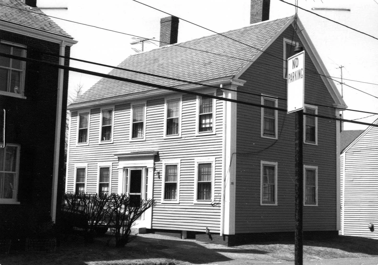
Stop 8 · c. 1840
76 Middle Street
Joseph M. George House
Photo: Massachusetts Historical Commission, MACRIS inventory
The inventory form calls this the Joseph M. George House, a Greek Revival house of about 1840. The histories have nothing on Mr. George, so the form is all we have.
Sources: MACRIS inventory form
Walk · a few stepsA few steps further, on your right, is the double house at 80–82.
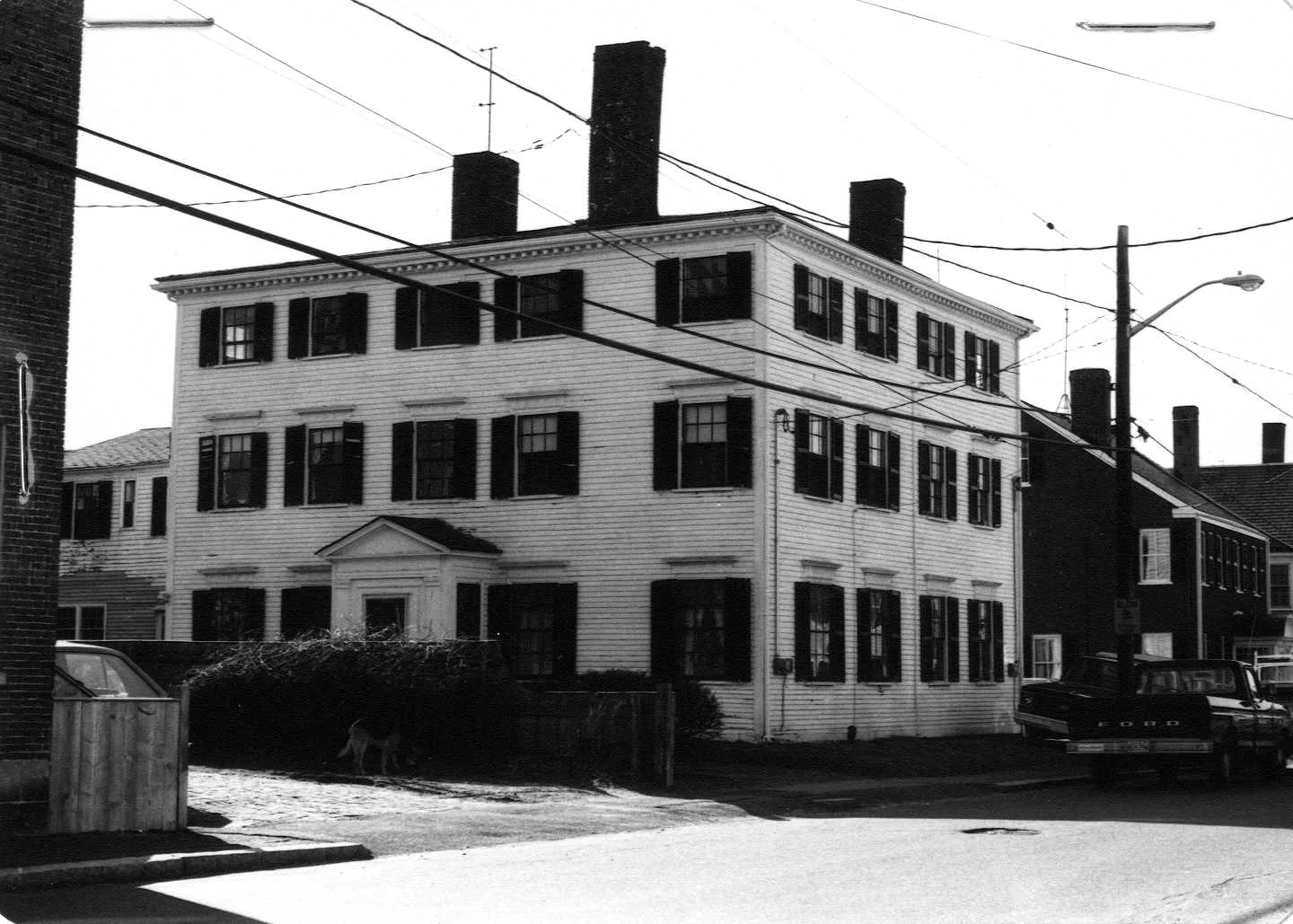
Stop 9 · c. 1815
80–82 Middle Street
Thomas Lancaster House
Photo: Massachusetts Historical Commission, MACRIS inventory
The inventory form lists this as the Thomas Lancaster House, a Federal house of about 1815, and the histories are silent on it. You are now near the Federal Street end of Middle Street, the stretch Currier says was being used as a way “for near thirty years” before the landowners formally laid it down in 1724.
Sources: MACRIS inventory form · Currier, History of Newbury (1902), p. 426
Walk · 50 yardsWalk the last 45 yards to Federal Street. The brick Federal building on the right-hand corner, where Middle Street meets Federal Street, is 38 Federal Street.
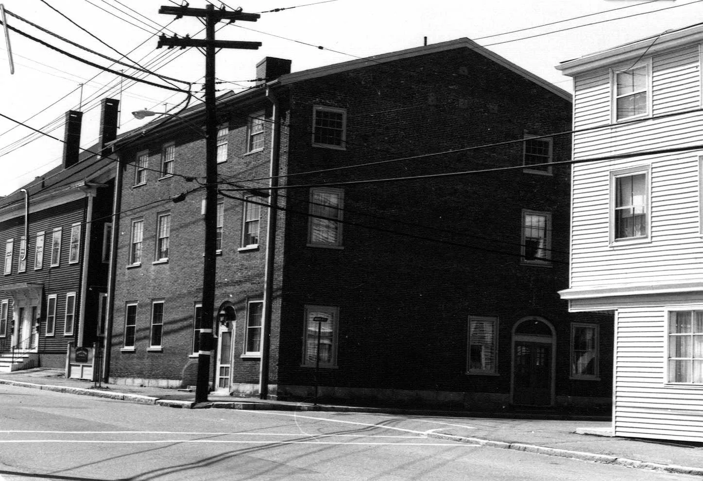
Stop 10 · c. 1810
38 Federal Street
Sarah Brown House
Photo: Massachusetts Historical Commission, MACRIS inventory
The inventory form calls this the Sarah Brown House and dates it to about 1810. Our own research for this site, on the building page for the Tilton store further up the street, says Daniel G. Tilton opened his first grocery in 1840 “on the corner of Federal and Middle Streets” and kept it there for seventeen years before building his own store at Spring Street; which corner that was, the record does not say, but you are standing at the junction.
Sources: MACRIS inventory form · oldnbpt.com research
Walk · 80 yardsTurn left onto Federal Street and walk down toward the river, about 80 yards. Keep to the right-hand side. The three-storey brick house on your right is number 19. look: Three storeys of brick with a hipped roof, the shape of a Newburyport merchant's house of the 1790s.
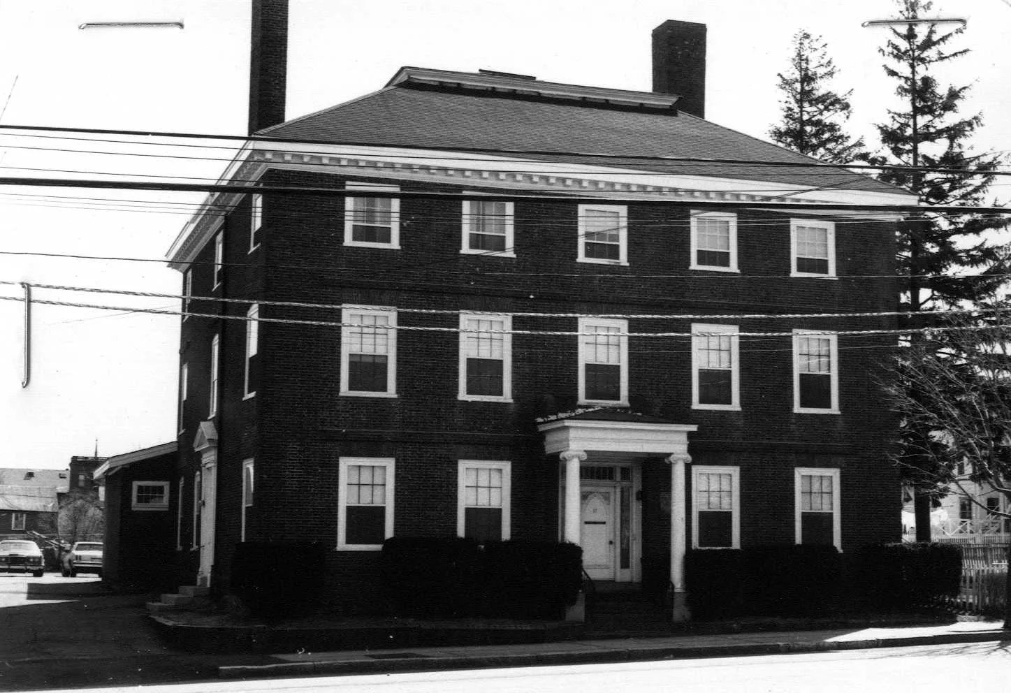
Stop 11 · c. 1798
19 Federal Street
William Bartlett House
Photo: Massachusetts Historical Commission, MACRIS inventory
Albert Hale photographed this house for his Old Newburyport Houses in 1912, when it was numbered 13, and calls it the Bartlet-Porter House: “This property was bought by William Bartlet in 1798 and the house built soon afterward, passing at his death, in 1841, to his daughter, Hannah (Mrs. John) Porter.” Currier's second volume tells the same story from the deeds: Bartlet bought land adjoining his Federal Street lot in 1798, running back to Beck Street and Ship Street, and “erected a three-story brick dwelling house which he owned and occupied at the time of his death.” He was the richest man in the town. Currier says he was born on Middle Street in January 1747, learned the shoemaker's trade, was in business for himself at twenty-one, and after the Revolution owned a fleet trading to the East and West Indies, England, Holland and Russia from his wharf at the foot of this street; his will gave twenty thousand dollars to each grandchild. “Ould Newbury” calls him one of the founders and generous benefactors of the Andover Theological Seminary, and you will meet his name again at the Old South, where he paid for the Whitefield cenotaph. Hale carries the owners on: the Porters until 1874, then Sewell B. Noyes, then in 1906 the Roman Catholic Church, whose priest was living here when Hale wrote. The state inventory form dates the house to about 1798 and names it for William Bartlett.
Sources: Hale, Old Newburyport Houses (1912), p. 63 · Currier, History of Newburyport, vol. 2 (1909), pp. 233–236 · Currier, “Ould Newbury” (1896), p. 703 · MACRIS inventory form
Walk · a few stepsThe next house down on your right, the brick house with the little temple-front porch, is number 17. look: The porch: a pediment on Doric columns with a Doric frieze, the inventory form's “classical temple in miniature,” and the brick belt course between the first and second floors.
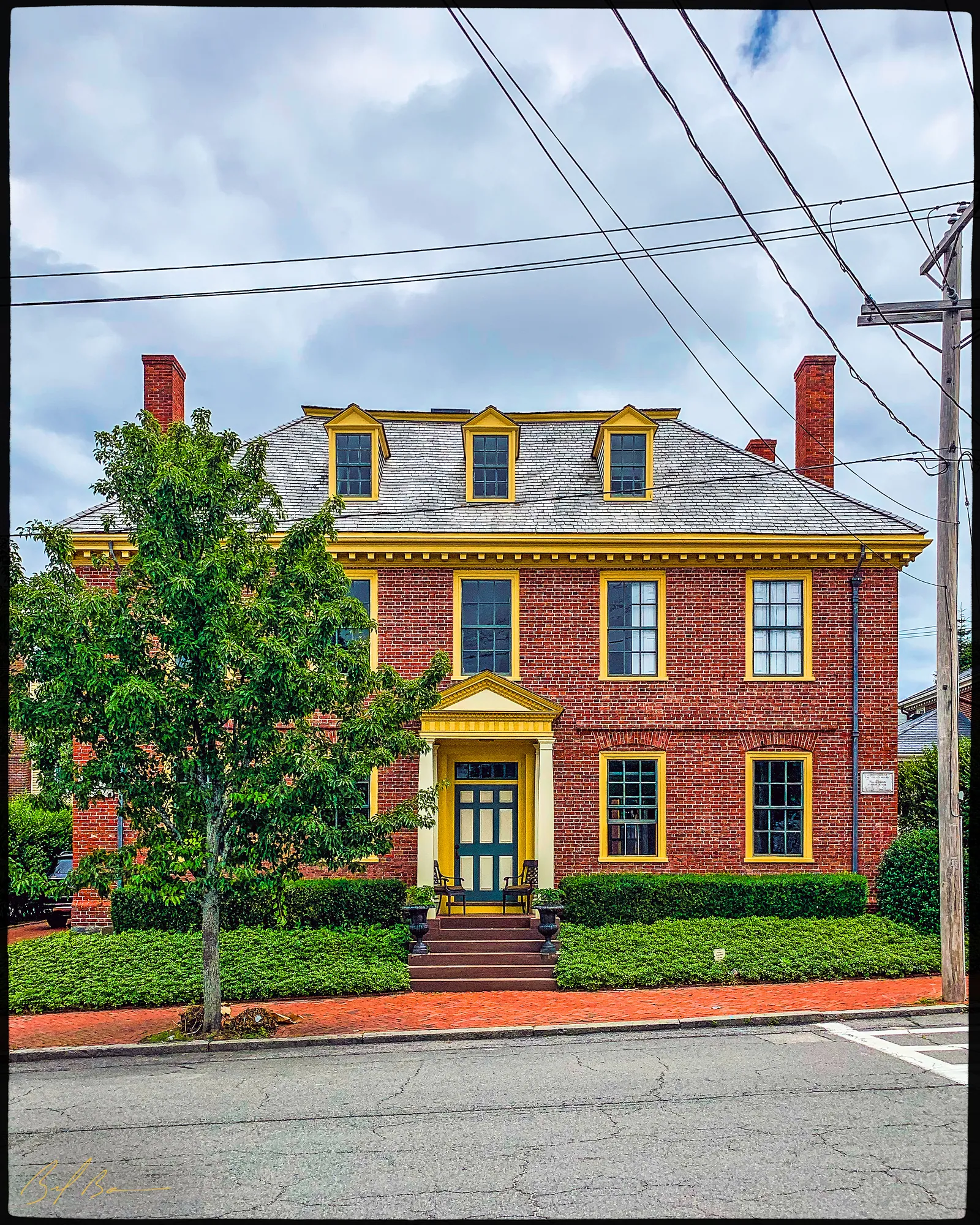
This is the house of Captain William Pierce Johnson, of the family that built ships at the foot of the street. Currier's second volume says he was born on April 22, 1745, the son of the shipbuilder Eleazer Johnson, “was a successful ship-master, and also the owner of a large number of vessels engaged in the West India trade,” and married Sarah Greenleaf, the daughter of Jonathan Greenleaf, in 1770. He was one of the thirteen captains who signed the standing laws of the Marine Society in November 1772, according to Bayley and Jones, and was its deputy master and vice president in the 1790s. Currier says he built the wharf at the foot of Ship Street in 1798 and died suddenly on June 4, 1802; the state inventory form, which dates the house to about 1780 and counts him among the ten richest men in town in 1790, gives his death as 1804. His twin sons were born here in November 1790. Eleazer, Currier says, was town clerk from 1831 and city clerk from the charter of 1851 until his death in 1870, and his brother Jonathan Greenleaf Johnson was for many years a physician in the town; the inventory form says Eleazer owned the house in 1851. In the twentieth century it was the French School of the Church of St. Louis de Gonzaga, as the plaque on the front says, and was turned back into dwellings after 2003.
Sources: Currier, History of Newburyport, vol. 2 (1909), pp. 242–243, 305 · Bayley and Jones, History of the Marine Society (1906), pp. 6, 82–84 · MACRIS inventory form
Walk · 130 yardsTurn around and walk back up Federal Street, away from the river, for about 130 yards, crossing Middle Street. The white meeting house set back on your left, at the corner of School Street, is the Old South. Stop at the gate. look: The weathercock on the spire has been there since 1759, Horace Hovey said in 1906; the clock dials below it once had a single hand.
The First Presbyterian Church was gathered in 1746 by followers of George Whitefield who had broken from the First Parish, and its own Origin and Annals, published for its hundred-and-fiftieth anniversary in 1896, describes the raising of this house in 1756: “The frame-work of the structure was of white oak from the farms of the members. The wrought iron nails came from England. The raising took three days.” Hovey, the pastor, says in his 1906 discourse on the building that the land was bought on April 12, 1756, from Jonathan Beck and Parker Noyes for a hundred and thirteen pounds, and that “What is familiarly styled the ‘Old South Meeting-house’ is the oldest house of worship in this region.” Whitefield died in the pastor's house on School Street on September 30, 1770, and Currier's History says he was buried in a brick crypt under the pulpit, where visitors were let down to look at him for decades. Hurd's History of Essex County of 1888 adds that a bone of his arm was stolen and carried to England, and sent back in 1849. His friend Jonathan Parsons, the first pastor, lies beside him. Hovey says that in the broad aisle, “at the call of Parsons, stood forth Ezra Lunt and his men, on the identical day when the colonial congress voted to raise an army for the Revolution.” “The bell we now have was cast in 1802 by Paul Revere, and was bought in 1803, and we hold the autograph receipt of Paul Revere among our treasures.” In 1829, Currier says, the galleries and pews were taken out, the pulpit moved from the side to the end, and a new crypt built under it; William Bartlet paid for the marble cenotaph to Whitefield. The remodelling made the whispering gallery, which one old member described in 1896 as “so perfect, that when everything was still I have heard a watch tick in a corner one hundred and fifty feet away.” The state inventory lists the church as built in 1756.
Sources: Origin and Annals of “The Old South” (1896), pp. 50, 99 · Hovey, “The House of God” (1906), pp. 5, 8, 12, 14 · Currier, History of Newburyport, vol. 1 (1906), pp. 265–267 · Hurd, History of Essex County, vol. 2 (1888) · Coffin, Sketch of the History of Newbury (1845), p. 238 · MACRIS inventory form
Walk · 80 yardsTurn left into School Street, alongside the church. About 70 yards down, on your left, the clapboard house next to the church property is 3–5 School Street.
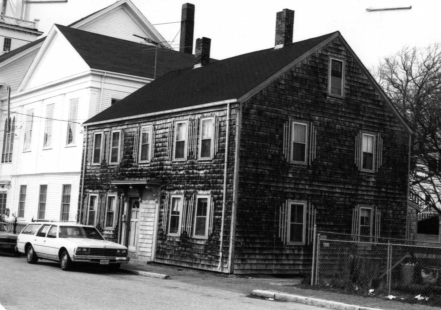
Stop 14 · c. 1750
3–5 School Street
William Lloyd Garrison House
Photo: Massachusetts Historical Commission, MACRIS inventory
Currier's “Ould Newbury” begins its sketch of the abolitionist here: “In a house still standing on the easterly side of School Street, next to the meeting-house and vestry of the First Presbyterian Society of Newburyport, William Lloyd Garrison was born Dec. 10, 1805.” His parents had come from New Brunswick that spring and rented rooms from Captain David Farnham, a coasting skipper, whose wife Martha became the family's steadfast friend. His sister Caroline died here in 1808 and another sister was born here the same year; a few months later his father went back to New Brunswick and never supported the family again. Currier says the boy went to live with Deacon Ezekiel Bartlett on Merrimac Street when his mother left for Lynn in 1812, had a short spell at the grammar school by the mall, and was remembered as a bright, active boy who “is said to have led the South End boys against the ‘North Enders’ in the snowball contests of that day.” Currier's second volume adds that “When only thirteen years of age he was apprenticed to Ephraim W. Allen, editor and proprietor of the Newburyport Herald, and for seven years was busily engaged in learning the trade of a printer.” He read the Declaration of Independence at the Harris Street meeting house on the Fourth of July, 1826, started his own paper here that year, and went on to the Liberator in Boston. The city put up his statue in Brown Square in 1893. The state inventory form dates the house to about 1750. Further along the street, the Old South's annals say, is the double house that was the home of Jonathan Parsons, where Whitefield died.
Sources: Currier, “Ould Newbury” (1896), ch. "William Lloyd Garrison" · Currier, History of Newburyport, vol. 2 (1909), p. 314 · Currier, History of Newburyport, vol. 1 (1906), p. 433 · Origin and Annals of “The Old South” (1896), p. 209 · MACRIS inventory form
Walk · 90 yardsWalk back up School Street to Federal Street and turn left. About 20 yards on, the small two-storey brick building on your right, on the corner of Spring Street, is 48 Federal Street. look: The round window in the gable end and the granite lintels; the inventory form says the shop front originally had a door in the middle with a window either side.
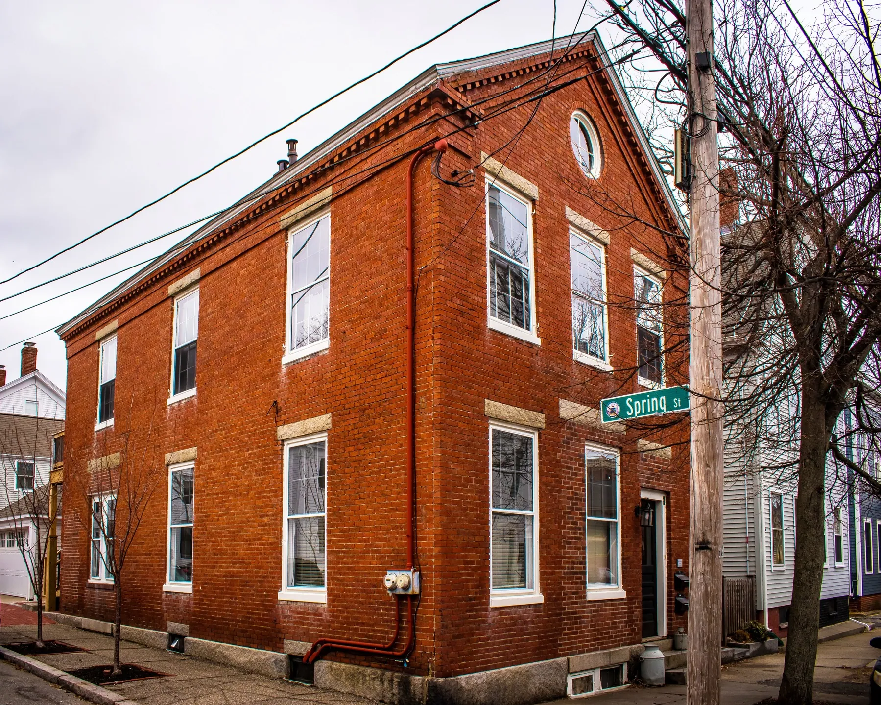
Our research for this site, from the newspapers and the old maps, tells this one. Daniel G. Tilton was born in Newbury in 1816, clerked for five years and went into the grocery business for himself in 1840 at the corner of Federal and Middle Streets, where you were a few minutes ago. In 1857 he built this brick store on the corner of Spring Street and stayed forty-one years, selling it to his son Daniel E. Tilton in 1896 for two thousand dollars; the son sold it to Harold Adams in 1918. When the old man died in 1900 the Daily News headlined him as having “Been in Honorable Trading for 64 Years in This City.” The state inventory form calls the building a good small example of mid-century commercial work and dates it about 1860. Spring Street beside it, Currier's History says, was laid out by the selectmen and accepted on September 21, 1797.
Sources: oldnbpt.com research · MACRIS inventory form · Currier, History of Newburyport, vol. 1 (1906), p. 351
Walk · 70 yardsTurn right into Spring Street. About 55 yards along, on your right, is number 13.
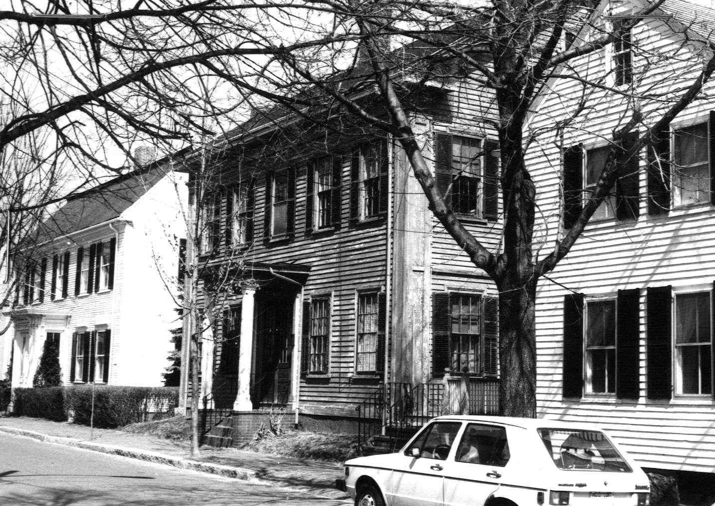
Stop 16 · c. 1845
13 Spring Street
David Woodwell House
Photo: Massachusetts Historical Commission, MACRIS inventory
The inventory form lists this as the David Woodwell House, a Greek Revival house of about 1845, and says no more. The street had a doctor and a sea captain in its day: Currier's list of the physicians living in the city in 1851 puts Dr. Jonathan Greenleaf Johnson, the twin from 17 Federal Street, on Spring Street, and Emery remembered that “Capt. Samuel Bailey's residence was on Spring street.”
Sources: MACRIS inventory form · Currier, History of Newburyport, vol. 2 (1909), p. 309 · Emery, Reminiscences of a Nonagenarian (1879)
Walk · 70 yardsA little further along, on your left, is the row of four joined houses, 12 to 18 Spring Street. Stand across from the middle of the row. look: The deep bracketed eaves, the high front stoops and the row of chimneys, which the inventory form says show in a stereo view of the street taken in the 1860s.
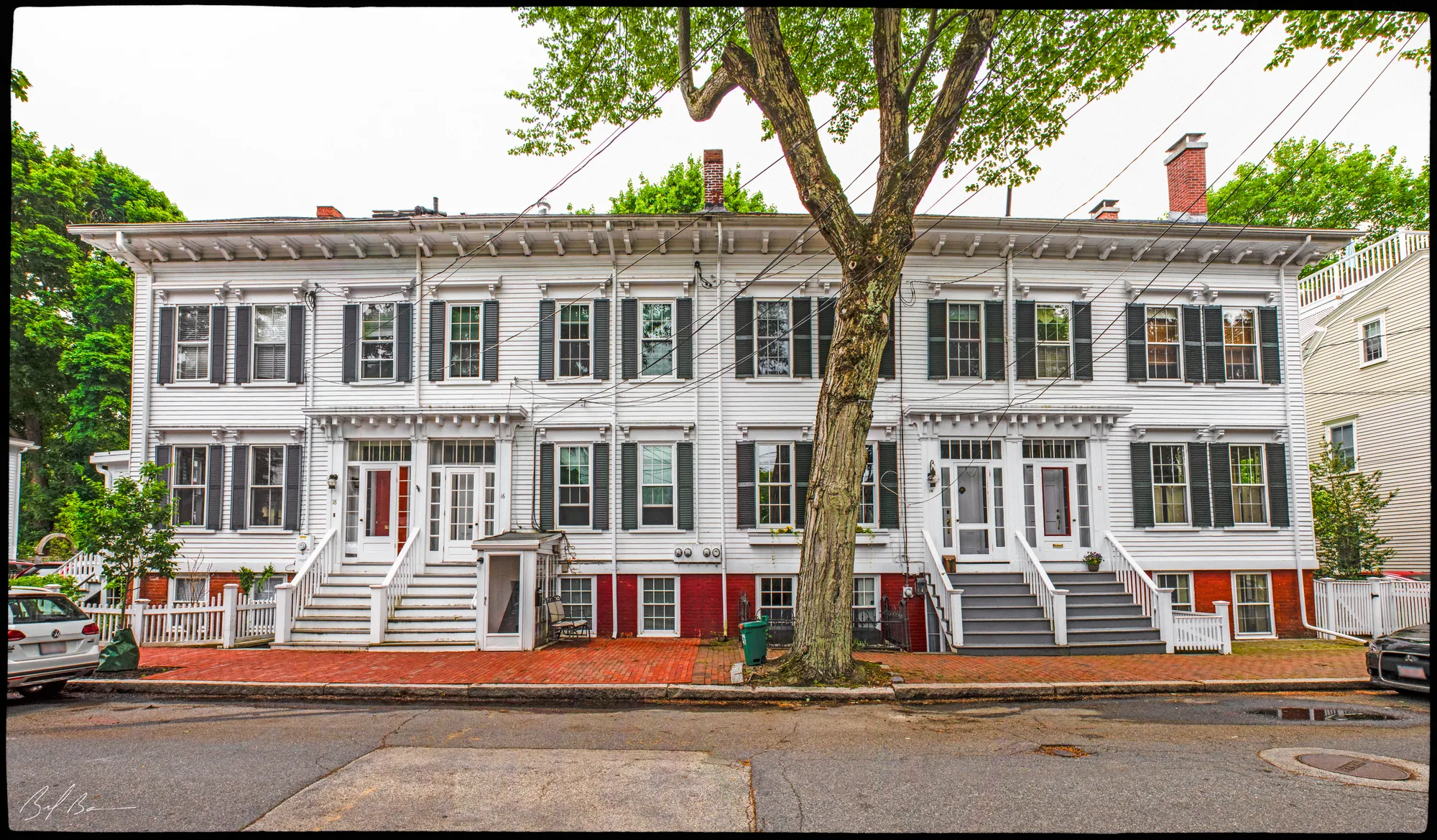
Rows are rare in Newburyport, and the inventory form for number 14 explains why this one is here. The 1851 map shows two separate buildings on the site, one marked for the heirs of Abraham Wheelwright, the ship owner, with a gap between them; by the 1872 map the row was continuous, so the form thinks it was built or rebuilt in its present shape about the end of the Civil War, at a time when few houses were going up in the old part of town. The first known occupant of number 14 was Ebenezer P. Goodwin, the sailmaker whose brick house you saw on Middle Street, listed here in the directories from 1866 to 1873 with a kinsman, Dennis C. Goodwin, another sailmaker, boarding with him. The form reads the details as transitional, Greek Revival corner pilasters under Italianate brackets, and dates the row to between 1851 and 1867.
Sources: MACRIS inventory form
Walk · a few stepsNext along on your left is the double house at 8–10.
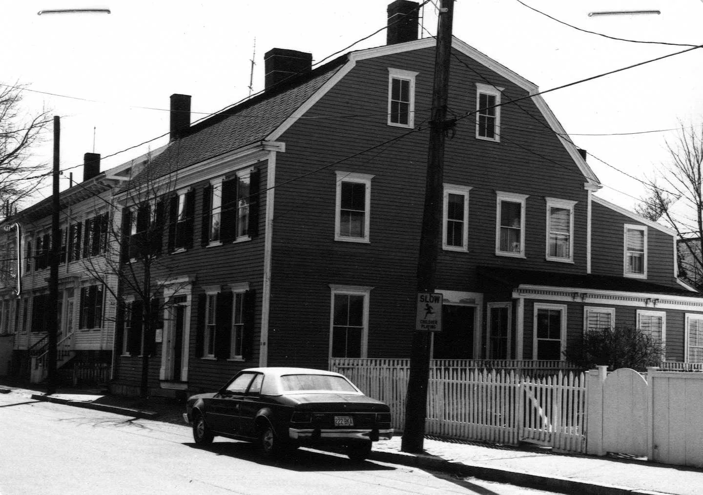
Stop 18 · c. 1785
8–10 Spring Street
Samuel Noyes House
Photo: Massachusetts Historical Commission, MACRIS inventory
The inventory form names this the Samuel Noyes House, a Georgian house of about 1785, which would make it older than the street as the town accepted it in 1797. That is all we have on it.
Sources: MACRIS inventory form · Currier, History of Newburyport, vol. 1 (1906), p. 351
Walk · 60 yardsContinue to the far end of Spring Street, about 60 yards. The last house on your right, on the corner of Fair Street, is number 1. look: A five-bay front with Doric pilasters at the door; the inventory form reads the plain classical cornice and window caps as early Georgian.
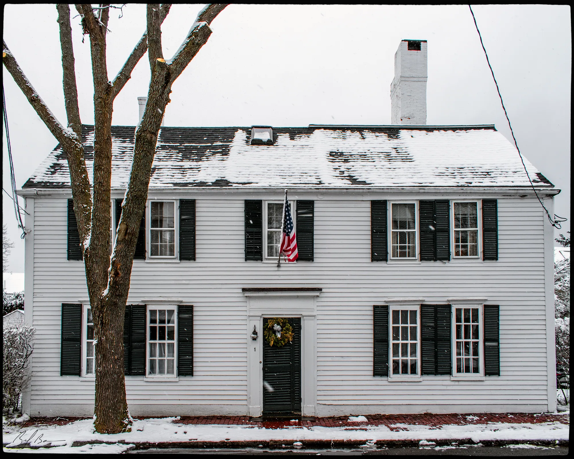
The inventory form thinks this is one of the oldest houses on the walk, dating to the early 1700s, from the first settlement of this end of the water-side, and says it was owned in 1851 by Enoch Stickney, whose family kept it to the end of the century. Currier's second volume lists an Enoch Stickney among the soldiers stationed at Plum Island in the war of 1812: a musician in Sergeant Hodge's detachment, serving from the first to the eighth of October 1814, when the town was watching the river mouth for British ships and the Silver Greys and the Sea Fencibles were helping to build the fort. The form believes the owner of 1851 was that musician's son. It also says he signed the petition to incorporate Newburyport in 1762; the petition as Currier prints it has Stickneys on it, but no Enoch.
Sources: MACRIS inventory form · Currier, History of Newburyport, vol. 2 (1909), pp. 514, 520 · Currier, History of Newburyport, vol. 1 (1906), p. 17
Walk · 50 yardsTurn left onto Fair Street. The three-storey house just past the corner on your left is number 33. look: Three storeys under a hipped roof, the windows shrinking floor by floor, splayed lintels: the inventory form's checklist of the Federal merchant's house.
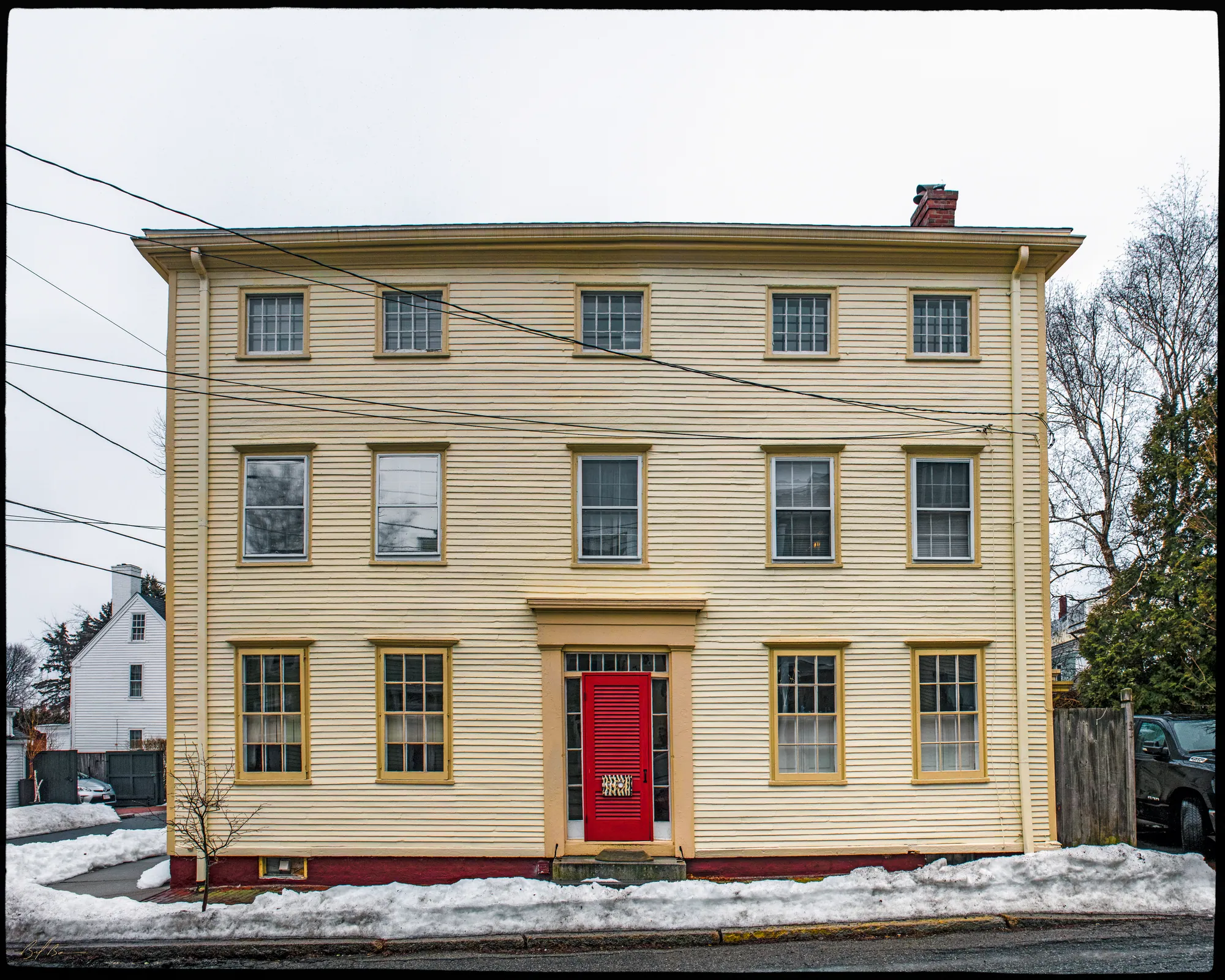
The inventory form dates this house to about 1800 and says that in 1851 it belonged to the estate of J. Follansbee, a family that owned many vessels built on the river; by 1872 it was Dudley D. Felton's, a founder of the Five Cent Savings Bank in 1854 and a vice-president of the Y.M.C.A. when it was organized in 1876, and he was still here in 1884. The Follansbees are all through the histories as shipmasters and owners, but none of them is tied to this house in print. Currier's 1909 volume records that the Y.M.C.A. began in 1876 in the brick building on the corner of State and Essex Streets.
Sources: MACRIS inventory form · Currier, History of Newburyport, vol. 2 (1909), p. 145
Walk · 110 yardsContinue along Fair Street, away from the river, for about 50 yards and turn left into Orange Street. About 55 yards down, on your left, is number 5.
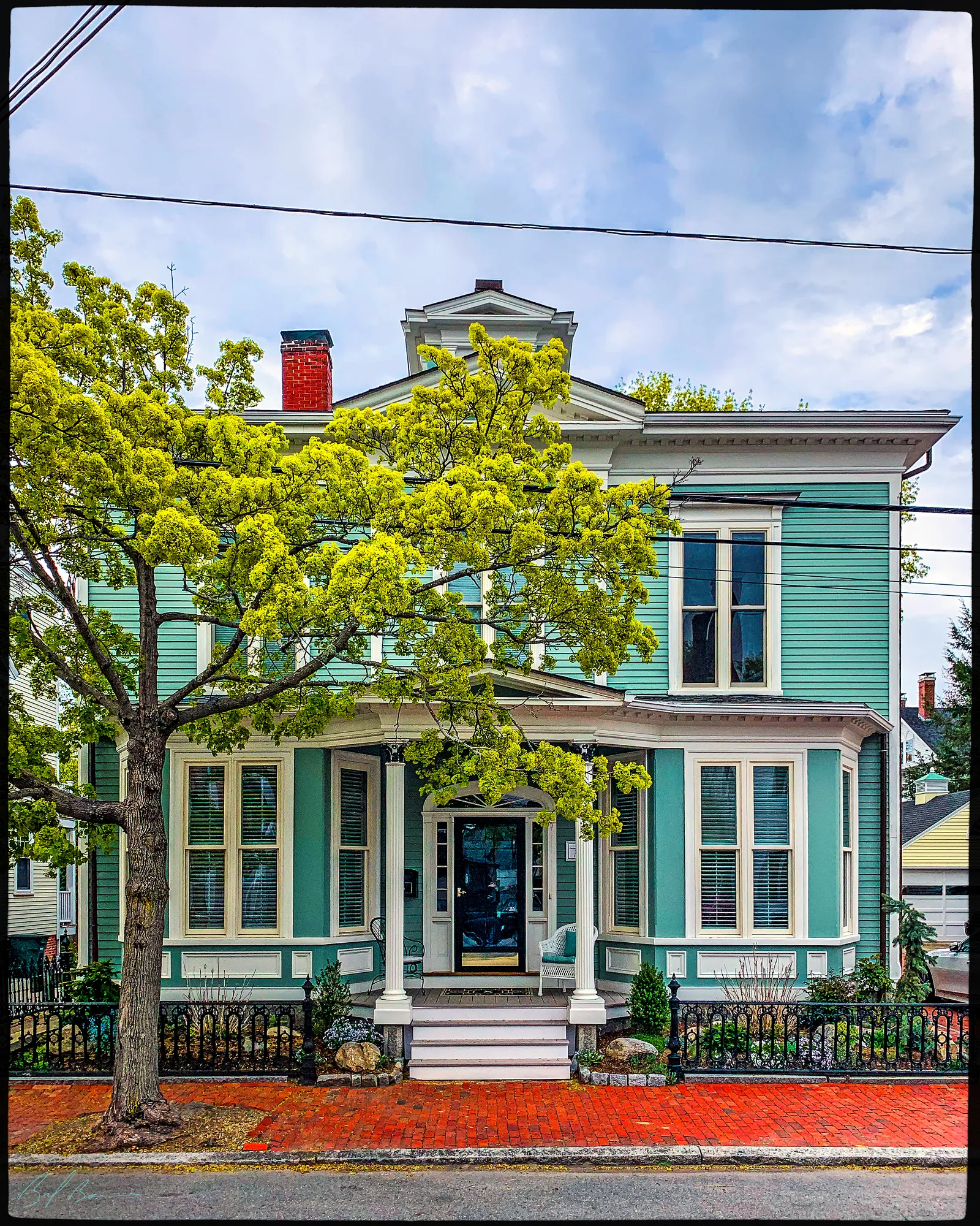
The inventory form lists this as an Italianate house of about 1875 and gives it no name. Orange Street is a century older: Currier's History says the town accepted it on March 12, 1783, running from Fair Street to Federal Street, and Emery remembered that a ropewalk had run “from Federal to Fair street, where Orange street now is,” before it was moved to the south side of Federal Street and became Edward Wigglesworth's.
Sources: MACRIS inventory form · Currier, History of Newburyport, vol. 1 (1906), p. 351 · Emery, Reminiscences of a Nonagenarian (1879), p. 227
Walk · 80 yardsThe next house along on your left is number 7. look: The rope moulding on the corners of the front and the dormers, which gives the house its name.
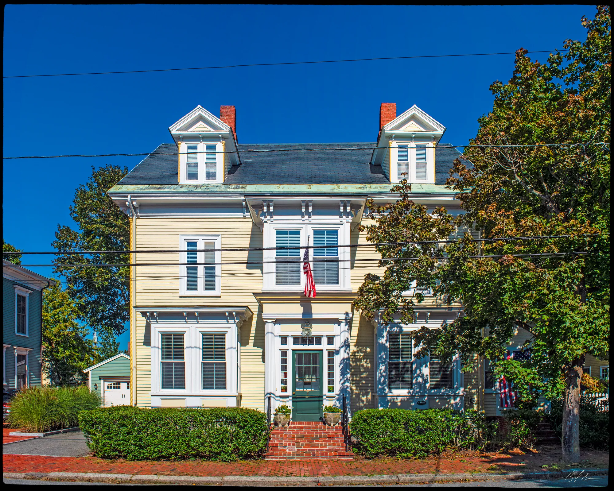
The inventory form calls this the Rope House, built about 1878, and says Rudolph Jacoby, who lived from 1853 to 1911, was here by 1891 and may have been its first occupant. Hale's Old Newburyport Houses lists a Rudolph Jacoby among the owners of a High Street house in 1886 and 1887. Currier's second volume says Dr. Samuel W. Wyman, Harvard 1814, lived for many years in a house still standing in 1909 on the south-westerly side of Orange Street until his death in 1867.
Sources: MACRIS inventory form · Hale, Old Newburyport Houses (1912), p. 38 · Currier, History of Newburyport, vol. 2 (1909), pp. 305–306
Walk · 90 yardsCarry on down Orange Street about 70 yards. The turreted house on your right is number 20. look: The turret with its carved panels and the cast-iron cresting along the ridge.
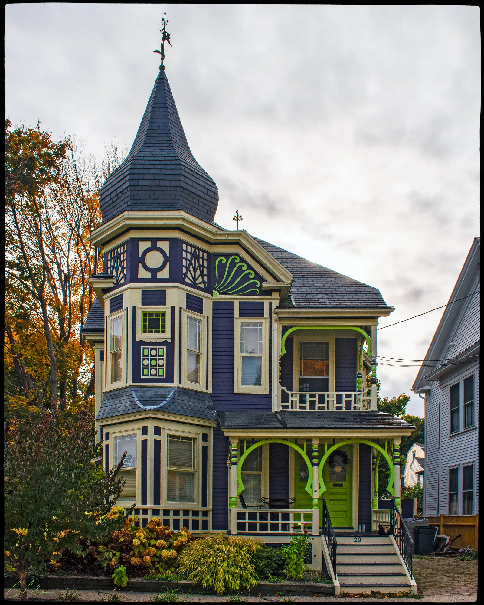
The inventory form calls this one of the most ornate Queen Anne houses in the city and traces its design to a pattern book: Design No. 86 in the Michigan architect D. S. Hopkins's Houses and Cottages, Book No. 5, published in 1891. It was built about 1890 by Henry T. Moody, a machinist with the Victor Manufacturing Company on Water Street, which made fireproof doors; Hurd's History of Essex County lists the Victor company among the employers that had taken the place of shipbuilding by the 1880s. An artist, Harry S. Moody, boarded here and was probably the son; the form says Henry Moody was still here in 1924 and that Harry sold the house in 1931. Currier's roll of city officers has a Henry T. Moody as alderman for Ward One in 1867 and 1868; whether that is the same man, the roll does not say.
Sources: MACRIS inventory form · Hurd, History of Essex County, vol. 2 (1888) · Currier, History of Newburyport, vol. 2 (1909)
Walk · 70 yardsWalk on to Federal Street, about 35 yards, and turn right. Cross Federal Street at the corner, with care, to the far side. About 35 yards up, on your left, the two-storey brick house with the columned porch, on the corner of Milk Street, is number 43. look: The porch, with its fluted Doric columns and pediment, the modillioned cornice and the arched brick lintels: what survived the division into apartments.
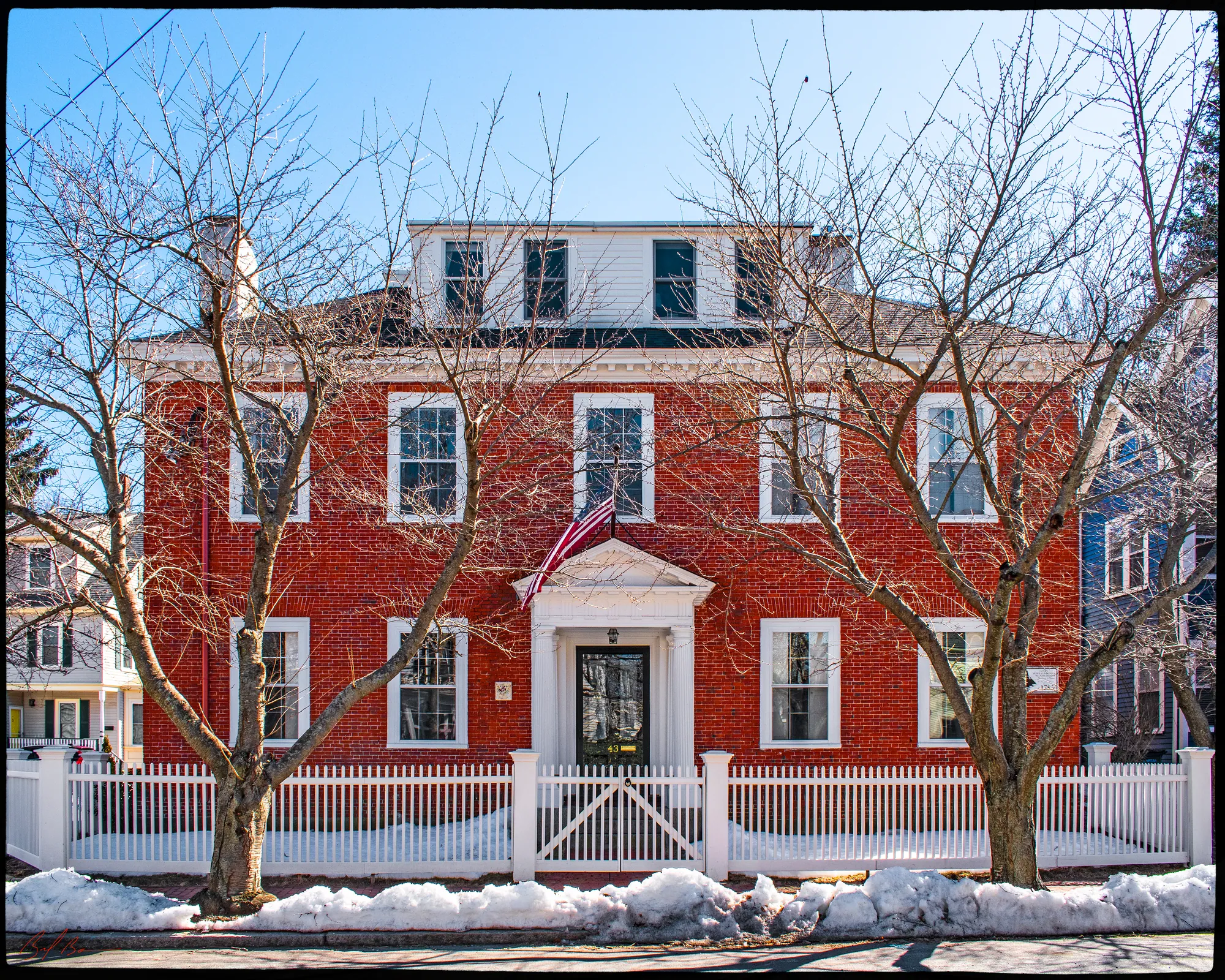
Captain Nicholas Johnson built this house, and he is the Newburyport captain who, Mrs. Smith says, “was the first to display the ‘stars and stripes’ from the masthead of his vessel, in the river Thames,” in the ship Count de Grasse after the peace. Albert Hale photographed the house in 1912, when it was numbered 35: “The land in this estate was bought in 1782 by Nicholas Johnson who subsequently erected this house which remained in the hands of his descendants until 1876.” Currier's second volume dates the building closer to the state inventory form's 1793: “The brick dwelling house on the corner of Milk and Federal streets, similar in shape and style of architecture, was built about the same date by Nicholas Johnson, brother-in-law of Capt. Benjamin Perkins,” whose gambrel-roofed brick house on Pleasant Street went up in 1795. Johnson had married Mary Perkins, the sister of Jacob Perkins the inventor, in 1776; Emery, who was related, counts their children. Bayley and Jones have him as treasurer of the Marine Society in the 1790s, and Smith prints the surgeon's account of the sloop-of-war Warren, “built at Salisbury, under the inspection of Capt. Nicholas Johnson, of Newburyport, and was launched on the 26th of September, 1799.” The inventory form adds the rest of a busy public life: ship owner, selectman, representative, a founder of the Marine Insurance Company, the Woolen Manufacturing Company and the Humane Society. Hurd's History says his son Henry Johnson, born here in 1796, was mayor in 1852 and 1853 after Caleb Cushing resigned, and president of the Merchants' Bank; the inventory form has Henry owning the house in 1851. After the family sold in 1876, Hale says, it went to William H. Huse and in 1900 to Mrs. Emma F. Ireland.
Sources: Smith, History of Newburyport (1854), pp. 116, 123 · Hale, Old Newburyport Houses (1912), p. 62 · Currier, History of Newburyport, vol. 2 (1909), p. 361 · Emery, Reminiscences of a Nonagenarian (1879) · Bayley and Jones, History of the Marine Society (1906), pp. 82–84 · Hurd, History of Essex County, vol. 2 (1888) · MACRIS inventory form
Walk · 70 yardsWalk back the 20 yards to the corner and turn right into Milk Street. About 45 yards down, on your left, is 5–7 Milk Street.
Stop 25 · c. 1880
5–7 Milk Street
The state's inventory lists this as a two-family house of about 1880 in the mixed Victorian manner, and no page has been written for it yet. The street is older than the house: Currier's History says Milk Street, from Federal Street to Lime Street, was accepted on March 22, 1802, and Mrs. Smith says that when the followers of the Reverend Charles Milton broke from the Old South in 1792, and the town refused them the town house, they met in Mr. Anthony Morse's private house in Milk Street until their meeting house on Prospect Street was ready.
Sources: MACRIS inventory form · Currier, History of Newburyport, vol. 1 (1906), p. 351 · Smith, History of Newburyport (1854), p. 310
Walk · 80 yardsReturn to Federal Street and turn left, away from the river. About 30 yards up, on your right, is number 64.
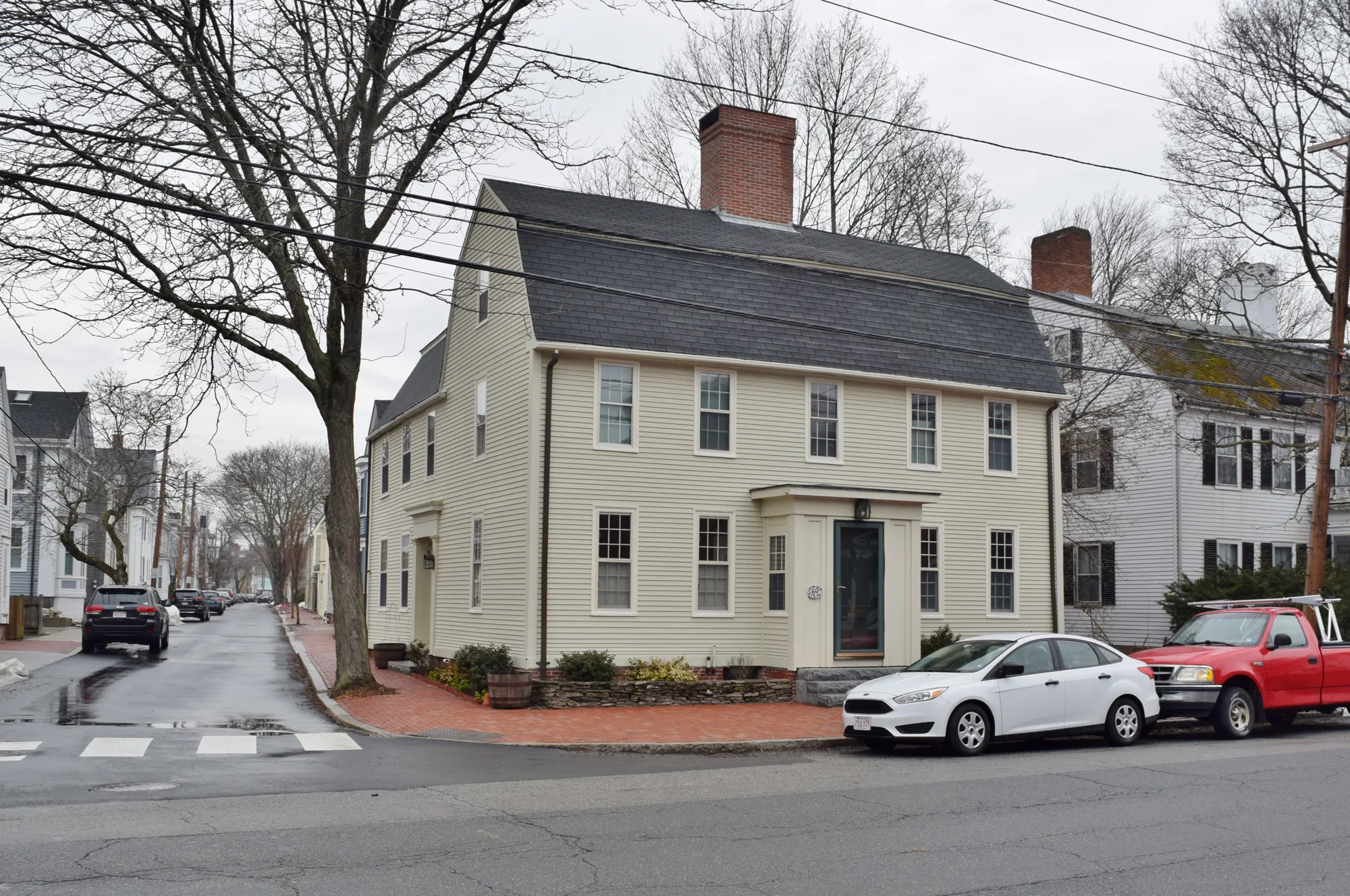
Stop 26 · c. 1771
64 Federal Street
Daniel Plumer House
Photo: Massachusetts Historical Commission, MACRIS inventory
The inventory form calls this the Daniel Plumer House and dates it to about 1771, which would put it here when the street was still King Street. Currier's History names a Daniel Plummer as one of the three men who took the deed of the Prospect Street meeting house for its proprietors in 1796, and the Old South's annals list one among its early parish members; whether either is the Plumer of this house, neither book says.
Sources: MACRIS inventory form · Currier, History of Newburyport, vol. 1 (1906), pp. 281, 335 · Origin and Annals of “The Old South” (1896), p. 177
Walk · 80 yardsA few steps on, turn right into Temple Street. About 70 yards along, on your left, is the double house at 52–54.
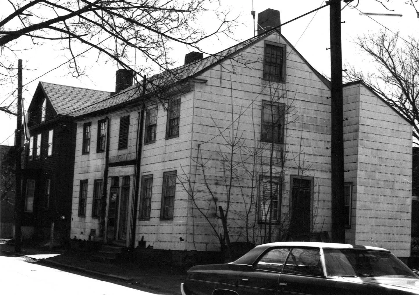
Stop 27 · c. 1750
52–54 Temple Street
Horace W. Bartlett House
Photo: Massachusetts Historical Commission, MACRIS inventory
The inventory form lists this as the Horace W. Bartlett House, a Colonial house of about 1750, and the histories have nothing on Mr. Bartlett. Temple Street, Currier's History says, was laid out by the selectmen and accepted on March 8, 1774, running past the houses of Moses Frazier, Mark Fitz and Nathaniel Tilton to Andrew Hills's house on King Street, “a name it still retains,” though it was probably a private way for some years before that.
Sources: MACRIS inventory form · Currier, History of Newburyport, vol. 1 (1906), p. 349
Walk · a few stepsNext door, on your left, is 48–50.
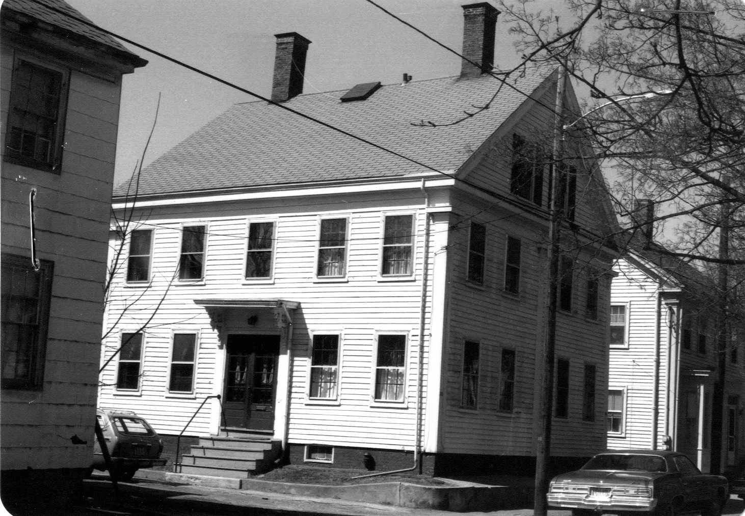
Stop 28 · c. 1850
48–50 Temple Street
Henry W. Kinsman–John Downer House
Photo: Massachusetts Historical Commission, MACRIS inventory
The inventory form names this Greek Revival double house of about 1850 for Henry W. Kinsman and John Downer. Currier's second volume has a Henry Willis Kinsman who fits the date: born in Portland in 1803, a Dartmouth graduate of 1822 who read law with Daniel Webster, came to Newburyport in 1836, sat three times in the legislature, was collector of customs from 1841 to 1845 and again from 1849 to 1853, and died here on December 4, 1859. Currier's History has him presiding at the Irish relief meeting of 1847, on the committee that won the city charter in 1851, and giving the Fourth of July oration in 1849. Whether he lived in this house, Currier does not say.
Sources: MACRIS inventory form · Currier, History of Newburyport, vol. 2 (1909), p. 281 · Currier, History of Newburyport, vol. 1 (1906), pp. 193, 209, 436
Walk · a few stepsAbout 40 yards on, on your right, is number 37.
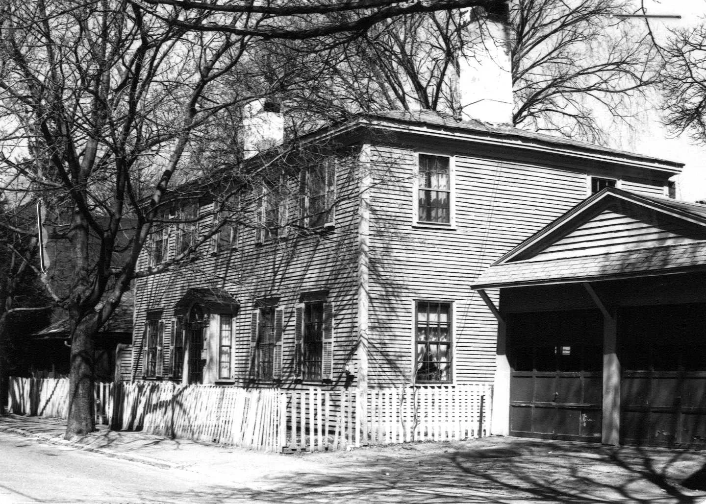
Stop 29 · c. 1810
37 Temple Street
Capt. Samuel Knapp House
Photo: Massachusetts Historical Commission, MACRIS inventory
The inventory form calls this the Captain Samuel Knapp House, a Federal house of about 1810. Bayley and Jones's History of the Marine Society has the captain: he joined the society on November 30, 1843, served on its relief committee, and died suddenly on January 21, 1858, aged fifty-four, with seventeen members at his funeral at Oak Hill. The society's record says he commanded the brigs Sea Island, Lady Washington and Carthage and the ships John Currier, General Harrison, Ferax and Clarissa Currier, among others; one of the shipping merchants in the same book remembers him in the John Currier in 1848.
Sources: MACRIS inventory form · Bayley and Jones, History of the Marine Society (1906), pp. 329, 387, 419
Walk · 70 yardsContinue up Temple Street about 70 yards to its end at Fair Street. The gambrel-roofed house on your right, on the corner, is number 29. look: The curved front slope of the gambrel roof, which the inventory form says occurs in only two or three other houses in the city.
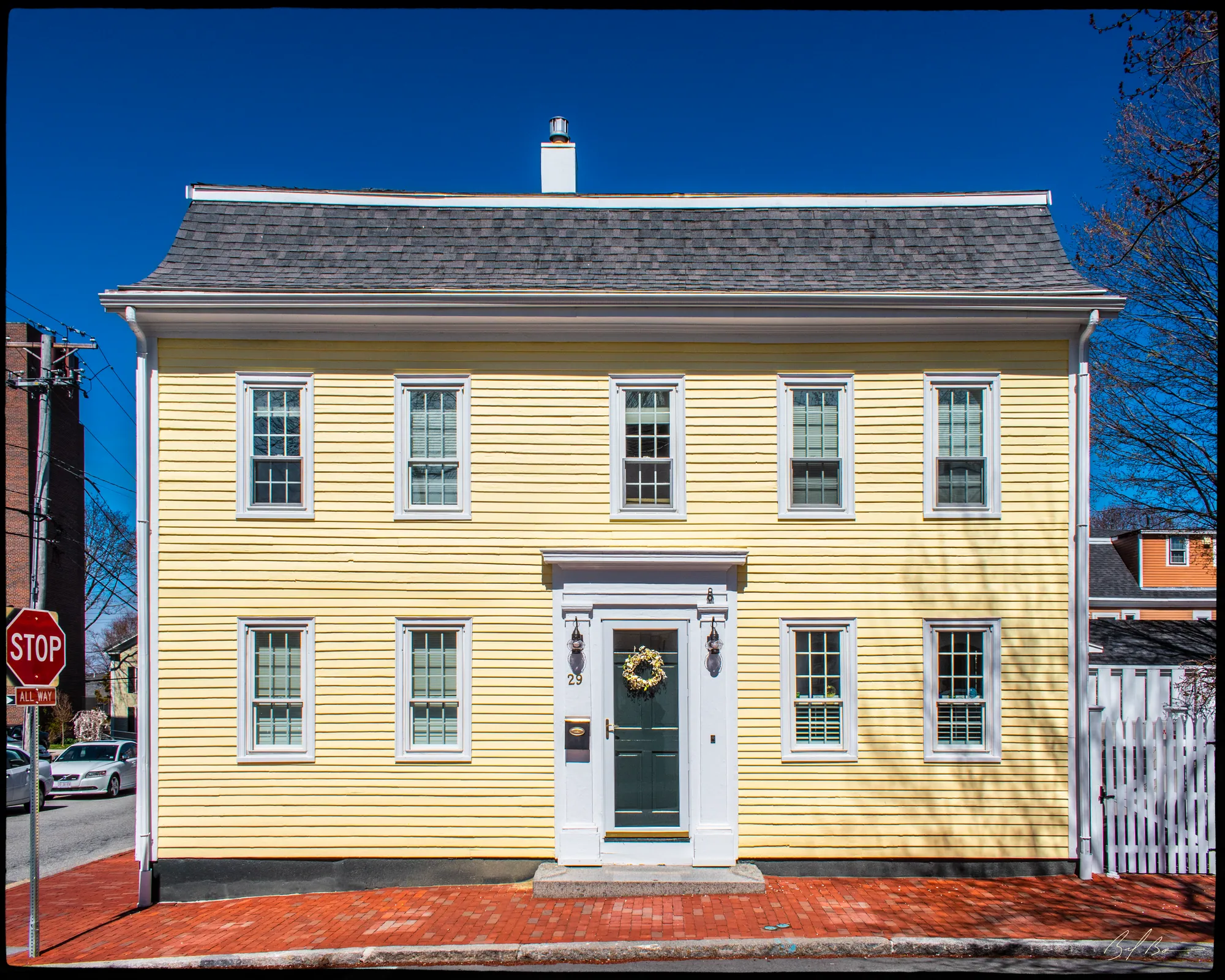
This was Colonel Edward Wigglesworth's house, and the street in front of it was laid out past his door: Currier's History prints the 1782 petition for Fair Street, “laid down from Temple street, fronting Col. Edward Wigglesworth's house and John Woodman's house to Cross street.” Currier's second volume says Wigglesworth was born in Ipswich in January 1742, graduated from Harvard in 1761, clerked for his classmate Jonathan Jackson and commanded a vessel for Jackson, Tracy and Tracy in the West Indies; on November 4, 1773, he “purchased a small lot of land on the southeasterly corner of Fair and Temple streets, extending to Orange street, with a dwelling house and barn thereon.” Mrs. Smith, who had his papers from his daughter, gives him the longest biography in her book. Commissioned colonel in June 1776, he was sent by General Gates to be third in command of Arnold's little fleet on Lake Champlain, and his journal of the fight of October 1776 is printed there; he was at Monmouth, and Washington made him president of a court of inquiry in 1778. When he asked to resign in 1779, Washington wrote: “I hope your success in the line of life you are about to pursue, will fully compensate for the losses you have sustained in the service of your country.” Smith adds, “But Colonel Wigglesworth's pecuniary prospects were already ruined by his devotion to his country.” Washington made him collector of the port in 1792, and Currier says that in 1796 his house and land were taken on execution for his debts; Dudley Atkins Tyng, who followed him as collector, conveyed it to David Coffin in 1799, and the inventory form says Coffin sold it to Abel Lunt the next year. Wigglesworth got a pension through President Monroe, an old comrade, and Currier says that “with the assistance of relatives and friends, managed to eke out a scanty subsistence until his death, December 8, 1826,” when he was buried with military honours from the Prospect Street meeting house, the survivors of Bunker Hill carrying the pall. In the Lunts' time the house produced a writer: the inventory form says George Lunt was born here on December 31, 1803, and Currier's appendix has him as United States attorney for Massachusetts from 1849 to 1853 and editor of the Boston Courier.
Sources: Currier, History of Newburyport, vol. 1 (1906), pp. 337, 581 · Currier, History of Newburyport, vol. 2 (1909), pp. 227–228, 514 · Smith, History of Newburyport (1854), pp. 356–362 · MACRIS inventory form
Walk · 110 yardsTurn left onto Fair Street and walk about 55 yards, then turn right into Prospect Street. The church lot on your right, running through from Prospect Street back to Temple Street, is the site of the Fourth Religious Society's meeting house, the Prospect Street Church. Stop opposite it, about 40 yards along.
Stop 31
Prospect Street Church
The congregation that built here walked out of the Old South. Currier's History says the Reverend Charles W. Milton, a Londoner educated by Lady Huntingdon, came from New Brunswick to supply the Federal Street pulpit in 1791 and preached so well that part of the congregation refused to let him go; the Presbyterians suspended the members who went to hear him, and his friends organized a church of their own. The frame of their meeting house went up on June 11, 1793, and Mrs. Smith quotes the Essex Journal of the next day: “the frame of a meeting-house sixty-seven feet by sixty, was raised in Temple street. It is designed for a handsome edifice, and, on the plan of the new meeting-house in Boston, it is to have two steeples in front.” Currier says the main entrance was on Prospect Street, with a door under the pulpit on Temple Street since closed, and that the society was incorporated as the Fourth Religious Society on February 22, 1794, Milton being installed that March; a bell of a thousand and twenty pounds followed. Smith says “Mr. Milton's fame has been spread abroad by the eccentricities of his character,” and Currier's second volume gives one: finding a parishioner named Mark asleep on a hot Sunday, he stopped, shouted the man's name twice, and went on with the psalm, “Mark, I say, the perfect man, and behold the upright, for the end of that man is peace.” He preached here for over forty years. His successor, the Reverend Randolph Campbell, came from New Jersey in 1837 and, Currier says, “remained active pastor until 1877 and pastor emeritus until his death, August 9, 1886.” Our own research for this site records that Frederick Douglass spoke in this church in September 1841, early in his life as a lecturer, when it was still called the Temple Street Church. Currier adds a wartime scene: on Washington's birthday in 1862 the town met here, the bells rang morning, noon and night, and Mr. Campbell's successor on the platform read the farewell address while the city celebrated the fall of Fort Donelson.
Sources: Currier, History of Newburyport, vol. 1 (1906), pp. 280–283, 425 · Currier, History of Newburyport, vol. 2 (1909), pp. 448–449 · Smith, History of Newburyport (1854), pp. 310, 376 · oldnbpt.com research
Walk · a few stepsWalk back toward Fair Street about 25 yards. The Georgian house on your right, across the street from the church lot and a few doors short of the corner, is number 24.
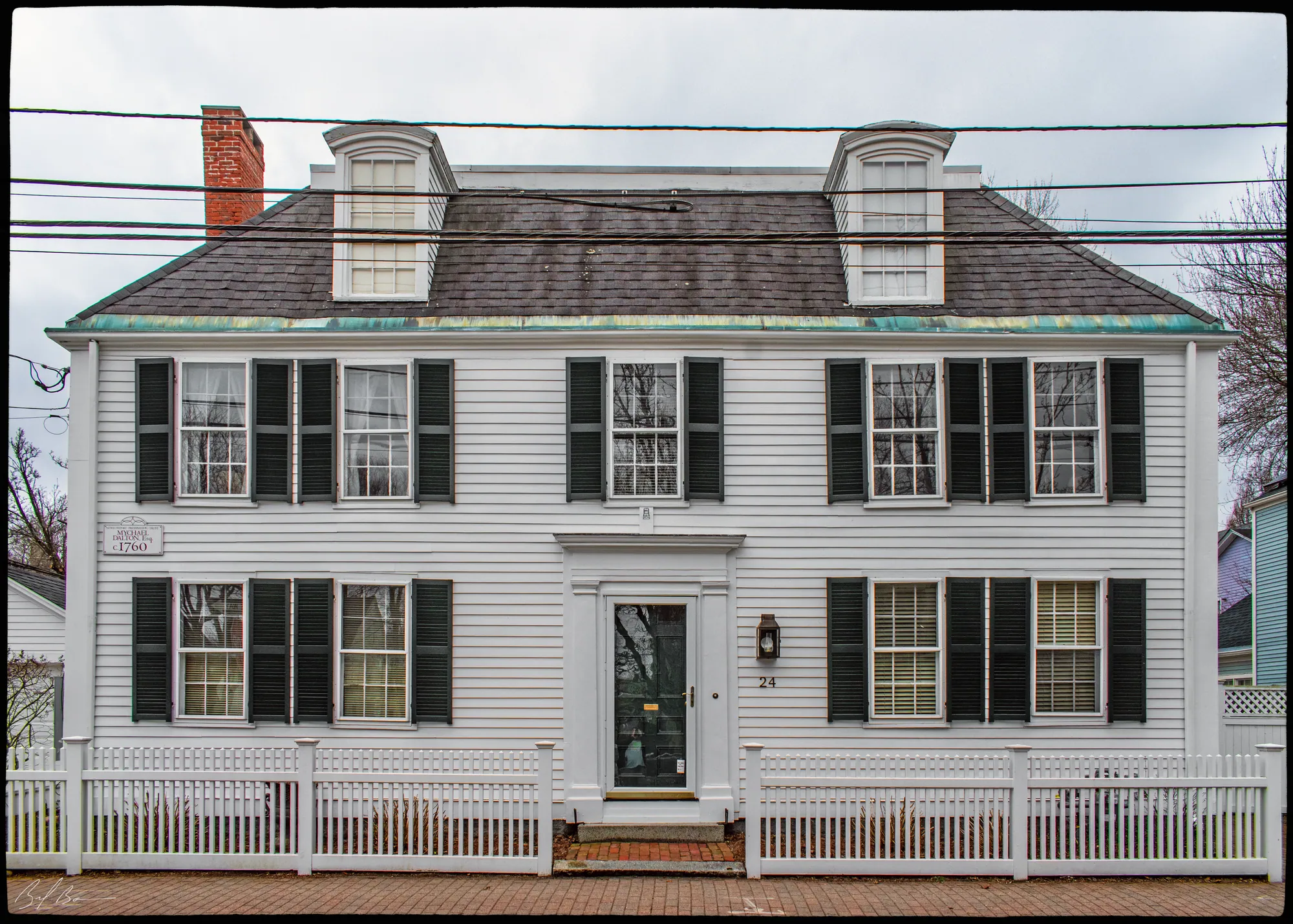
The inventory form dates this house to about 1790 and gives it no name, and the histories do not mention it. Prospect Street is one of the oldest ways on the walk: Currier's History says Newbury accepted it on March 15, 1750, a rod and a half wide, from Fish Street, now State Street, to King Street, now Federal.
Sources: MACRIS inventory form · Currier, History of Newburyport, vol. 1 (1906), p. 349
Walk · 270 yardsContinue to Fair Street and turn left, back toward the river. Follow Fair Street for about 200 yards, crossing Temple, Orange and Spring Streets, and turn left into Essex Street, the last turning before Middle Street. About 45 yards along, on your left, is number 24.
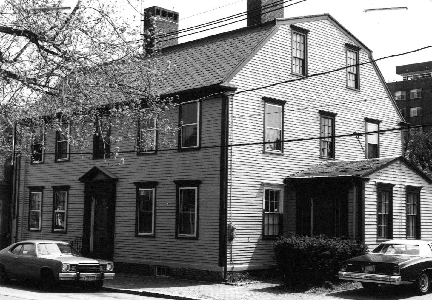
Stop 33 · c. 1750
24 Essex Street
Charles Whipple House
Photo: Massachusetts Historical Commission, MACRIS inventory
The inventory form calls this the Charles Whipple House, a Georgian house of about 1750, which would make it older than Essex Street itself: Currier's History says the street, from State Street to Fair Street, was accepted on April 4, 1796. Currier's volumes know a Charles Whipple who kept a bookstore and circulating library at No. 4 State Street from 1815 and published books here for years, including Caleb Cushing's history of the town in 1826, and Cushing lists a Charles Whipple among the town's tithingmen that year; whether he is the Whipple of this house, the books do not say. Essex Street was the edge of the great fire: Mrs. Smith says that in 1811 “On Essex street, the destruction extended only to the house of Captain James Kettle,” on the north-east side, the side opposite you.
Sources: MACRIS inventory form · Currier, History of Newburyport, vol. 1 (1906), pp. 349, 499, 521 · Cushing, History and Present State of Newburyport (1826) · Smith, History of Newburyport (1854), p. 185
Walk · a few stepsNext door on your left, the gambrel-roofed house with the projecting centre bay, is number 22. look: The doorway: fluted Doric pilasters, a fanlight with fine tracery and a pediment over the projecting bay, which the inventory form calls exceptional in every detail.
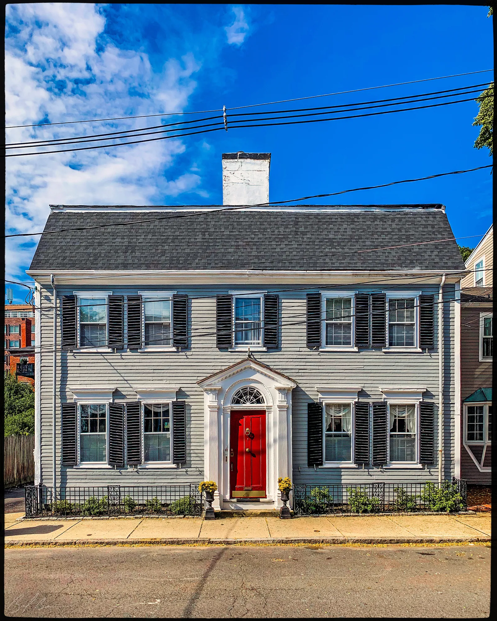
The inventory form dates this house to about 1800 and names it for Tristram Chase, who owned it in 1851 and kept a grocery at 3 Merrimac Street. Currier's History lists a Tristram Chase among the tithingmen elected in March 1837, the last year the town bothered with them, and Cushing's history has him in the same office in 1826. By 1872 the house belonged to the Reverend Randolph Campbell of the Prospect Street church you have just left, who, Currier says, was installed on October 12, 1837, after preaching several Sundays that summer, remodelled the meeting house in 1845, and served forty years before he died in 1886.
Sources: MACRIS inventory form · Currier, History of Newburyport, vol. 1 (1906), pp. 27, 283 · Cushing, History and Present State of Newburyport (1826)
Walk · a few stepsA few steps on, on your left, is number 18.
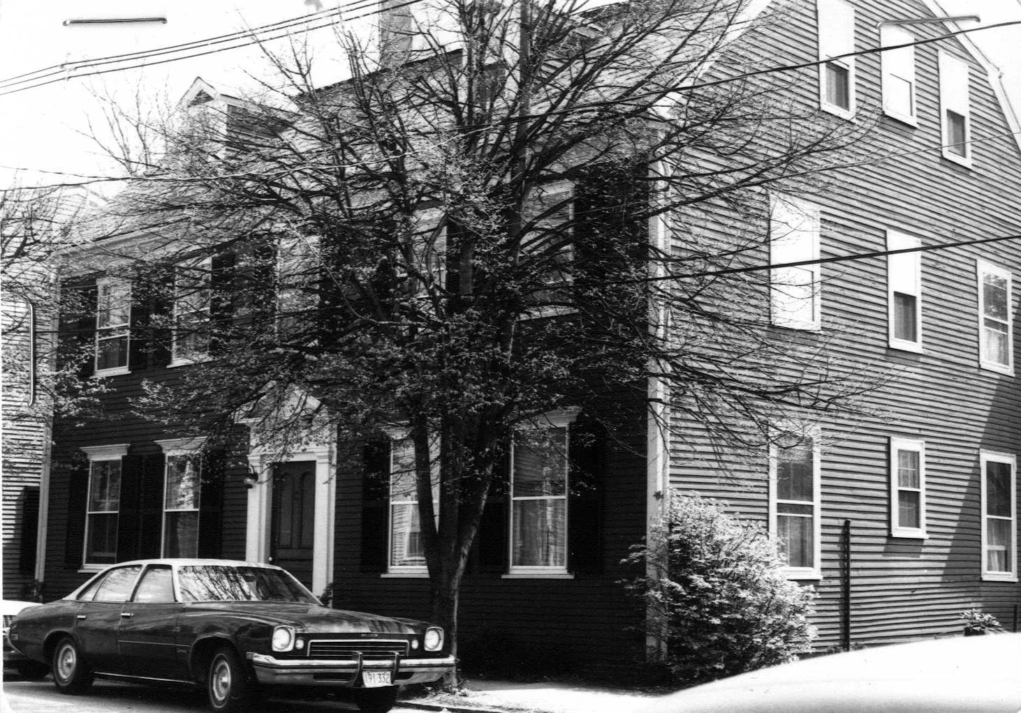
Stop 35 · c. 1750
18 Essex Street
Ann G. Tappan House
Photo: Massachusetts Historical Commission, MACRIS inventory
The inventory form lists this as the Ann G. Tappan House, a Georgian house of about 1750. Currier's second volume records that in 1901 the estate of Miss Ann G. Toppan gave nine thousand dollars to the General Charitable Society of Newburyport, the largest gift in its list, which had been looking after the sick and destitute of the town since the 1850s; whether she is the owner the inventory names, Currier does not say.
Sources: MACRIS inventory form · Currier, History of Newburyport, vol. 2 (1909), p. 144
Walk · a few stepsNext door on your left, the three-storey house with the small square third-floor windows, is number 16. look: The pedimented doorway with Doric pilasters, between Georgian and Federal; the inventory form says a fully Federal door would have a fanlight and sidelights.
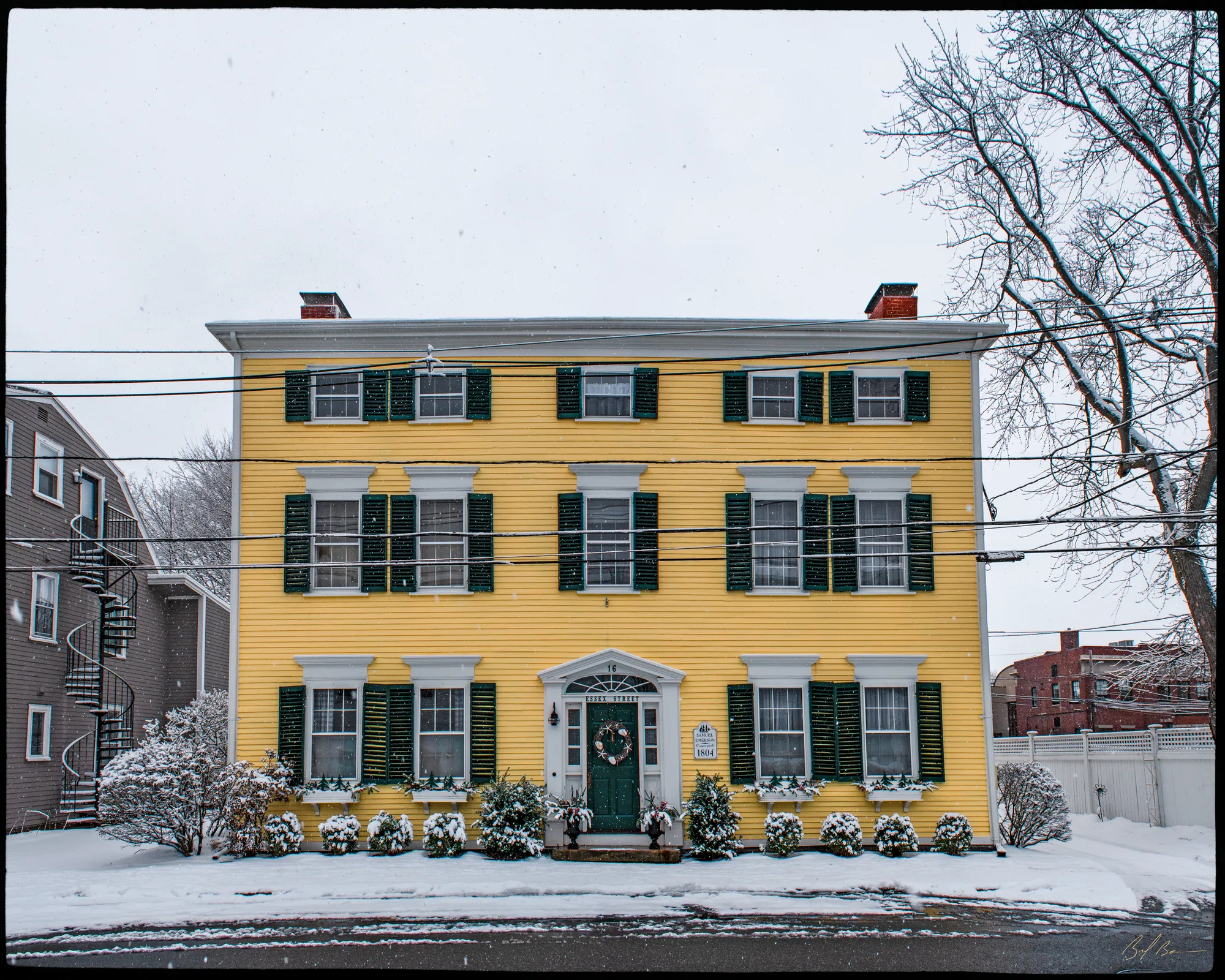
The inventory form says this house was built about 1804 for Samuel Emerson, a coppersmith, and that in 1851 it belonged to William Wells, who came from Andover in 1847 to be the first principal of the Putnam Free School. Currier's second volume confirms a William H. Wells as principal from the school's opening in April 1848 to July 1854, and as the first president of the Merrimack Library Association, formed to buy books for a public library. By 1872, the form says, the house was Dr. Henry C. Perkins's, who owned several houses on this street. Currier's list of the city's physicians in 1851 already puts Dr. Perkins on Essex Street. “Ould Newbury” says he was born in an upper chamber of the Wolfe Tavern on November 13, 1804, where his father was the innkeeper; Currier's second volume adds that he took his Harvard degree in 1824 and his medical degree in 1827, and lectured the town's lyceum on heat and on the theory of eclipses. The house stayed in the Perkins family well into the twentieth century.
Sources: MACRIS inventory form · Currier, History of Newburyport, vol. 2 (1909), pp. 175, 305, 309, 387 · Currier, “Ould Newbury” (1896), p. 503
Back to the start · 260 yardsContinue along Essex Street about 90 yards to State Street, with the Institution for Savings on the far corner, and turn right. Walk down State Street toward the river about 75 yards and turn right into Middle Street. Number 23, where you began, is about 100 yards along on your left; about 250 yards in all.
You end where the fire of 1811 stopped. Smith says it took every building on the north side of State Street from Pleasant Street to Market Square, was checked on Essex Street at Captain Kettle's house, and ran down Middle Street to Fair. The brick blocks at the foot of these streets are what the town built back; the clapboard houses beyond them, on Fair, Spring and Temple Streets, are what it never lost.
Sources for this walk
The script paraphrases and quotes these works, all of them out of copyright, and names each one as it goes. Page numbers are from the editions linked here. Where the script says “our research for this site,” the facts are from the building page it links to.
- John J. Currier, History of Newburyport, Mass., 1764–1905, vol. 1 (Newburyport: the author, 1906). archive.org/details/historyofnewbury01curr
- John J. Currier, History of Newburyport, Mass., 1764–1905, vol. 2 (Newburyport: the author, 1909). archive.org/details/historyofnewbury04curr
- John J. Currier, “Ould Newbury”: Historical and Biographical Sketches (Boston: Damrell & Upham, 1896). archive.org/details/ouldnewburyhisto00curr
- John J. Currier, History of Newbury, Mass., 1635–1902 (Boston: Damrell & Upham, 1902). archive.org/details/historyofnewbury1902curr
- Joshua Coffin, A Sketch of the History of Newbury, Newburyport, and West Newbury, from 1635 to 1845 (Boston: Samuel G. Drake, 1845). archive.org/details/sketchofhistoryo00coff_0
- E. Vale Smith, History of Newburyport; from the Earliest Settlement of the Country to the Present Time (Newburyport, 1854). archive.org/details/historyofnewbury00blake
- Sarah Anna Emery, Reminiscences of a Nonagenarian (Newburyport: William H. Huse, 1879). archive.org/details/reminiscencesofn00emer
- Caleb Cushing, The History and Present State of the Town of Newburyport (Newburyport: E. W. Allen, 1826). archive.org/details/historypresentst00cush
- William H. Bayley and Oliver O. Jones, History of the Marine Society of Newburyport, Massachusetts, from Its Incorporation in 1772 to the Year 1906 (Newburyport, 1906). archive.org/details/historyofmarines00baylrich
- Albert Hale, comp., Old Newburyport Houses (Boston: W. B. Clarke Co., 1912). archive.org/details/cu31924015356714
- First Presbyterian Church, Origin and Annals of “The Old South,” First Presbyterian Church and Parish, in Newburyport, Mass., 1746–1896 (Boston: Damrell & Upham, 1896). archive.org/details/originannalsofth00firs
- Horace C. Hovey, “The House of God”: Historical Discourse on the Sesqui-centennial of the Old South Meeting House (Newburyport, 1906). archive.org/details/thehouseofgodhis00hove
- D. Hamilton Hurd, comp., History of Essex County, Massachusetts, vol. 2 (Philadelphia: J. W. Lewis & Co., 1888). archive.org/details/historyofessexco02hurd
- Massachusetts Historical Commission, Massachusetts Cultural Resource Information System (MACRIS), Newburyport inventory forms. mhc-macris.net
- Biff Bouse, oldnbpt.com building pages (own research from deeds, Sanborn maps and newspapers). oldnbpt.com
More walks: State Street and Market Square · Green Street, Brown Square and Pleasant Street · High Street: Down Along and the Ridge · The Water Street Waterfront · Joppa: The Oldest Houses · Joppa: The Fishing Village · Along the River: The North End Shipyards · The Rail Trail: Mills, Ropewalks and Old Hill · Newburyport in the Civil War · Churchyards and Burying Grounds