Walking tours · Downtown · 29 stops
Green Street, Brown Square and Pleasant Street
A short downtown loop from the Bartlett Mall down Green Street, the street of merchants' houses laid out in 1782, to Brown Square and City Hall, then along Pleasant Street past the Unitarian church, the site of the cotton mills and the shoe factories, and back up State Street to High Street. About a mile and a quarter, mostly level, with a gentle climb at the end.
- Length
- About 1.2 mi, a loop
- Time
- About 85 min, with the reading
- Start and finish
- Bartlett Mall, in front of the courthouse
Before you set off
This walk is the town the merchants built after the Revolution, in the thirty years when Newburyport was rich. John J. Currier's “Ould Newbury,” published in 1896, says that Stephen Sewall, Stephen Hooper, Nathaniel Tracy, the Titcombs and the heirs of Benjamin Frothingham gave the land for a four-rod way from High Street to the river between State and Market Streets, and that on March 28, 1782, Green Street, as laid out, was accepted by the town. Pleasant Street, he says, was accepted in 1796 and Titcomb Street in 1798, and Brown Square was never laid out by the town at all: it was the gift of Moses Brown, the chaise-maker turned merchant, who owned the land between Green and Titcomb Streets and wrote the square into his deeds in 1802. Sarah Anna Emery, who was born in 1787 and wrote her Reminiscences of a Nonagenarian at ninety, remembered the summer of 1800, when “the gulley at the head of Green street was filled up, and the mall was laid out, graded and railed,” and the summer of 1805, when the court house went up, after which, she says of High Street, “within a short period several handsome private residences had also been erected, adding much to the beauty of the street.”
The second half of the walk is the town that came after. Currier's History of Newburyport of 1906 records the vote of March 1850 to build the hall that became City Hall, the cotton mill at the corner of Pleasant and Inn Streets that burned in 1881, and the shoe factories that filled Pleasant Street in the 1870s. Between them stands the Pleasant Street meeting house of 1801, which Currier says was the town's place for orations and celebrations for half a century. Nearly everything on this loop is still standing; the three sites that are not are marked as we pass them.
Numbers follow the walk. The line is the route along the streets, back to where you started.
Read it aloud as you go: each stop begins with where to walk and where to stand, then what the old histories say about the place. The sources are named as you read and listed in full at the end.
StartThe loop starts on the Bartlett Mall, the long park on the south-west side of High Street between Green and Pond Streets, with the Frog Pond below it. Park on High Street or in the lot off Pond Street. Stand on the mall path in front of the courthouse, with the pond behind you and High Street in front of you.
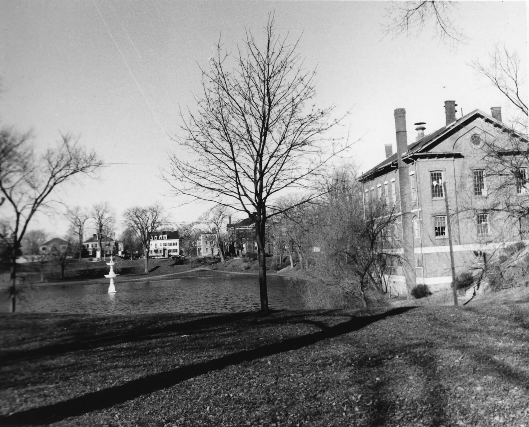
Currier's “Ould Newbury” says the uneven strip between the pond and the country road, which is High Street, was the last of the land round here to be graded, and was named Bartlet Mall. His History of Newbury of 1902 puts a windmill at the south-east end of the pond in 1703, and Joshua Coffin's Sketch of the History of Newbury of 1845 says the town granted John Crocker leave in 1748 to build a rope-walk “along by the windmill.” Emery remembered the pond in her childhood as “a tangled wilderness of alder and other bushes,” with a frightful ravine at the upper end, a gun house, the windmill on the heights and the rope-walk along the water.
The ravine is why the park has its name. Coffin says that in June 1800 Captain Edmund Bartlet began to fill the gully, a hundred and eighty feet long and fifteen feet deep, and that by August “the mall as it now stands was completed, at an expense of about eighteen hundred dollars, of which fourteen hundred were generously given by captain Bartlet.” The second volume of Currier's History, published in 1909, adds that Bartlet was then only twenty-four. Mrs. E. Vale Smith, whose History of Newburyport came out in 1854, describes the mall as “an enclosed piece of ground on the centre of which stands the County Court House, and at either end, a brick school-house,” with the pond behind it ringed by terrace walks. The schoolhouses are gone. Currier's 1909 volume says the park was re-graded in 1888 to plans by the landscape gardener Charles Eliot, that Daniel I. Tenney gave the Washington statue at the Pond Street end in 1879, and that the fountain in the pond was Edward S. Moseley's gift of 1891. Currier's 1906 History records the park's best day: in July 1817 President Monroe was brought here to meet the schoolchildren of the town before being escorted down to his dinner on State Street.
Sources: Currier, “Ould Newbury” (1896), ch. "Bartlet Mall" · Currier, History of Newbury (1902), p. 259 · Coffin, Sketch of the History of Newbury (1845), pp. 218, 272 · Emery, Reminiscences of a Nonagenarian (1879), p. 76 · Currier, History of Newburyport, vol. 2 (1909), pp. 183, 236, 399–401 · Smith, History of Newburyport (1854), p. 270 · Currier, History of Newburyport, vol. 1 (1906), p. 415 · MACRIS inventory form
Walk · 100 yardsWalk along the mall path toward High Street, about sixty yards, then turn left along High Street for about forty yards until you are opposite the head of Green Street. The courthouse is behind you on the mall; turn round and look at it from here, where its whole front is in view. look: The brick arches of the ground floor are filled in now; the open arcade and the statue over the door are gone, but walk round to the back later and the plain Federal brick of 1805 is still there.
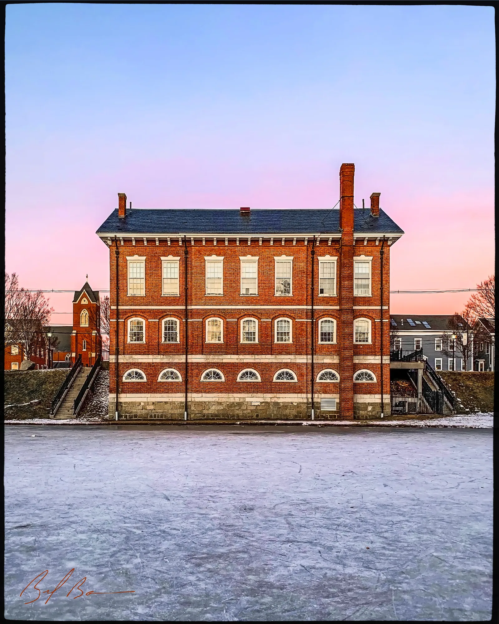
Currier's History of 1906 prints the town vote of October 2, 1804, to join the county in building a court house “between the Mall & frog pond, directly fronting the head of Green street,” and says the new building, designed by Charles Bulfinch of Boston, was finished in 1805. It was, he says, a stately building with an open portico, brick pillars and arches carrying the second storey, and a figure of Justice with her scales above the pediment; Emery, who saw it new, remembered her “holding a scale and sword.” Before this, Currier's “Ould Newbury” says, the courts sat in the old town house at State and Essex Streets, and the opening of a session was rung in on the bell of the Second Presbyterian meeting house, the church on Harris Street, which the boys of the town heard as “Run, boys, run! The Court's begun! Stand 'fore the justice And tell what you've done.”
For nearly thirty years, the 1906 History says, town meetings were held here and a girls' school was kept in a lower room, until the town sold its share to the county in 1834. Then came 1853: the old roof came off and a bracketed one went on, the arches were bricked up, Justice was taken down and the whole building coated in mastic. Mrs. Smith, writing the next year, says the exterior was “modernized, and finished with mastic cement of a dark brown color,” for twelve thousand four hundred dollars, and thought it now the best court house in the county. Currier did not: the alterations, he wrote, “have obliterated all traces of architectural beauty and converted the court house into a plain and substantial edifice, convenient and commodious, perhaps, but otherwise unattractive.” The state inventory form adds that it is one of the oldest courthouses in the country still in use.
Sources: Currier, History of Newburyport, vol. 1 (1906), pp. 129–133 · Currier, “Ould Newbury” (1896), ch. "Bartlet Mall" · Emery, Reminiscences of a Nonagenarian (1879), p. 76 · Smith, History of Newburyport (1854), p. 168 · MACRIS inventory form
Walk · 60 yardsCross High Street at the crossing by the head of Green Street and walk down Green Street, away from the mall, on the right-hand side. After about fifty yards the big three-storey house on your right is number 49. look: The doorway is a later Greek Revival one, with a plain Doric frame and wide side lights; the delicate caps over the windows and the cornice above are the original Federal work.
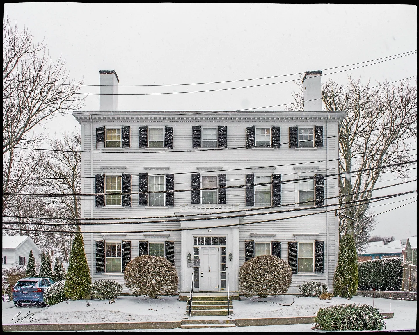
Albert Hale photographed this house for his Old Newburyport Houses of 1912 under the number it then carried, 41–43 Green Street, and called it the Pike-Coffin House: “In 1806 this land was bought by James Potter who built the house shortly afterward.” Potter sold it in 1809 to John Pettingell, it passed in 1828 to his son-in-law Joseph S. Pike, and in 1860 to Frederick J. Coffin. Pettingell appears all over Currier's 1906 History as a man of affairs: a signer, with Moses Frazier and Tristram Dalton, of the petition to the selectmen of 1774, two months before the first Continental Congress met, and in 1816 one of the incorporators, with William Bartlet and Moses Brown, of the Merrimack River Association, which was to build locks and canals round the falls of the river; the inventory form adds that he was a selectman in the 1790s and part owner of privateers. Coffin, the owner from 1860, was the architect of the next generation. Currier names him on the committee that built the town hall in 1850, Mrs. Smith lists him among the originators of the Ocean Steam Mill, and the inventory form credits him with the Baptist church you will pass at the foot of this street and with several of the city's schools.
Sources: Hale, Old Newburyport Houses (1912), p. 22 · Currier, History of Newburyport, vol. 1 (1906), pp. 149, 203, 531 · Smith, History of Newburyport (1854), p. 287 · MACRIS inventory form
Walk · 140 yardsContinue down Green Street about ninety yards and turn right into Harris Street. Number 16 is about fifty yards along on your right, the white house with the carved doorway. look: Fluted pilasters, carved wreaths in the frieze over the door, and a door panel carved with leaves: the inventory form compares it to the pattern books of the New York architect Minard Lafever.
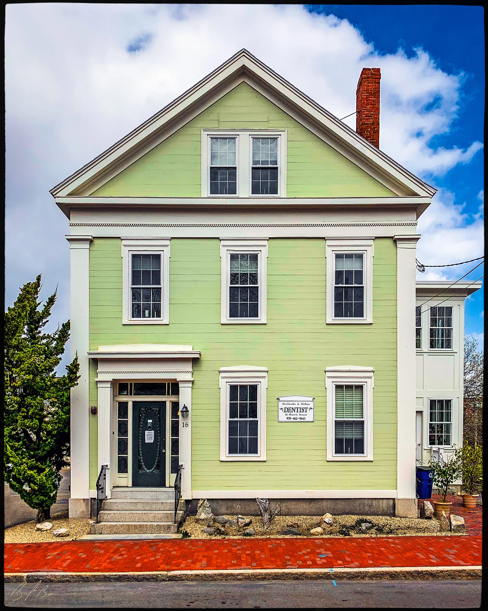
Emery explains the street. The Harris estate, she says, once ran from State Street nearly up to High and back to Green Street, and “Harris street was cut through the grounds, thus deriving its name”; Currier's History of 1906 gives the date the town accepted it, March 17, 1796. The house is younger. The state inventory form dates it to about 1840 and says that in 1851 it was the home of Richard Fowler, a coal and wood dealer whose firm, Richard Fowler and Son, was on Water Street, and whose family stayed here for decades. Currier gives Fowler one civic moment: in March 1851 the town chose him, with Philip K. Hills and Isaac H. Boardman, to go before the General Court and argue for annexing the Ridge, Joppa and the rest of the Newbury waterside to Newburyport, the bill that made the city what it is.
Sources: Emery, Reminiscences of a Nonagenarian (1879), p. 232 · Currier, History of Newburyport, vol. 1 (1906), pp. 207, 283 · MACRIS inventory form
Walk · 60 yardsGo back up Harris Street to Green Street and turn right. The brick house just past the corner on your right, with the two arched doorways, is number 39. look: Brownstone lintels over the windows and elliptical fanlights in both doors; the inventory form calls the fanlights exceptional and original.
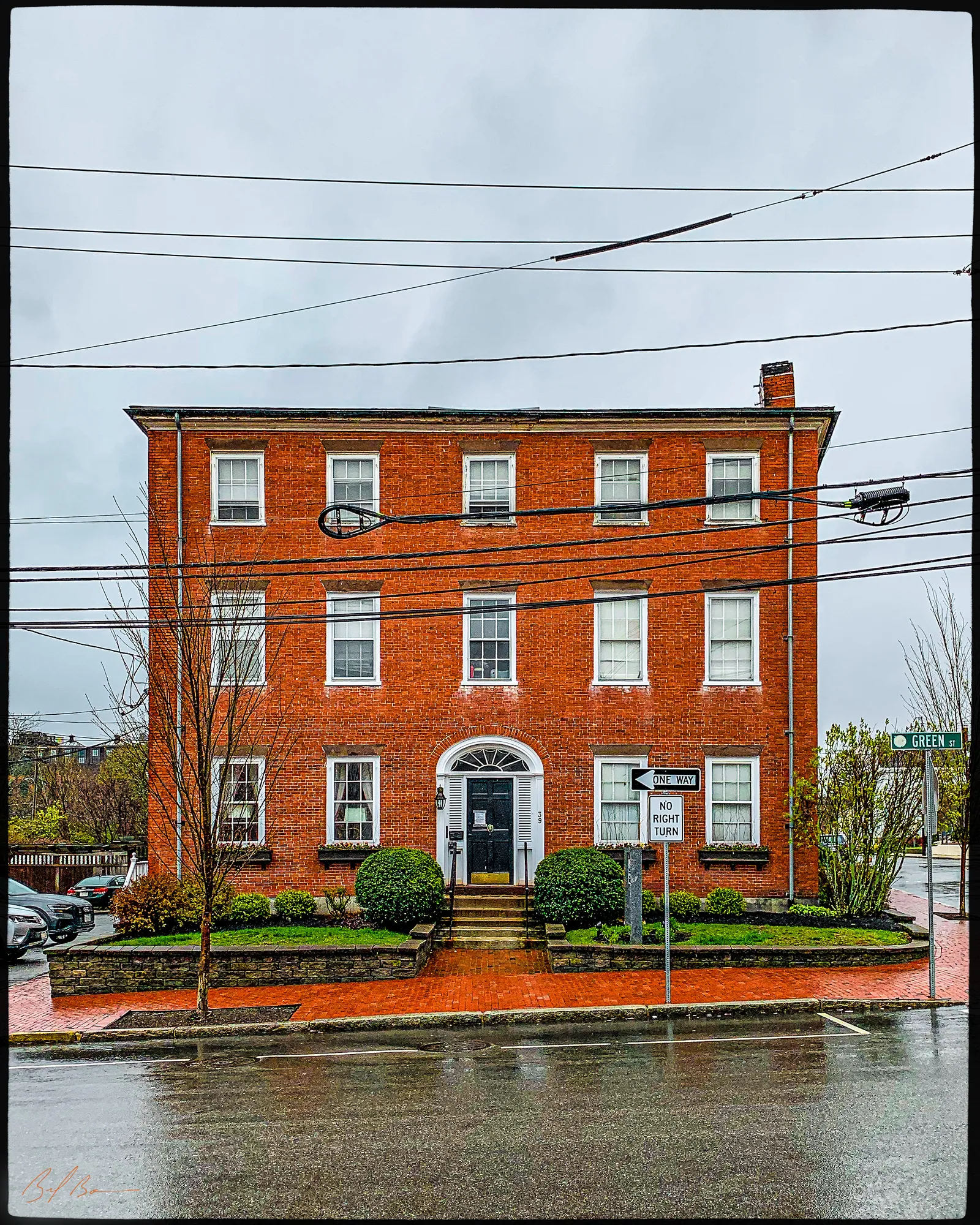
Hale, who photographed it as the Davis House, says “This house was built by Allen Dodge, it is believed in 1811, the land having been purchased by him in 1807.” Emery, walking down Green Street in her memory, puts “the residence of Mr. Allen Dodge” on this corner opposite the two houses Leonard Smith built for his sons, and the second volume of Currier's History has Dodge serving as a selectman in 1814 and 1815. The inventory form adds that he owned the schooner Citizen and part of a ship of the same name.
Hale's owners run from Dodge to Parker Roberts in 1824, Richard W. Drown from 1833 to 1840, Thomas Davis and his heirs from 1840 to 1906, and James Kiley after that. Drown is the one with a story. Currier's 1909 volume says he came to Newburyport from New Hampshire at fifteen or sixteen, learned the trade of a clock and watch maker, and “had a shop on the northeasterly side of Merrimack street, opposite the foot of Green street, that he owned and occupied for many years.” He left this house for a new one at High and Court Streets in 1842, and when he died in 1888 his will gave two thousand dollars each to the Howard Benevolent Society and the Ladies' General Charitable Society; the inventory form says the bulk of his estate went to the poor and aged men of the city. The inventory form says Thomas Davis, the owner for the rest of the century, had commanded the batteries on Plum Island as a sergeant in the War of 1812 and was later treasurer of the Newburyport Railroad.
Sources: Hale, Old Newburyport Houses (1912), p. 25 · Emery, Reminiscences of a Nonagenarian (1879), p. 232 · Currier, History of Newburyport, vol. 2 (1909), pp. 383–384, 599 · MACRIS inventory form
Walk · a few stepsA few steps on, about thirty-five yards, the next house on your right, with the full third storey and the Italianate porch, is 35–37. look: Nearly every three-storey Federal house in town has a short top floor; this one's was built up to full height later, which is why it looks so tall. The porch and door are later still.
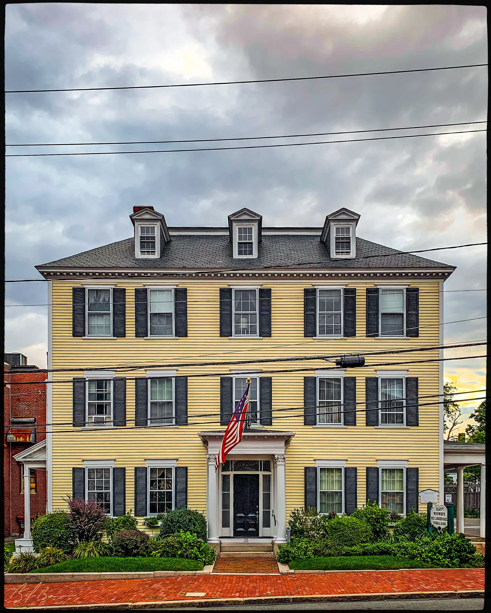
The inventory form says Moses Frazier built this house, and Frazier is everywhere in the Revolutionary pages of Currier's History of 1906: on the petition of July 1774 with Patrick Tracy and Tristram Dalton, on the Committee of Safety that September, and in the list of the town's representatives to the General Court, where he sits beside Theophilus Parsons. Hurd's History of Essex County of 1888 has him as town treasurer in 1782. The best story in the house belongs to his daughter. The second volume of Currier's History says that John Quincy Adams, studying law in Newburyport in 1788, “wrote a poem entitled ‘A Vision,’ in which he criticised the airs, graces and follies of some of the young ladies then prominent in society,” and a footnote identifies the one he called Clara, whose charms “no vulgar poets claim,” as Mary Frazier, Moses Frazier's daughter, born in 1774, afterwards Mrs. Daniel Sargent. The inventory form says plainly that Adams courted her here.
The second name on the house is Jonathan Greenleaf, the shipbuilder. Currier says Greenleaf was building small vessels at the foot of what is now Federal Street in the 1760s, that the frigate Boston was built there for the state in 1776, and that Stephen and Ralph Cross built the Hancock and the Protector in the yard next to his. Emery says Greenleaf “owed all that he was to his industry and natural talents,” rising from a mechanic in the yard to its owner and to the General Court. In 1851, the inventory form says, the house belonged to Stephen W. Marston, justice of the police court and president of the Newburyport Bank, and in the twentieth century it became a funeral home.
Sources: MACRIS inventory form · Currier, History of Newburyport, vol. 1 (1906), pp. 448, 531, 535, 677 · Hurd, History of Essex County, vol. 2 (1888) · Currier, History of Newburyport, vol. 2 (1909), pp. 545–546 · Emery, Reminiscences of a Nonagenarian (1879)
Walk · a few stepsCross Green Street with care, there is no marked crossing here, and walk on about thirty yards. The brick house on the corner of Washington Street, now on your left, is number 32. look: The double-hipped roof, brick belt courses between the floors and a Doric doorway like the one at number 28; the inventory form says the roof is a Newburyport habit rarely seen elsewhere in New England.
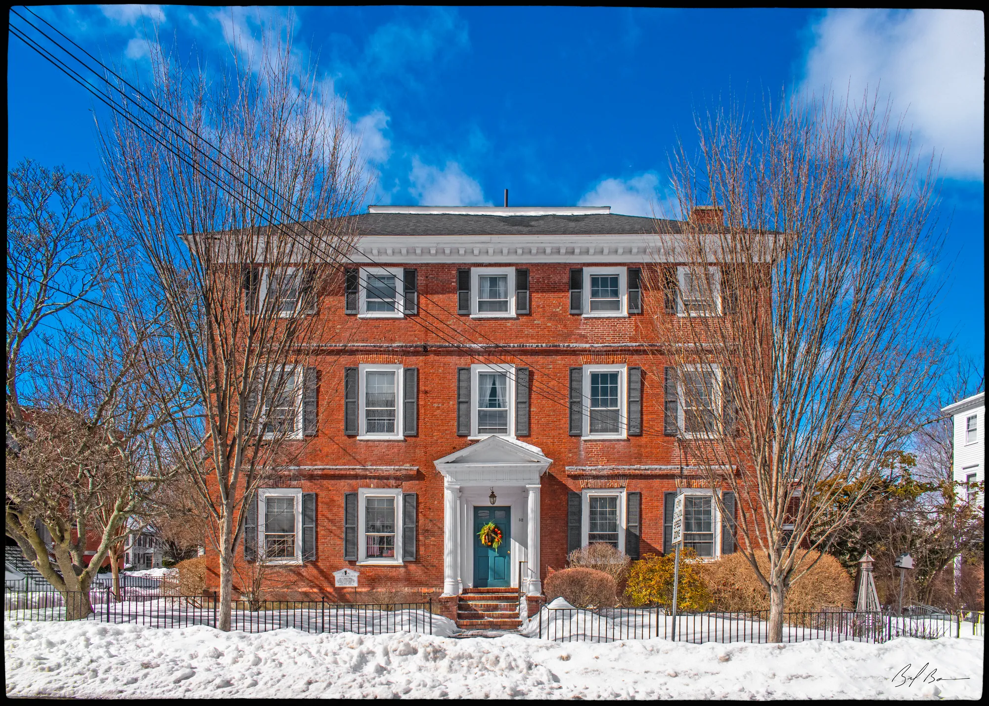
Hale calls this the Cutler-Bartlett House: “In 1782 this house, then in process of construction, was bought from the estate of Jonathan Mulliken by John Babson and completed by him.” Babson, the inventory form says, was a merchant who owned part of the privateer brig Ruby. The second volume of Currier's History picks up the story from the Marblehead side. Alice Hooper, daughter of “King” Hooper, the richest merchant in Marblehead, was painted by Copley; widowed, she married Joseph Cutler of Newburyport in 1782, and on March 9, 1786, Currier says, Cutler bought of John Babson of Gloucester “a brick dwelling house, with the land under and adjoining the same, on the northeasterly corner of Green street and Union, now Washington, street,” and lived here for many years. Emery remembered the lady: “Mrs. Joseph Cutler, as Miss Alice Hooper, had been a celebrated beauty. Her portrait, by Copley, has excited universal admiration.” Cutler himself, in Currier's 1906 History, was treasurer in 1796 of the Proprietors of Locks and Canals on the Merrimack River and cashier of the Merrimack Bank under William Bartlet; he died in 1804 and his widow in 1826.
Hale says the house was divided into two in 1810, and lists the owners of each half for a century: on the westerly side Nathaniel Bradstreet and then Sally Bartlett, Josiah Bartlett's widow, and her heirs from 1829 to 1907, which is where the second name comes from; on the easterly side three Balches and then John McCusker. The inventory form adds that Wallace Nutting, the photographer and collector, owned and restored the house early in the twentieth century.
Sources: Hale, Old Newburyport Houses (1912), p. 26 · Currier, History of Newburyport, vol. 2 (1909), pp. 185, 194–196 · Emery, Reminiscences of a Nonagenarian (1879), p. 236 · Currier, History of Newburyport, vol. 1 (1906), p. 147 · MACRIS inventory form
Walk · a few stepsContinue down Green Street about fifty yards. The next big house on your left, with the balustrade along the roof, is number 30. look: The balustrade hides a very low hip roof; under it is a cornice of “bee hive” molding topped by a row of mutules, which the inventory form singles out.
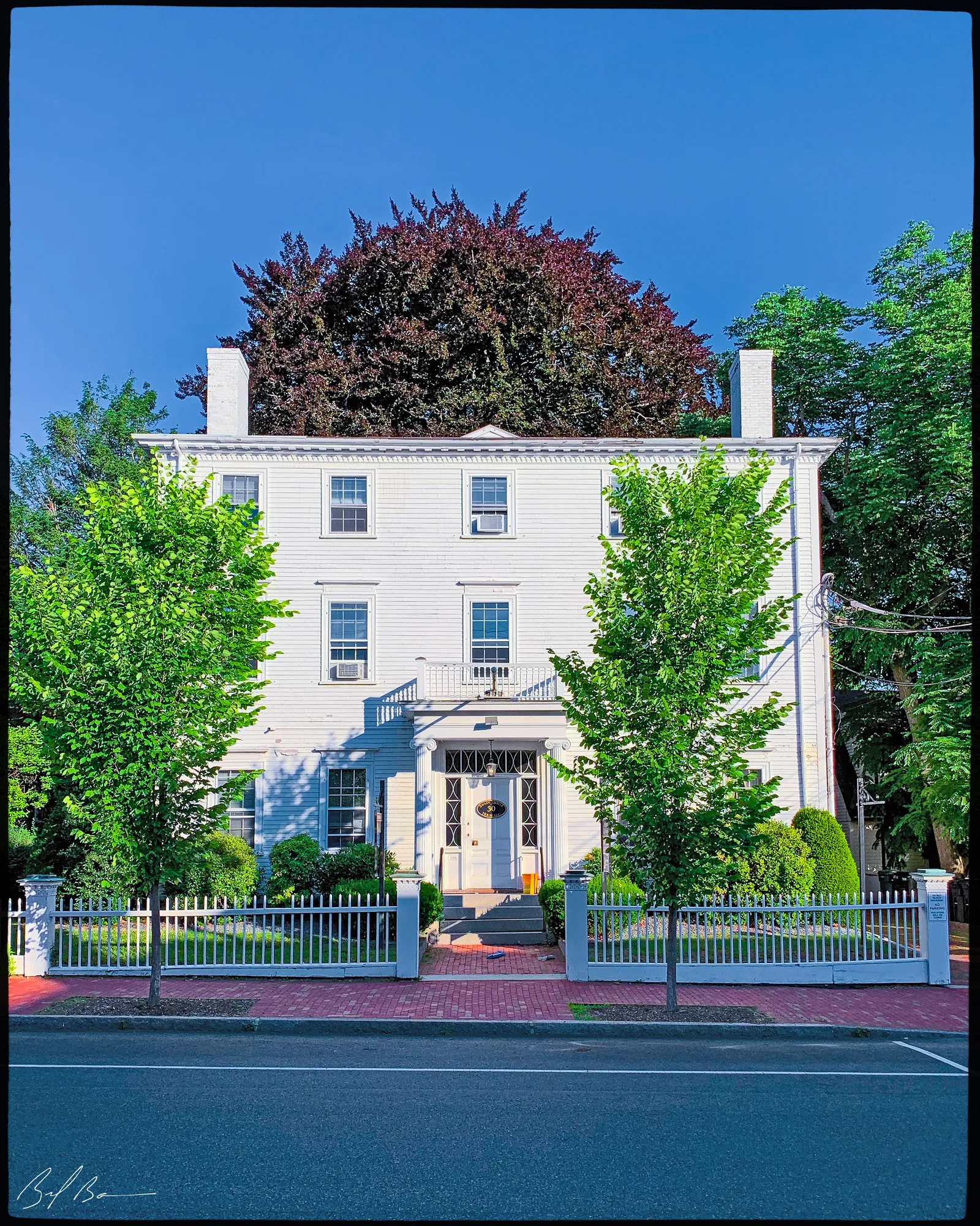
The inventory form, citing the architectural historian John Mead Howells, says this house was built by Levi Swain, a Newburyport merchant, shortly after 1800; the histories have nothing to add about Swain, so the form is all we have on the builder. The man who lived here longest, William C. Balch, is easier to find. Mrs. Smith's History of 1854 names him as agent of the Essex Steam Mill and one of the principal originators of the Ocean Steam Mill at Kent and Monroe Streets, which spun two million yards of printing cloth a year; Currier's History of 1906 has him on the first common council when the city was organized in June 1851, and his second volume lists him among the incorporators of the Newburyport Five Cents Savings Bank in 1854 and as an alderman in 1865. The inventory form says Balch owned the house for about twenty-five years in the middle of the century, and that the door, with its side and transom lights, was changed in the Greek Revival years.
Sources: MACRIS inventory form · Smith, History of Newburyport (1854), pp. 285, 287 · Currier, History of Newburyport, vol. 1 (1906), p. 209 · Currier, History of Newburyport, vol. 2 (1909), p. 169
Walk · 60 yardsAbout sixty yards further down on your left, set back behind its fence, is the gambrel-roofed house, number 28. look: Three dormers breaking the roof, and a doorway with a Doric order, triglyphs and a modillioned cornice: the inventory form calls it one of the finest Georgian houses in the city.
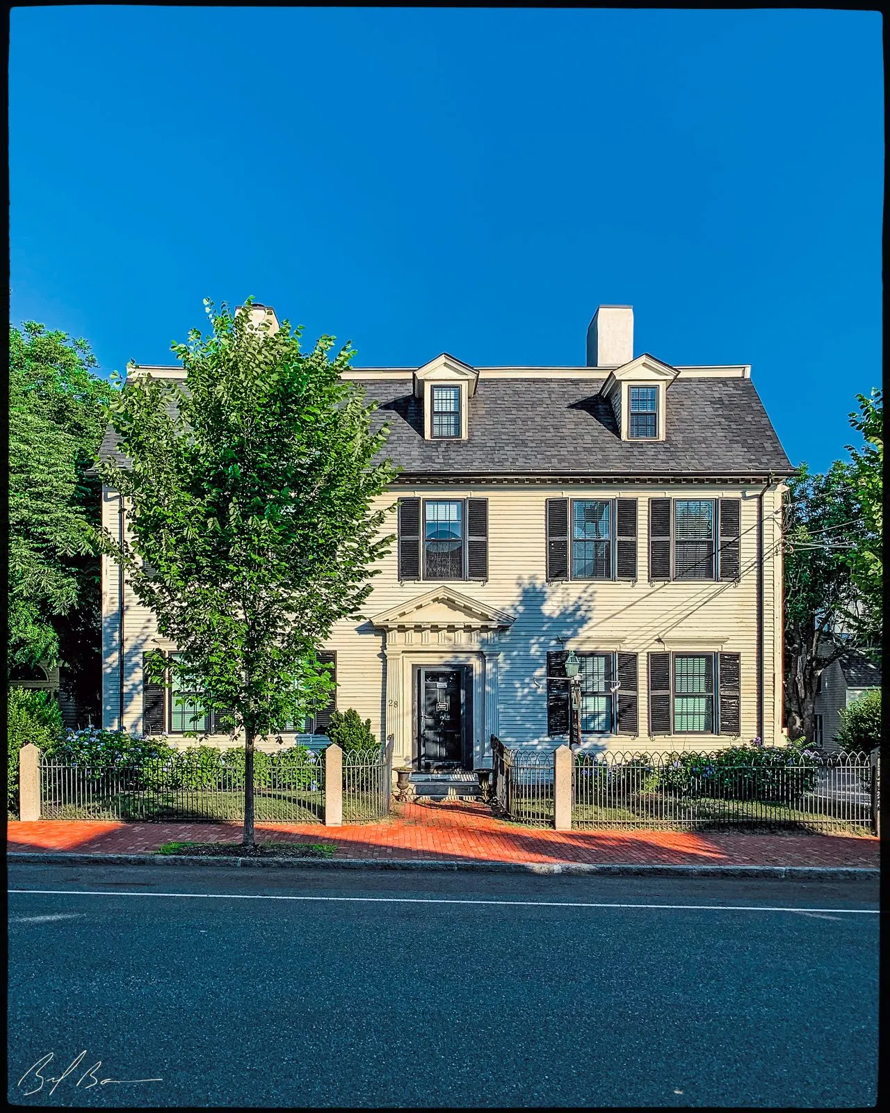
Hale's Old Newburyport Houses says the land “was bought in 1786 by Theophilus Bradbury who then built this house, probably prior to 1791,” and gives it two plates, one for the doorway alone. Caleb Cushing's history of the town, published in 1826, has Bradbury born in Newbury in 1739, a Harvard graduate of 1757, a lawyer in Portland, then Falmouth, and Mrs. Smith adds that his student there was Theophilus Parsons, whose name went on to outshine his teacher's. Currier's 1906 History has Bradbury on the committee that reviewed the state constitution in 1780 and in Congress in 1796; Smith sums him up as “eminent as a Judge of the Supreme Court of Massachusetts,” the bench he reached in 1797. Hale's owners run from Bradbury's heirs to Josiah Little in 1811, Robert Jenkins from 1814 to 1847, Hannah K. Johnson, who the inventory form says kept a grocery at the foot of this street, and from 1876 the family of the Reverend Samuel J. Spalding of the Whitefield church, whose daughter still lived here when Hale took his photograph. The inventory form notes that Newburyport went on building gambrel roofs for its best houses right up to 1800, long after the fashion had passed elsewhere.
Sources: Hale, Old Newburyport Houses (1912), p. 23 · Cushing, History and Present State of Newburyport (1826) · Smith, History of Newburyport (1854), p. 345 · Currier, History of Newburyport, vol. 1 (1906), pp. 64, 109 · MACRIS inventory form
Walk · a few stepsA few steps on, about forty yards, the stone-trimmed Gothic church on your left, at the corner where Brown Square opens off Green Street, is number 26.
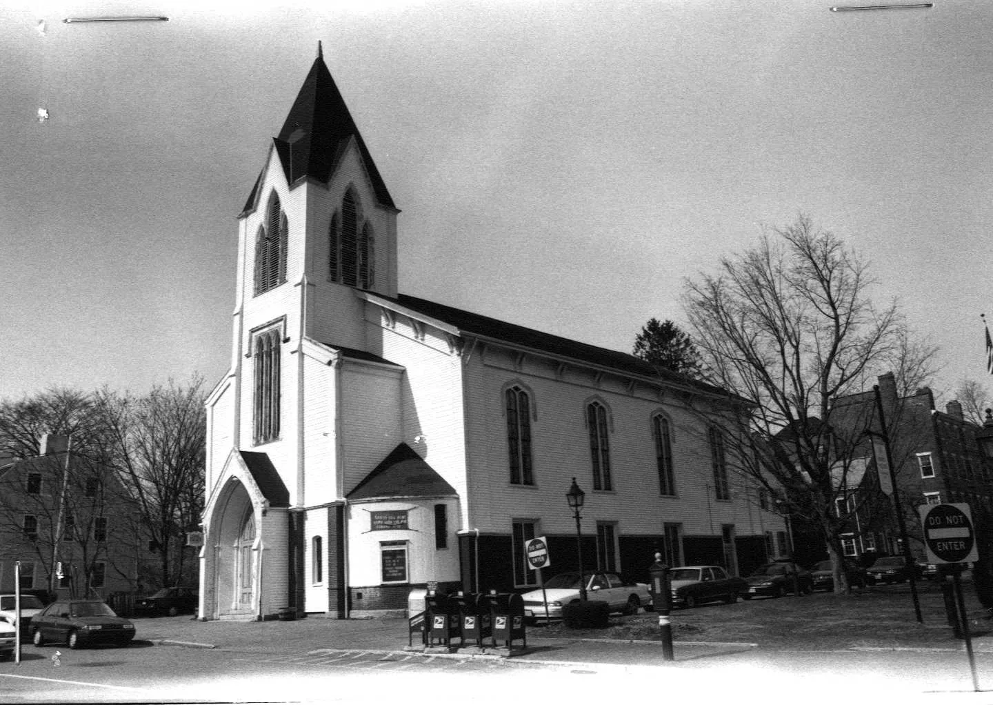
Stop 10 · c. 1847
26 Green Street
Green Street Baptist Church
Photo: Massachusetts Historical Commission, MACRIS inventory
Currier's History of 1906 tells how it came to be here. On April 11, 1846, some members who had left the First Baptist church on Congress Street met at William Gunnison's house to organize a new one; they hired Washington Hall, called the Reverend Nicholas Medbery, and on June 15, 1846, Ebenezer and Sarah W. Hale sold Gunnison and his fellow proprietors a lot of land “on the corner of Green street and Brown square.” The meeting house built on it was dedicated on February 9, 1848, and that May the church changed its name from Central Baptist to Green Street Baptist. The inventory form, and the page for the house at 49 Green Street, name Frederick J. Coffin, the architect of City Hall, as its designer. Currier says the two Baptist congregations in town were reunited in 1869 as the Baptist Church of Newburyport, and that this building, not the old one on Congress Street, was the one they kept.
Sources: Currier, History of Newburyport, vol. 1 (1906), pp. 290–292 · MACRIS inventory form
Walk · 60 yardsTurn left out of Green Street into Brown Square, the short street running along the south side of the small park. The first house on your left, about fifty yards along, is number 5.
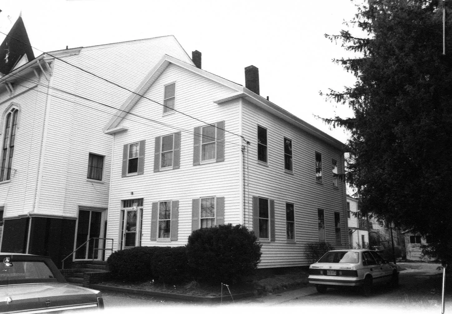
Stop 11 · c. 1853
5 Brown Square
Charles Hasseltine House
Photo: Massachusetts Historical Commission, MACRIS inventory
The inventory form calls this the Charles Hasseltine House and dates it to about 1853, a Greek Revival house of the years when the town was turning itself into a city; the histories have nothing on Hasseltine, so that is all we have. What they do say is that this side of the square was meant to look very different: Currier's “Ould Newbury” says Moses Brown planned a brick block of stores and houses along the whole westerly side, from Titcomb Street to Green Street, and built only the piece you are about to reach.
Sources: MACRIS inventory form · Currier, “Ould Newbury” (1896), ch. "Moses Brown"
Walk · a few stepsNext door, about twenty-five yards on, is number 7.
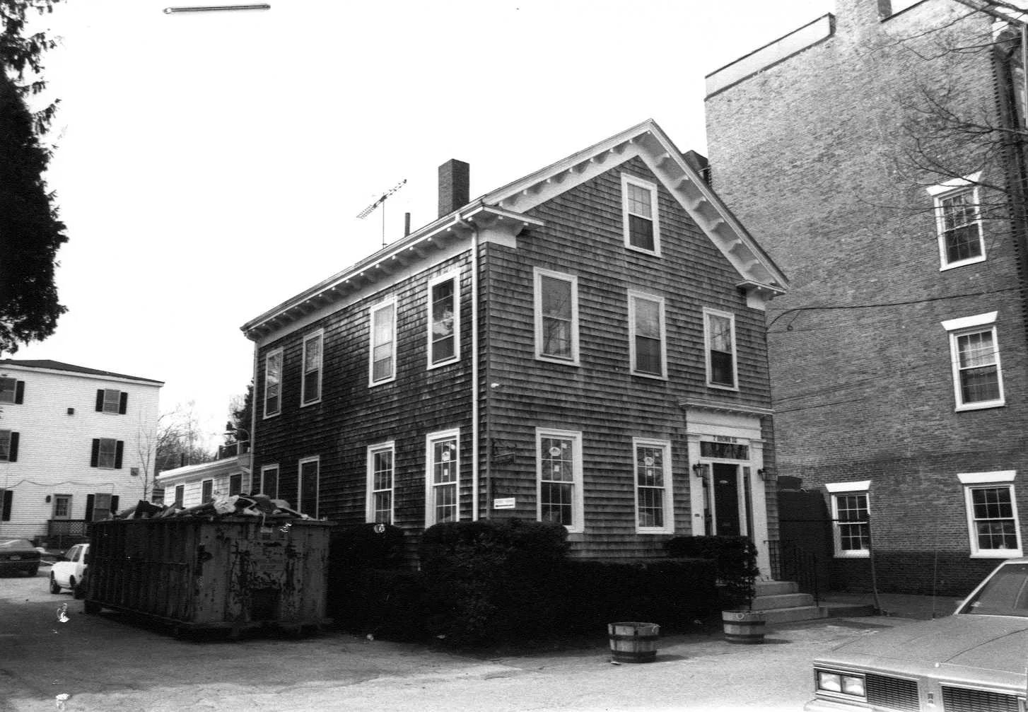
Stop 12 · c. 1854
7 Brown Square
Oliver B. Spaulding House
Photo: Massachusetts Historical Commission, MACRIS inventory
The inventory form names this the Oliver B. Spaulding House and dates it to about 1854, a year younger than its neighbour and in the same Greek Revival manner. The histories are silent on it. Stand here a moment and look across the park instead: the city hall at the far corner, the brick church on Titcomb Street and the big brick block beside you are the three buildings Currier's histories have the most to say about on this square.
Sources: MACRIS inventory form
Walk · a few stepsWalk on about thirty-five yards. The tall brick block on your left, four storeys high with two arched doorways, is 11 Brown Square, the Garrison Inn. look: Count the bays: eight across, four to each house, with the doors set in the inner bays. The inventory form says it is the largest Federal-period brick building left in the city.
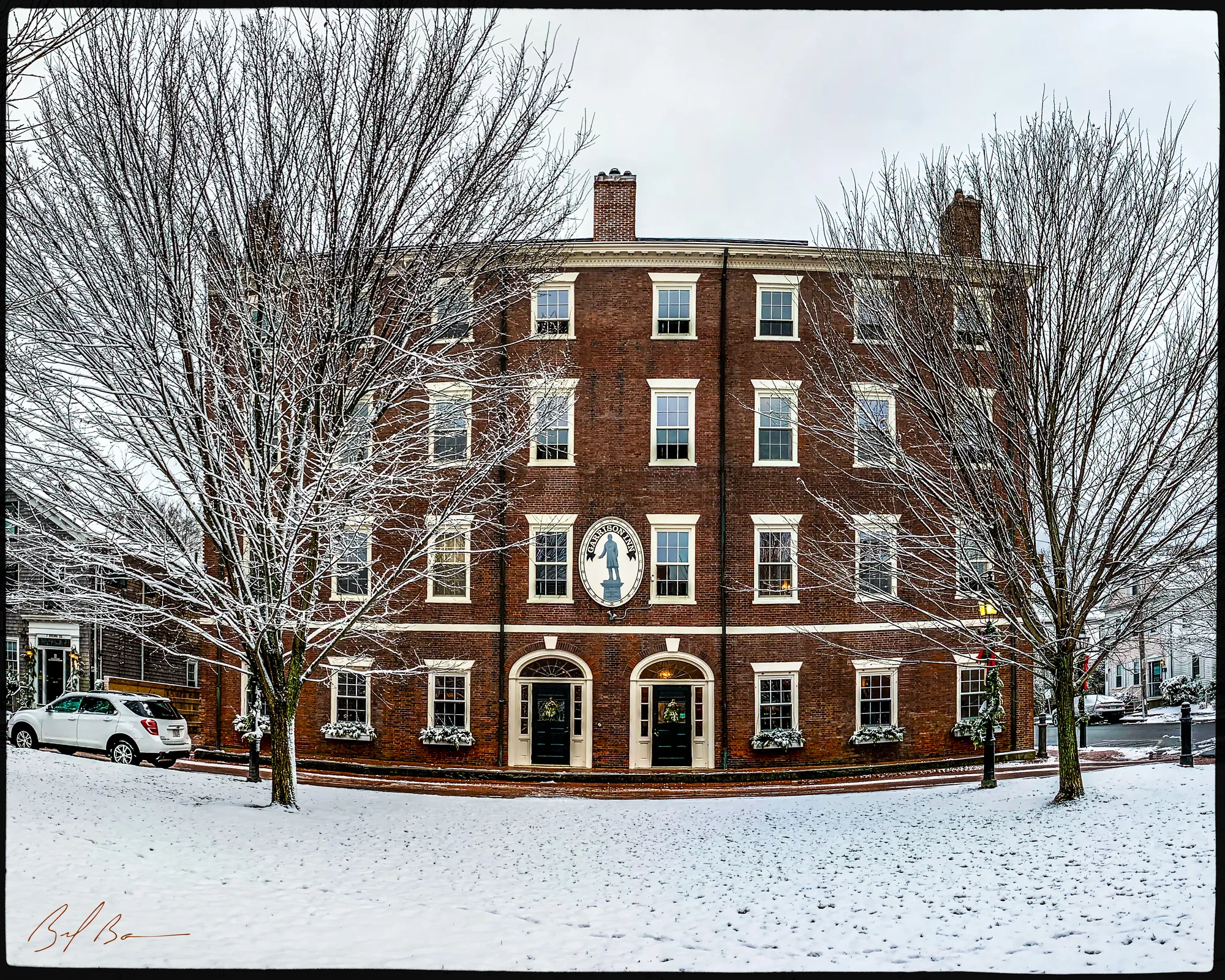
Currier's “Ould Newbury” tells the story of the man and the block. Moses Brown, born in the West Parish in 1742, was apprenticed to a chaise-maker on Prospect Street, set up as a carriage builder at twenty-one, and ten years later went into the West India trade in sugar and molasses. In 1792, the second volume of Currier's History says, he bought a wharf at the foot of Green Street and built warehouses and a distillery there; Emery remembered Moses Brown's wharf as the focus of his extensive business. He bought the land between Green and Titcomb Streets in 1801 and gave the square its name and its shape. “A few years later,” Currier says, “Mr. Brown decided to erect a large brick block of stores and dwelling-houses on the westerly side of the square, extending from Titcomb to Green streets.” The work was begun and partly done, but the contractor fell ill and gave up the job, and then “the great fire of 1811 and the war of 1812 produced such a depression in the business affairs of Newburyport that it was thought advisable to leave the building as it now stands.” It was a private house for many years, then a boarding house, and in 1885 it opened as a hotel, the Brown Square House. The inventory form carries it forward: the hotel was renamed the Garrison Inn in 1922, after the statue in the square, and closed in 1948.
Brown himself, Currier says, lived in the Dalton House on State Street, gave thirty-five thousand dollars to found the theological seminary at Andover, and died in 1827 at eighty-four. Currier quotes a tribute: “He pursued business as though the gains therefrom were not for his use alone, and he distributed them as a trust for the good of others.”
Sources: Currier, “Ould Newbury” (1896), ch. "Moses Brown" · Currier, History of Newburyport, vol. 2 (1909), pp. 226–227 · Emery, Reminiscences of a Nonagenarian (1879), p. 226 · MACRIS inventory form
Walk · a few stepsCarry on to the end of the block, about twenty yards, and turn right into Titcomb Street. The brick church on your left, facing the square, is number 14.
Stop 14 · c. 1861
14 Titcomb Street
Central Congregational Church
Photo: Massachusetts Historical Commission, MACRIS inventory
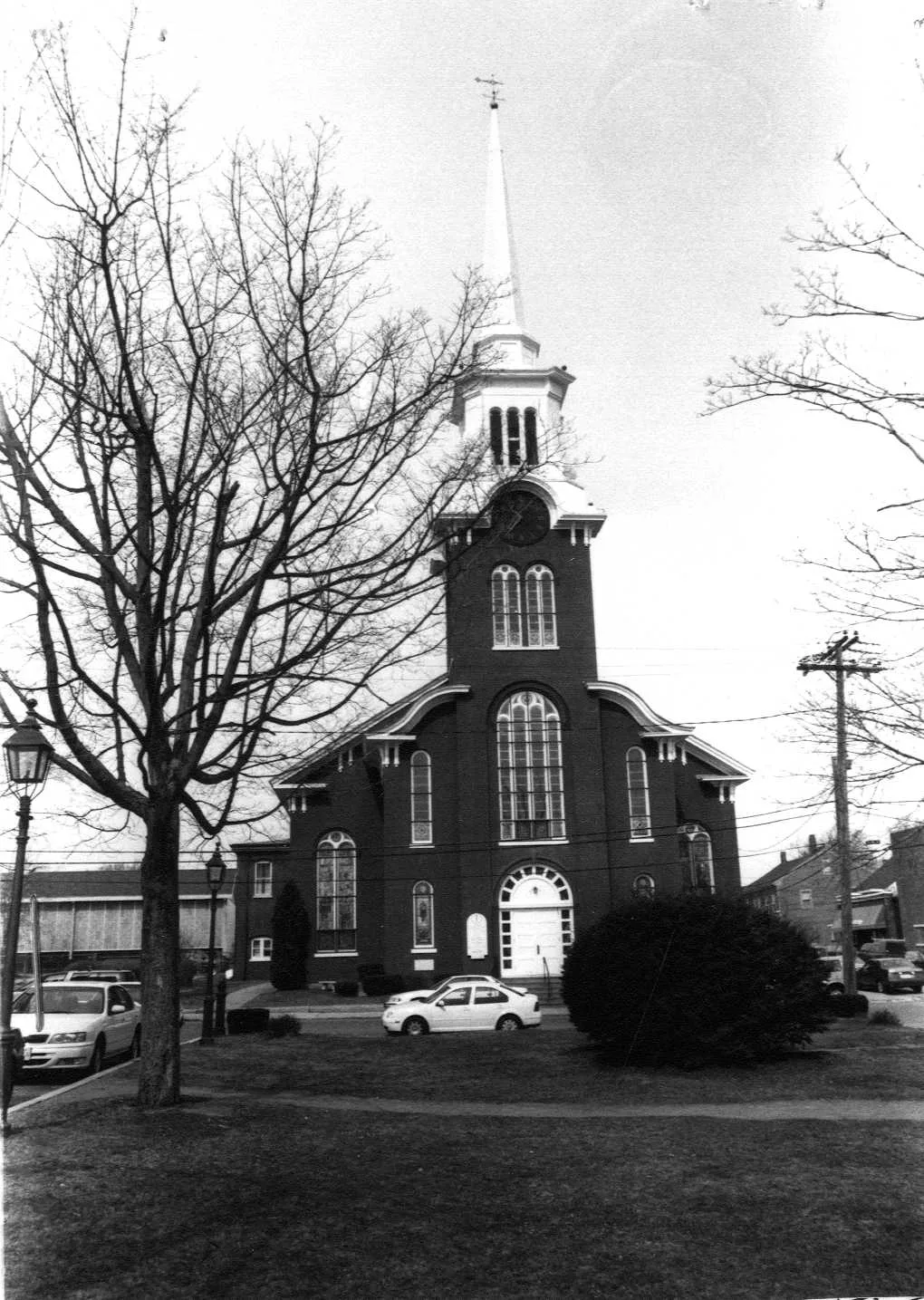
This is the third meeting house on the spot. Currier's History of 1906 says that in April 1768 Enoch Titcomb sold a committee land on a private way, now Titcomb Street, which he agreed to keep open to Merrimac Street, and that a wooden meeting house with a steeple went up that summer for the congregation that had split from the Third Parish; Emery says the split was over doctrine, the new society holding the stricter “Hopkinsian” views, and that the Reverend Christopher Marsh was ordained here in October 1768. The Reverend Samuel Spring followed him in 1777 and stayed more than forty years. In 1826 the society decided to rebuild. When the old steeple was taken down, Currier says, Brown Square and the streets round it were crowded with spectators, and he quotes the newspaper: “The steeple fell on the spot desired without injury to any person or accident of any kind.” The brick church that replaced it was dedicated in March 1827.
That church lasted thirty-four years. In 1860 the society took the name North Congregational, and between one and two o'clock on the morning of March 22, 1861, Currier says, the meeting house burned, with the chapel beside it, leaving only the brick walls standing; two firemen, Francis C. Lunt and Henry Goodwin, died of injuries received at the fire. The society rebuilt at once, and the church you are looking at was dedicated on October 23, 1861. The inventory form dates it to that year and calls it Italianate; the site's page gives the name the congregation carries today, Central Congregational, which it took after Currier wrote.
Sources: Currier, History of Newburyport, vol. 1 (1906), pp. 270–278 · Emery, Reminiscences of a Nonagenarian (1879) · MACRIS inventory form
Walk · a few stepsTurn round, go back the few steps to the corner and turn left along the west side of the square, the continuation of Brown Square. Stop after about ten yards, by the first house frontage on your left.
Stop 15 · Lost
Charles R. Sargent home
The house that stood here is gone, and the histories never describe it; it is our own research for this site that places the home of Charles R. Sargent, cabinetmaker, gunsmith and the city's sealer of weights and measures, who lived from 1813 to 1883, on this spot. Sargent does turn up twice in the old books, both times with his hands on machinery. The second volume of Currier's History says that when the river steamer Lawrence was sold to be taken to California, she was completely dismantled in the dock at Brown's wharf by Charles R. Sargent and Daniel H. Smith, her engine and timbers shipped round the Horn, and the boat rebuilt in California as the first steamboat on the Yuba River. And Bayley and Jones's History of the Marine Society of 1906 says that at the society's centennial in 1872 the arch over the platform, twelve feet high and lettered “Marine Society 1772,” was lit by fifteen hundred gas jets “arranged by Mr. Charles R. Sargent.”
Sources: oldnbpt.com research · Currier, History of Newburyport, vol. 2 (1909), p. 71 · Bayley and Jones, History of the Marine Society (1906), p. 266
Walk · a few stepsA few steps further along, about fifteen yards, is the next site.
Stop 16 · Lost
Butler’s Bakery
Nothing of it stands, and the printed histories do not mention it: our own research for this site puts the Butler family bakery here, baking pilot bread and ship bread for vessels leaving the port. Emery gives the trade its setting. Listing the bakers of her youth, she says that John Berry Titcomb had a bakery and flour store behind the North church, that “Mr. Gunnison carried on an extensive business on Titcomb street,” and that Pulaski Woodman, the Pearsons, Samuel Wheeler and Ebenezer Pearson all had bake-houses within a few streets of here; a town that sent ships to sea needed a great deal of hard bread.
Sources: oldnbpt.com research · Emery, Reminiscences of a Nonagenarian (1879), p. 228
Walk · a few stepsWalk on about forty yards and step into the park itself. Stand by the statue in the middle. look: The bronze is William Lloyd Garrison, with the Garrison Inn behind him and City Hall across the street; the war memorials are at the Green Street end.
Stop 17 · 1802
Brown Square
Currier's “Ould Newbury” says the square was never formally laid out by the town; it exists because Moses Brown put it in his deeds. When he sold Joshua Titcomb a lot on November 13, 1802, he described it as adjoining “a square which I will lay down eight rods, at least, in width,” on condition that only a brick building be put up at its end. The next summer the town committee looking for a site for the new court house picked a lot “by Mr. Moses Brown's Square as the most eligible situation,” before the court of sessions chose the mall instead. The square was useful as well as handsome: Currier's History of 1906 says that in 1839 the town voted to lay an iron pipe from the Frog Pond to Brown Square with a hydrant in the square, for fires and to sell water to the cotton mill on Pleasant Street.
The statue was given to the city on July 4, 1893, by William H. Swasey, and Currier's 1909 volume says it was “designed and modeled by David M. French of Newburyport.” Garrison, that volume says, was born on December 10, 1805, in a house still standing on School Street, was apprenticed at thirteen to Ephraim W. Allen of the Newburyport Herald, learned the printer's trade for seven years, and in 1826 published his own paper here, the Free Press, for six months before he went to Baltimore, to jail for libel over a Newburyport ship carrying slaves, and to Boston to start the Liberator in 1831. He died in 1879.
Sources: Currier, “Ould Newbury” (1896), ch. "Moses Brown" · Currier, History of Newburyport, vol. 1 (1906), p. 199 · Currier, History of Newburyport, vol. 2 (1909), pp. 314–317, 399 · MACRIS inventory form
Walk · 130 yardsLeave the park at its north-west corner and follow the Brown Square street about fifty yards to Titcomb Street; turn right, and after about thirty yards turn right again into Pleasant Street. Stop after about forty-five yards, on the left-hand side, where the houses face the square.
Stop 18 · 1836 · Lost
Butler family home
The house is gone, and the histories are silent on it: our own research for this site places the Butler family house here, facing Brown Square, and says that the first meeting of the Essex County Anti-Slavery Society gathered in front of it in 1836. Currier's volumes give Garrison's Newburyport years but do not mention the society, so the story rests on the site's research. You are standing where the square's own abolitionist history began, five years after the Liberator and fifty-seven before the statue behind you.
Sources: oldnbpt.com research
Walk · a few stepsWalk on about forty yards. The big brick building on your left, on the corner of Green Street, is City Hall. look: The bronze lamp-posts at the door were given in 1877 by Daniel I. Tenney, the same man who gave the Washington statue on the mall.
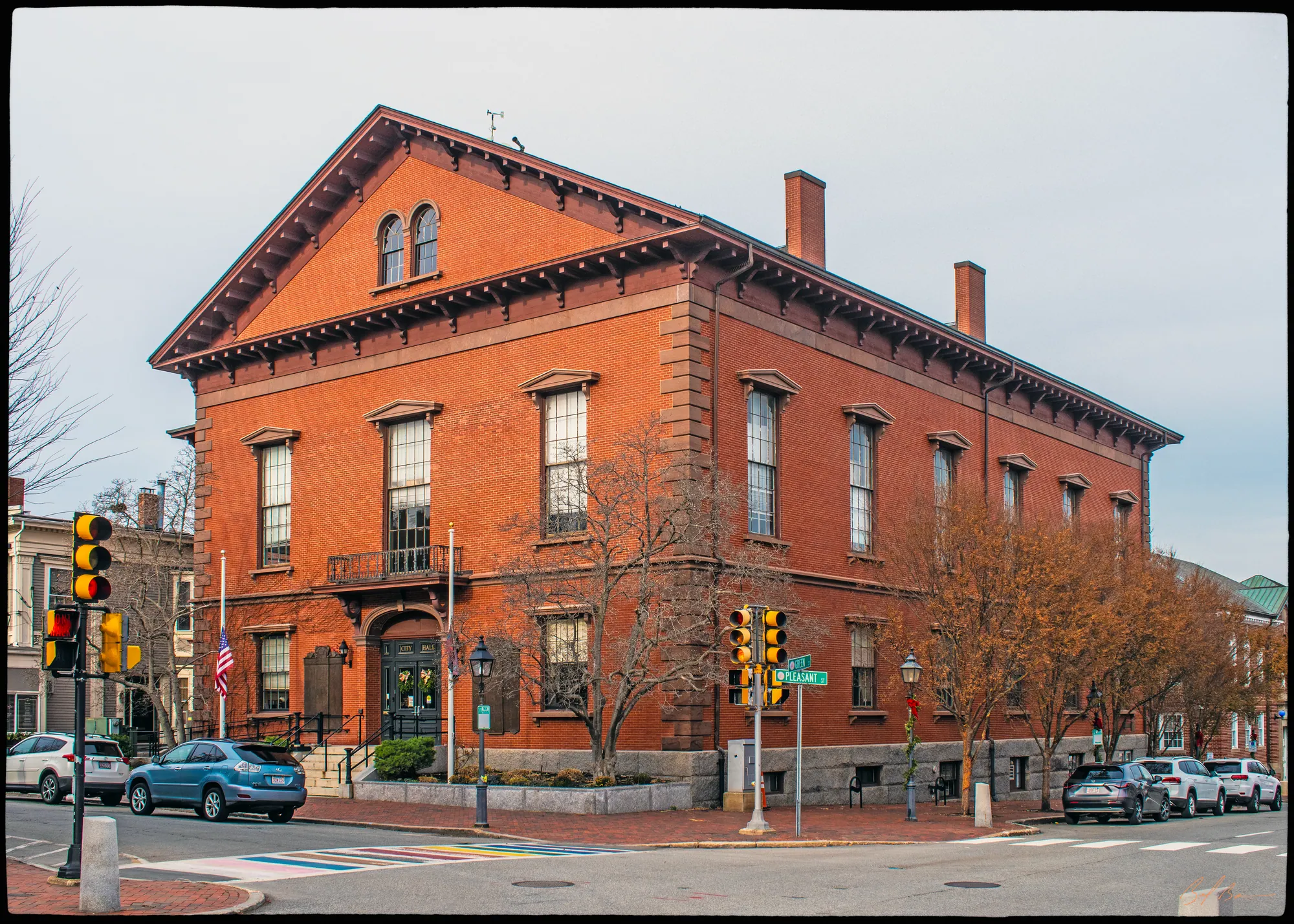
Currier's History of 1906 says that on March 19, 1850, the town “voted to build a new and commodious Hall at a cost not exceeding thirty thousand dollars,” and that in April a committee including Charles H. Coffin, Albert Currier, Frederick J. Coffin and James Blood was authorized to buy the land on the corner of Green and Pleasant Streets, opposite Brown Square, and build. An attempt to undo the vote was beaten after a long struggle. The corner-stone was laid on July 4, 1850, with a procession to Brown Square and an address by Caleb Cushing, and the building was finished in February 1851; the town's last annual meeting was held in it that March, and in June, after the annexation of the Newbury waterside, the first city government was organized here with Cushing as mayor. The inventory form names Frederick J. Coffin as architect and says the city's first public library was kept in a room on the ground floor from 1855 to 1865; the second volume of Currier's History remembers it as inconveniently housed on the first floor, on the north-west side of the building. Currier says the upper hall got a new stage entrance and galleries in 1882 for evening entertainments, and the inventory form lists what went on in it: the firemen's fair, the policemen's ball, minstrel shows, memorial services, lectures and concerts. Plans drawn about 1873 for a tower and a portico on the Green Street side, the form says, were never carried out, which is why the building looks much as Currier's photograph of 1851 shows it.
Sources: Currier, History of Newburyport, vol. 1 (1906), pp. 202–204 · Currier, History of Newburyport, vol. 2 (1909), pp. 399, 415 · MACRIS inventory form
Walk · 70 yardsCross Green Street at the corner and carry on along Pleasant Street about sixty yards. The brick building with the three marble-trimmed arches, now on your right, is the post office.
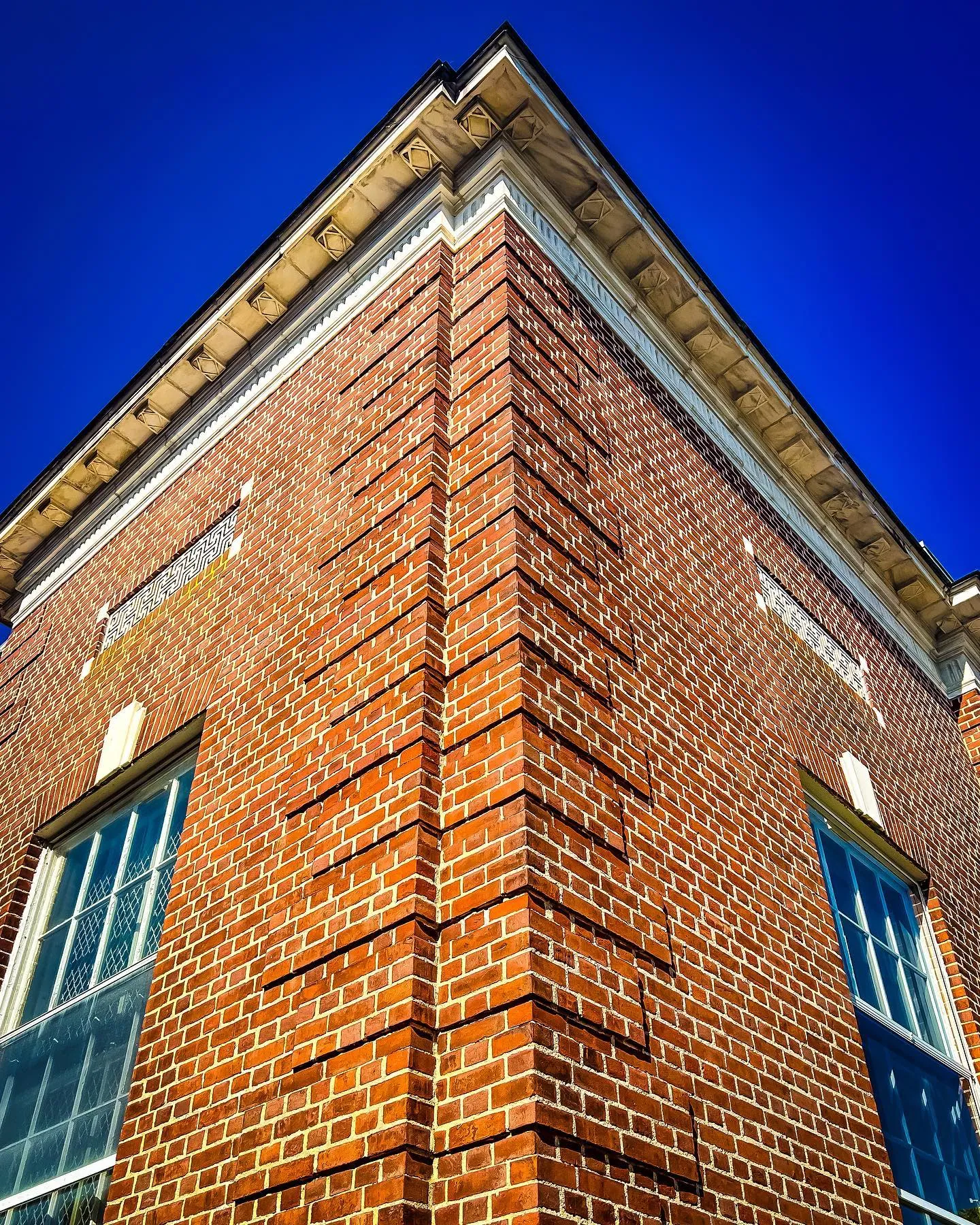
This is the newest building on the walk, and the inventory form is our only source for it. The land was bought by the government in 1919, the building begun in 1927 and opened in the summer of 1928, the city's first purpose-built post office after a century of rented rooms. Before it, the form says, a large brick Georgian house and several smaller wooden ones stood on the lot. The three arched openings with their Palladian motif, the granite steps with brass railings, the marble belt course and the slate hip roof are a 1920s idea of what a Georgian town deserved, and the form says the outside is much as it was when it opened.
Sources: MACRIS inventory form
Walk · 80 yardsWalk on about twenty yards and turn left into Unicorn Street. Go about fifty-five yards along it and stop; the site lies between you and the back of the church on your right.
Stop 21 · 1835 · Lost
Engine Company Five
The second volume of Currier's History gives the firehouse its paper trail. On May 4, 1835, the selectmen were authorized to buy a lot and put up a building for Engine Company No. Five and the Hook and Ladder Company, “and a School Room, if, in their opinion, it is expedient.” They bought land on the easterly side of Pleasant Street, bounded by a way twenty-four feet wide on one side and by the land of the First Religious Society on the other, and the building was up before March 1836. Currier's 1906 History shows the school room in use: the Newburyport Female High School, with Eben S. Stearns as principal, was organized on December 18, 1843, “in an engine house on Pleasant street” while its own building at Court and Washington Streets was going up. The town spent two hundred and nineteen dollars repairing engine house No. 5 in 1844. Our research for this site says the wooden firehouse stood between the church and Unicorn Street and was torn down late in the nineteenth century.
Sources: Currier, History of Newburyport, vol. 2 (1909), pp. 39–40 · Currier, History of Newburyport, vol. 1 (1906), p. 323 · oldnbpt.com research
Walk · 100 yardsGo back down Unicorn Street to Pleasant Street and turn left. The white wooden church on your left, about forty yards on, is the First Religious Society's meeting house. look: The steeple is the one in all the old views of the town; Currier's History of 1906 gives it a plate of its own.
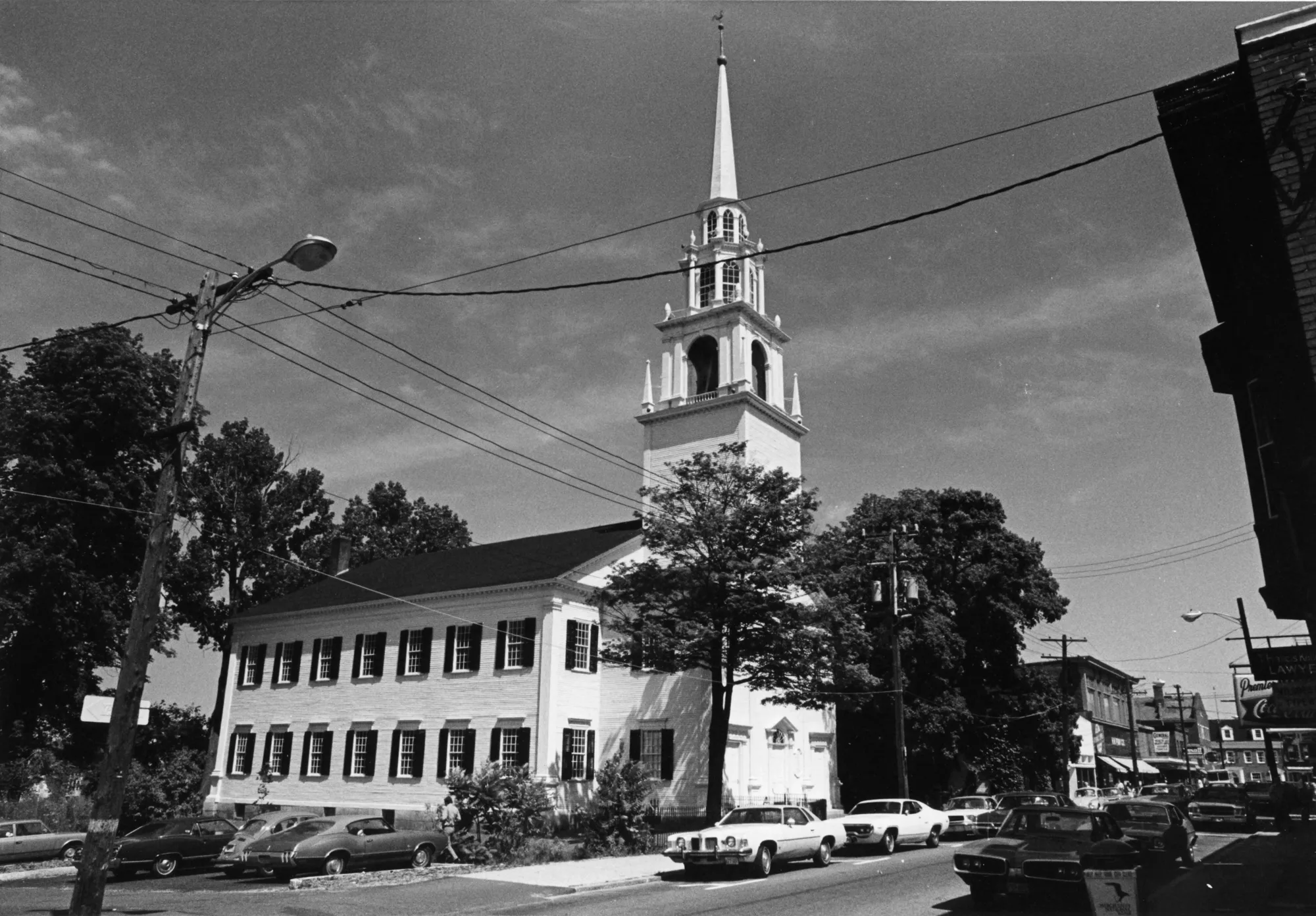
Stop 22 · c. 1801
28–30 Pleasant Street
Church of the First Religious Society (Unitarian)
Photo: Massachusetts Historical Commission, MACRIS inventory
Currier's 1906 History says the society was allowed in June 1800 to sell its old meeting house in what is now Market Square and build elsewhere; the last service there was held on September 27, 1801, the steeple came down the next day, and the new meeting house on Pleasant Street was dedicated on Thursday, October 1, with a sermon by the Reverend John Andrews, a dinner for the visiting clergy and, in the afternoon, a concert by the organist P. A. Von Hagen. Emery, who was there, says Leonard Smith had bought the upper corner wall pew on the Green Street side and had two pews made into one for his large family, and that “the new church gave great satisfaction, and for several years was crowded every Sunday.” As to who designed it, Currier is careful: “Tradition asserts that Timothy Palmer, who built the Essex-Merrimack bridge in 1792, was the architect who drew the plans for this new edifice, but the fact cannot be established beyond a reasonable doubt.” Palmer and Spofford supplied the lumber and labour.
For the next fifty years this was the town's hall for great occasions. Currier's chapter on celebrations has the Fourth of July procession of 1810 marching from the court house on the mall down Market Street and up State to an oration here; the Washington Benevolent Society hearing Stephen Hooper here in 1812 and 1814; the centennial of Washington's birth in 1832, with Washington's farewell address read and hymns by Hannah F. Gould sung; and John Quincy Adams, who had read law in this town, delivering a Fourth of July oration “to an immense audience, in the meeting house on Pleasant street.” The inventory form dates the church to about 1801 and calls it Federal.
Sources: Currier, History of Newburyport, vol. 1 (1906), pp. 254–256, 417, 425, 432 · Emery, Reminiscences of a Nonagenarian (1879) · MACRIS inventory form
Walk · 100 yardsContinue along Pleasant Street about seventy yards and turn left into Inn Street, the pedestrian mall. Stop after about twenty-five yards. The mills stood on the corner you have just turned, between Pleasant and Inn Streets.
Stop 23 · 1842 · Lost
Bartlet Steam Mills
Nothing is left of the biggest building that ever stood on this street. The second volume of Currier's History says that on April 7, 1837, Richard S. Spofford, Samuel T. De Ford and John Chickering were incorporated as the Wessacumcon Steam Mills to make cotton cloth; land was bought on the corner of Pleasant and Inn Streets and a large brick factory built, with a bell in its tower that had been cast in Malaga in 1723 and was said to have hung for years on a convent in Spain. In 1840 the capital was raised to four hundred thousand dollars, a second brick factory was built, and the name was changed to the Bartlet Steam Mills. Mrs. Smith, writing in 1854 while the looms were running, says the two buildings made two million yards of sheetings and shirtings a year and employed about four hundred hands. Currier's 1906 History says the town agreed in 1840 to sell the mills water from the Frog Pond through the pipe to Brown Square, and in 1845 let them use their steam force-pump outside the mill yard at fires. The end, in Currier's words: “Both factories were destroyed by fire March 18, 1881, and have not been rebuilt.” Our research for this site says the fire began with an explosion.
Sources: Currier, History of Newburyport, vol. 2 (1909), pp. 149–150 · Smith, History of Newburyport (1854), pp. 285–286 · Currier, History of Newburyport, vol. 1 (1906), pp. 199–201 · oldnbpt.com research
Walk · 80 yardsGo back to Pleasant Street and turn left. The three-storey brick block on your right, about fifty yards on, is 37–39.
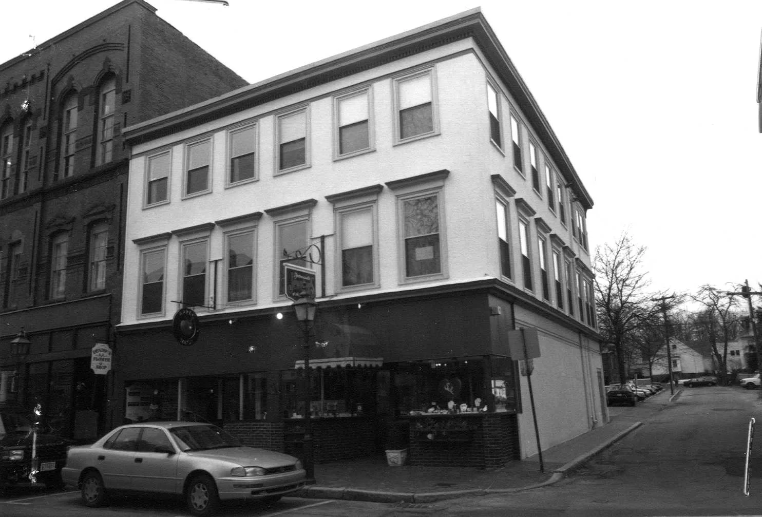
Stop 24 · c. 1880
37–39 Pleasant Street
Hunt and Davis Block
Photo: Massachusetts Historical Commission, MACRIS inventory
The inventory form calls this the Hunt and Davis Block and dates it to about 1880, a Classical Revival commercial block put up on the street where the shoe factories were going in; the histories do not mention it, so the form is all we have.
Sources: MACRIS inventory form
Walk · a few stepsA few steps on, about thirty-five yards, the next brick block on your right is the Griffin Block. look: Look above the modern shopfronts: bands of terra cotta, egg-and-dart mouldings, foliate medallions of at least ten designs, and sandstone pediments over the second-floor windows. The heavy bracketed cornice that once crowned it is gone.
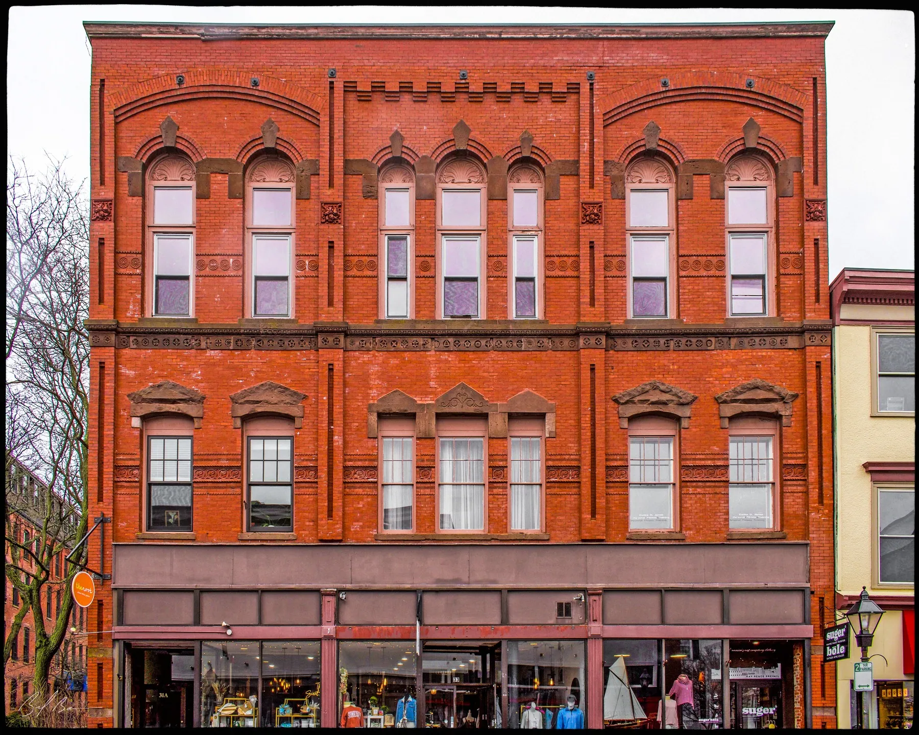
The inventory form dates the Griffin Block to 1889 and describes it as Queen Anne in the panel-brick manner, with the variety of its brick and terra-cotta detail its chief glory; old photographs, it says, show a cornice with four big brackets rising from the roofline, removed before the 1940s, and the storefronts were replaced about 1990. Currier's History of 1906 catches the block in use: when William R. Usher and his son incorporated their shoe company in 1898, after Usher left the firm of Burley and Usher, they kept “an office in Griffin block on Pleasant street,” with their factory in Maine, and after that factory burned in 1905 they were arranging to build a new one here. Our research for this site adds that the building next door was later taken down, exposing this block's side wall.
Sources: MACRIS inventory form · Currier, History of Newburyport, vol. 1 (1906), p. 225 · oldnbpt.com research
Walk · a few stepsContinue about forty yards. The big five-storey brick factory on your right, with the mansard roof and the chimney behind, is the E. P. Dodge building. look: The chimney at the rear carries the date 1880; the inventory form says the engine house and chimney were added that year, and that the top floor and mansard may be the same age.
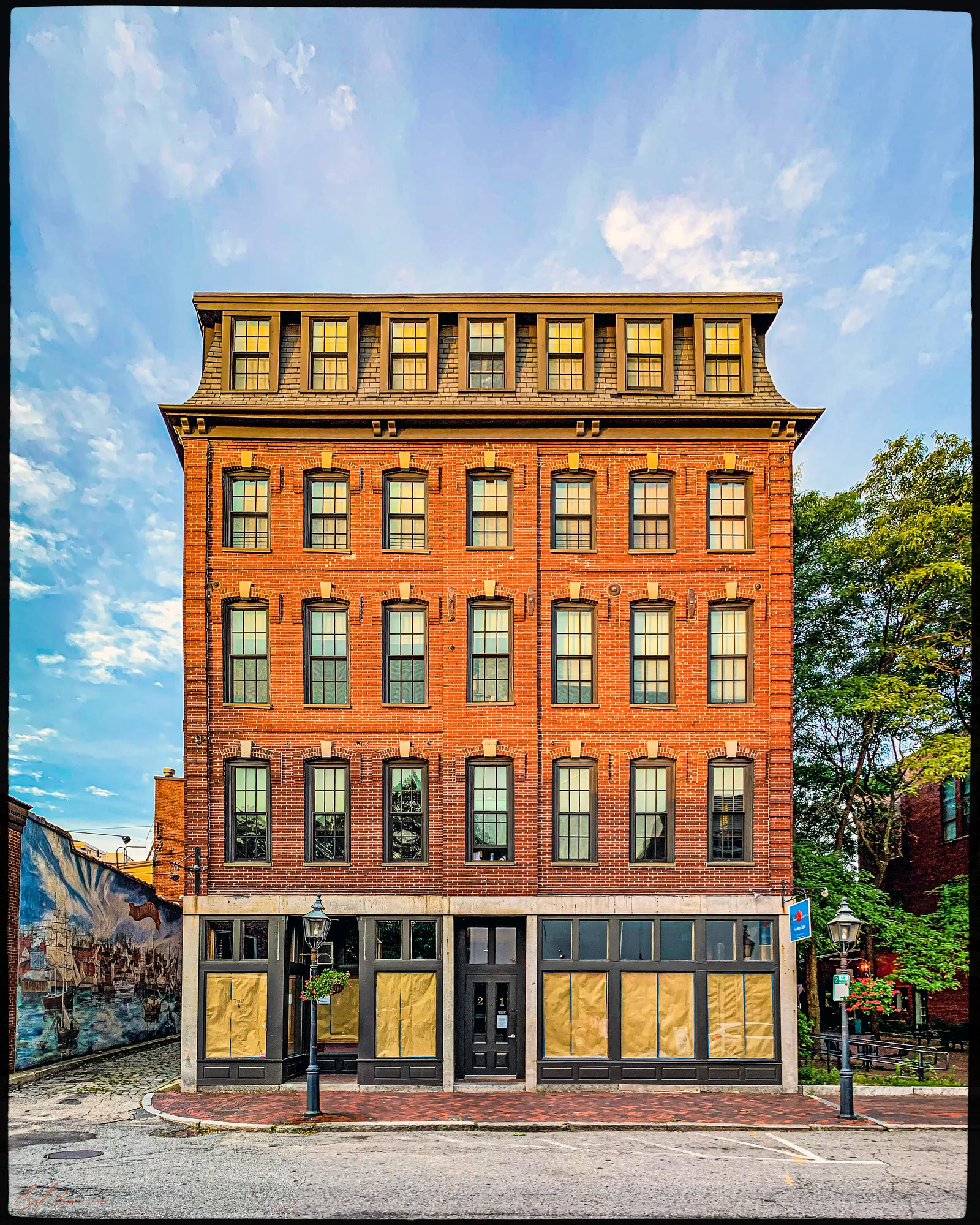
Currier's History of 1906 follows Elisha P. Dodge from the second storey of a wooden building at Pleasant Street and Hale's Court, where he began making ladies' shoes with Joseph N. Danforth in December 1867, to this: “In 1873, he erected the brick factory, No. 21 Pleasant street,” and in 1875, with Edwin N. Sherrill and Henry B. Little as partners, enlarged it to meet orders from the South and West. The E. P. Dodge Manufacturing Company was incorporated in 1889 and sold out in 1902 to the C. A. Ellis Company, which was still making boots and shoes here when Currier wrote. Currier gives Dodge the credit the inventory form repeats: “He was one of the first to combine the many parts of shoe manufacturing under one roof,” making shoes from raw material to finished pair under one man's management. The 1909 volume's roll of mayors has him in office in 1890 and 1891, and the inventory form says he macadamized the roads, gave to the public library and helped found the Anna Jaques Hospital. The form calls this one of the few surviving shoe factories in the city and traces it through the W. D. Hannah company in the 1920s and 30s to the Martin-Tickell firm after 1955.
Sources: Currier, History of Newburyport, vol. 1 (1906), pp. 221–224 · Currier, History of Newburyport, vol. 2 (1909), p. 610 · MACRIS inventory form
Walk · 410 yardsThis is the longest leg. Carry on down Pleasant Street about sixty yards to State Street and turn right, up State Street, away from the river; it is about three hundred yards to the top, past the Wolfe Tavern corner and the churches. At High Street turn right and keep to the right-hand side. The first house, about twenty-five yards along on your right, is number 114.
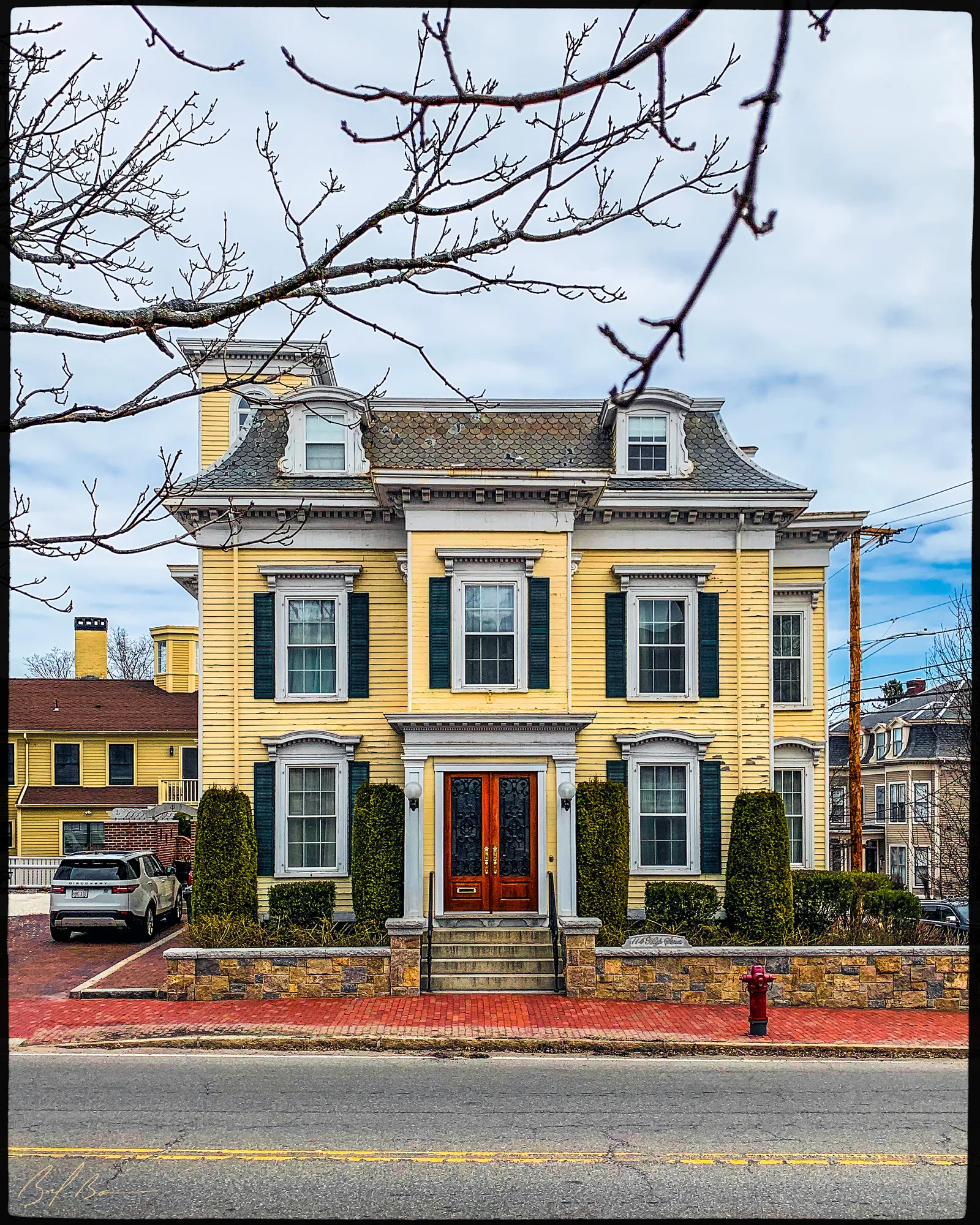
The inventory form dates this house to about 1870 and calls it Second Empire, which the mansard roof tells you at a glance; it gives it no historic name, and the histories say nothing about it. It is a reminder that High Street went on being built up long after the merchants' years.
Sources: MACRIS inventory form
Walk · a few stepsNext door, about twenty-five yards on, is the row house, 116–122.
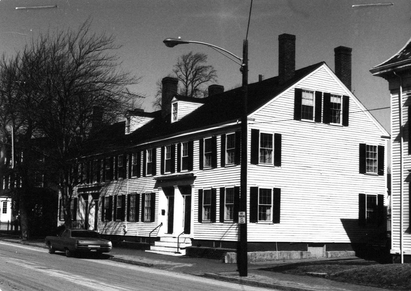
Stop 28 · c. 1855
116–122 High Street
Charles H. Coffin Row House
Photo: Massachusetts Historical Commission, MACRIS inventory
The inventory form calls this the Charles H. Coffin Row House and dates it to about 1855, a Greek Revival row of four. Coffin himself is well documented. Hurd's History of Essex County of 1888 says that as a young clerk he and Michael Simpson sent private ventures abroad in their employers' ships, and that before they were of age they had sent a ship and cargo of their own to Calcutta. Mrs. Smith lists him among the prime originators of the James Steam Mill in 1842; Currier's 1906 History puts him on the committee that built City Hall in 1850; and the second volume says he was elected the first president of the First National Bank of Newburyport in 1864, an office Hurd says he still held in 1888. He died in 1901, and Currier's list of charitable bequests has eight hundred dollars from him for the purchase of fuel.
Sources: MACRIS inventory form · Hurd, History of Essex County, vol. 2 (1888) · Smith, History of Newburyport (1854), p. 287 · Currier, History of Newburyport, vol. 1 (1906), p. 203 · Currier, History of Newburyport, vol. 2 (1909), pp. 138, 169
Walk · a few stepsContinue about fifty yards along High Street. The three-storey brick house on your right, with the pedimented portico, is number 124. look: Brownstone lintels, a hip roof and a Roman Doric portico; Hale photographed it in 1912 under its old number, 118.
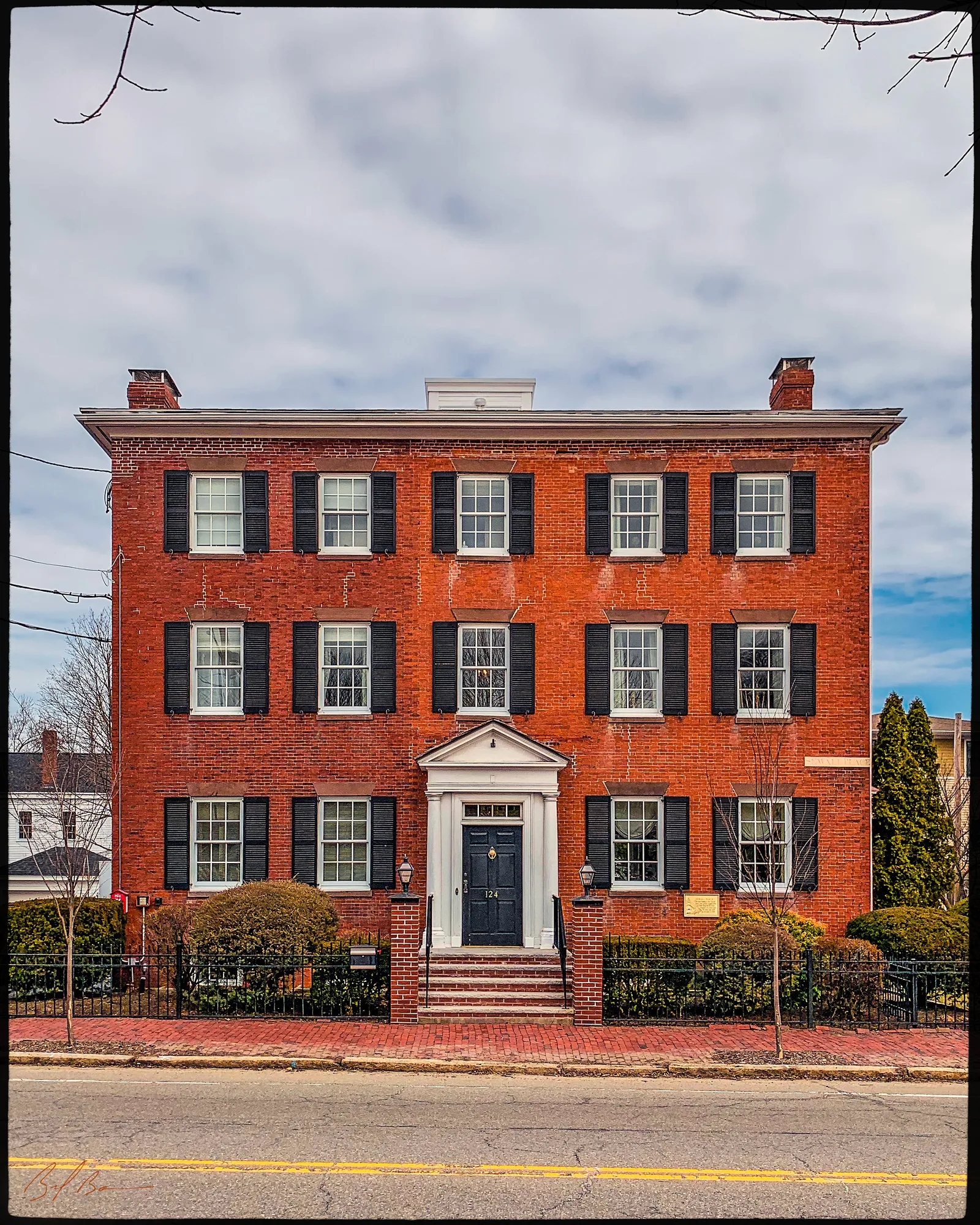
Hale calls it “Sewall Place.” The land, he says, was in the Sewall family; Charles Hodge, a relative, began buying it in 1806, and “The house was built by him prior to 1814, being subsequently enlarged with some changes of detail.” Hodge was a Revolutionary name. Currier's History of 1906 has Charles Hodge among the signers of the petition to set off the waterside as a new town, and in December 1773, when the news of the Boston tea party reached Newburyport, Captain Charles Hodge was one of five men appointed “to consider what may be proper for the Town to do.” Fifty years later Currier finds him still at work: when the hay scales were moved in 1823 from the far end of the Frog Pond to the corner of High and Pond Streets, the notice announced that “Capt. Charles Hodge, who resides near the Hay Scales, is appointed to the charge of the scales and will attend punctually to the weighing of Hay and other Articles.” Hale's owners run from Hodge's family in 1847 to Le Prilette Ingraham, a machinist with a shop on Fair Street according to the inventory form, then Ellen C. Kane, Eliza A. Pike, Willard J. Hale, Elisha R. Brown and, in 1912, Mrs. Carl Fehmer. The inventory form brings it to the present: the house became the Woodworth funeral home, and Todd Woodworth, the city's unofficial historian, began his Tiptoe Through the Tombstones cemetery walks here in 1988.
Sources: Hale, Old Newburyport Houses (1912), p. 21 · Currier, History of Newburyport, vol. 1 (1906), pp. 17, 53, 77 · MACRIS inventory form
Back to the start · 140 yardsWalk on along High Street about seventy-five yards to the crossing at the head of Green Street, cross to the mall side, and take the path back along the mall to where you started in front of the courthouse, about seventy yards more.
You have walked the whole of it in a mile and a quarter: the street the merchants laid out in 1782 and lined with their houses, the square a chaise-maker gave the town, the hall the town built when it was about to become a city, and the mills and factories that paid the bills afterward. Emery's summer of 1800, when the gully at the head of Green Street was filled and the mall graded and railed, is where it started, and it is where you finish.
Sources for this walk
The script paraphrases and quotes these works, all of them out of copyright, and names each one as it goes. Page numbers are from the editions linked here. Where the script says “our research for this site,” the facts are from the building page it links to.
- John J. Currier, History of Newburyport, Mass., 1764–1905, vol. 1 (Newburyport: the author, 1906). archive.org/details/historyofnewbury01curr
- John J. Currier, History of Newburyport, Mass., 1764–1905, vol. 2 (Newburyport: the author, 1909). archive.org/details/historyofnewbury04curr
- John J. Currier, “Ould Newbury”: Historical and Biographical Sketches (Boston: Damrell & Upham, 1896). archive.org/details/ouldnewburyhisto00curr
- John J. Currier, History of Newbury, Mass., 1635–1902 (Boston: Damrell & Upham, 1902). archive.org/details/historyofnewbury1902curr
- Joshua Coffin, A Sketch of the History of Newbury, Newburyport, and West Newbury, from 1635 to 1845 (Boston: Samuel G. Drake, 1845). archive.org/details/sketchofhistoryo00coff_0
- E. Vale Smith, History of Newburyport; from the Earliest Settlement of the Country to the Present Time (Newburyport, 1854). archive.org/details/historyofnewbury00blake
- Sarah Anna Emery, Reminiscences of a Nonagenarian (Newburyport: William H. Huse, 1879). archive.org/details/reminiscencesofn00emer
- Caleb Cushing, The History and Present State of the Town of Newburyport (Newburyport: E. W. Allen, 1826). archive.org/details/historypresentst00cush
- William H. Bayley and Oliver O. Jones, History of the Marine Society of Newburyport, Massachusetts, from Its Incorporation in 1772 to the Year 1906 (Newburyport, 1906). archive.org/details/historyofmarines00baylrich
- Albert Hale, comp., Old Newburyport Houses (Boston: W. B. Clarke Co., 1912). archive.org/details/cu31924015356714
- D. Hamilton Hurd, comp., History of Essex County, Massachusetts, vol. 2 (Philadelphia: J. W. Lewis & Co., 1888). archive.org/details/historyofessexco02hurd
- Massachusetts Historical Commission, Massachusetts Cultural Resource Information System (MACRIS), Newburyport inventory forms. mhc-macris.net
- Biff Bouse, oldnbpt.com building pages (own research from deeds, Sanborn maps and newspapers). oldnbpt.com
More walks: State Street and Market Square · High Street: Down Along and the Ridge · Federal, Spring and Middle Streets · The Water Street Waterfront · Joppa: The Oldest Houses · Joppa: The Fishing Village · Along the River: The North End Shipyards · The Rail Trail: Mills, Ropewalks and Old Hill · Newburyport in the Civil War · Churchyards and Burying Grounds