Walking tours · High Street · 28 stops
High Street: Down Along and the Ridge
A walk along the finest half mile of High Street, from State Street down to March's Hill and back up the short block of Fruit Street: the three-storey square houses of the sea captains and merchants, the Cushing House, the old Academy, the house where Caleb Cushing died and the hill where the town watched for British ships in 1813. For most of this stretch the street itself was the town line, Newburyport on one side and Newbury on the other, until 1851. About a mile and three quarters, on sidewalks, with one short climb.
- Length
- About 1.7 mi, a loop
- Time
- About 95 min, with the reading
- Start and finish
- High Street at State Street
Before you set off
High Street runs along a ridge, and the second volume of John J. Currier's History of Newburyport, published in 1909, explains why: it is a glacial esker. “A broad-topped esker extends the whole length of High street, through Old town, in Newbury, and out into the tidal marsh north of Parker river,” and the road along the top of it was laid out as early as 1645. Sarah Anna Emery, who was born in 1787 and wrote her Reminiscences of a Nonagenarian at ninety, remembered what the merchants built on it around 1800: “The first class dwellings of Newburyport, were mostly square structures, three stories in height, or of two stories with dormer windows in the roof; some were gambrel roofed houses.” Gardens were attached to most of them, she says, and “those on the upper side of High street usually had extensive grounds.” You will see both kinds on this walk, and the gardens that climb the ridge behind the houses on the upper side.
There is a line down the middle of this street that you cannot see. Currier's first volume, published in 1906, prints the act of 1764 that made Newburyport a town: its boundary ran up Cottle's Lane, now Bromfield Street, to High Street, “and so westwardly, as the said highway runs, on the northwardly side thereof, till it comes to a town way known by the name of Fish Street,” which is State Street. So between Bromfield and State the houses on the downtown side of High Street were in Newburyport, and the houses across the road, on the ridge side, were in Newbury, until the annexation of 1851. Currier says Caleb Cushing's house, which you will pass, was in Newbury when he bought it in 1849; two years later he was the man who pushed the annexation act through the legislature and became the first mayor of the enlarged city. Keep the line in mind as you cross and recross the street.
Numbers follow the walk. The line is the route along the streets, back to where you started.
Read it aloud as you go: each stop begins with where to walk and where to stand, then what the old histories say about the place. The sources are named as you read and listed in full at the end.
StartThe loop begins at the top of State Street, where it meets High Street. If you are driving, park downtown and walk up State Street; it is a steady climb of about half a mile. Stand on the corner on the downtown side of High Street with State Street at your back, then turn left to face along High Street. The big gambrel-roofed house a few steps along on your left, with the Palladian window in the gable end and the balustrade on the roof, is 110-112. look: The roof is steeper and the Palladian window grander than any eighteenth-century builder would have made them; this is a Georgian house imagined in the 1890s.
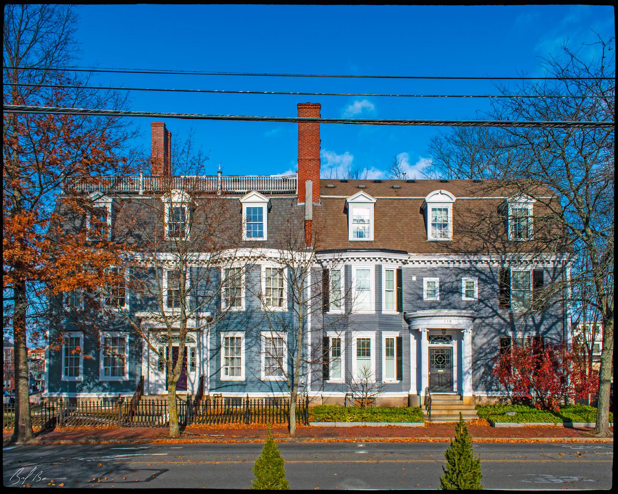
This house is not as old as it looks. The state's historic inventory form says it was built as a double house between 1851 and 1872, a transitional building with heavy window lintels and something of both the late Greek Revival and the Italianate, and that on February 24, 1894, it caught fire. The roof burned and much of the interior was destroyed. What was rebuilt in the years afterward is, in the form's words, the finest Georgian Revival house in Newburyport: the gambrel roof, the Palladian window, the ornate doorways and porticos in the Federal manner that the rest of the street made standard. The form names the owners at the time of the fire as the Reverend Louis A. Pope and Mrs. William Moseley. Currier's History of 1906 lists Mr. Pope as minister of the Baptist Church and Society of Newburyport from 1889 to 1901, and the second volume has him elected president of the Newburyport Choral Union when it was organized on November 30, 1896, the year the house was being rebuilt around him; by 1904 the Choral Union had a new president, the note says, Mr. Pope having died. The inventory form adds that the Reverend William A. Moseley, a Newburyport man and a Unitarian minister in Vermont and South Scituate, left a trust at his death in 1894 that went to the Newburyport Public Library after his sister's death. The histories have nothing more on the house itself, so the form is our guide here.
Sources: MACRIS inventory form · Currier, History of Newburyport, vol. 1 (1906), p. 293 · Currier, History of Newburyport, vol. 2 (1909), p. 184
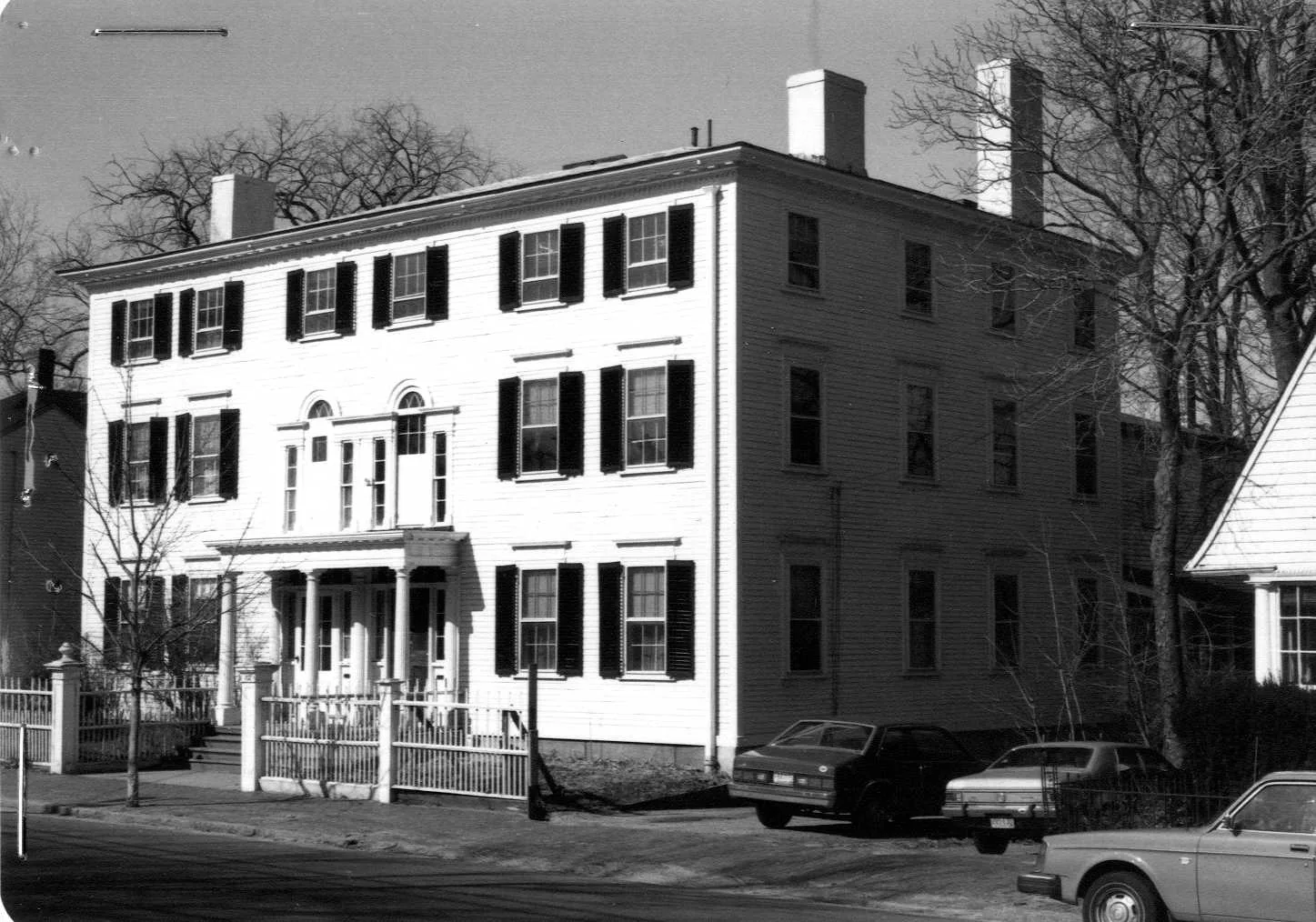
Walk · 60 yardsWalk on along High Street, keeping on the downtown side, for about 60 yards. The three-storey double house on your left is 102–104.
Stop 2 · c. 1807
102–104 High Street
Tenny–Noyes House
Photo: Massachusetts Historical Commission, MACRIS inventory
The inventory form calls this the Tenney–Noyes House and dates it to about 1807, and Albert Hale, who photographed it for his Old Newburyport Houses in 1912, fills in the names. He numbered it 96–98 High Street, because the street has been renumbered since, and says the land “was bought in 1806 by Samuel Tenney and John M. Noyes.” The house was built on Tenney's northerly portion; in 1822 he bought Noyes's land next door and the same year sold the northerly half of the house to Hector Coffin. Hale's two columns of owners run on from there, and one entry on the northerly side matters for the street's history: from 1855 to 1872 that half belonged to the First Presbyterian Society and was its parsonage. The Old South's own Origin and Annals of 1896 confirms it: the church was tired of its ministers living in hired houses, and Miss Mary C. Greenleaf started the movement to buy what the book calls, under the old numbering, the handsome property at 98 High Street, “for many years the Old South parsonage.” Samuel Tenney turns up all over Currier's two volumes as an insurance man: secretary of the Merrimack Marine and Fire Insurance Company for many years, and one of the men incorporated in 1819 as the Newburyport Howard Benevolent Society. Caleb Cushing's History and Present State of the Town of Newburyport of 1826 notes that there was a reading room at the private insurance office of Mr. Samuel Tenney. The inventory form says a roof balustrade once matched the one you will see two doors down.
Sources: MACRIS inventory form · Hale, Old Newburyport Houses (1912), p. 39 · Origin and Annals of “The Old South” (1896), p. 209 · Currier, History of Newburyport, vol. 2 (1909), pp. 137, 159 · Cushing, History and Present State of Newburyport (1826)
Walk · 70 yardsContinue about 70 yards along the same side. The brick house on the corner of Fruit Street, with its garden wall running down the side street, is the Cushing House, number 98. look: Flemish-bond brickwork, four tall chimneys and the wooden cornice with its rope moulding; the hipped roof was raised in 1863 for a nursery, the inventory form says.
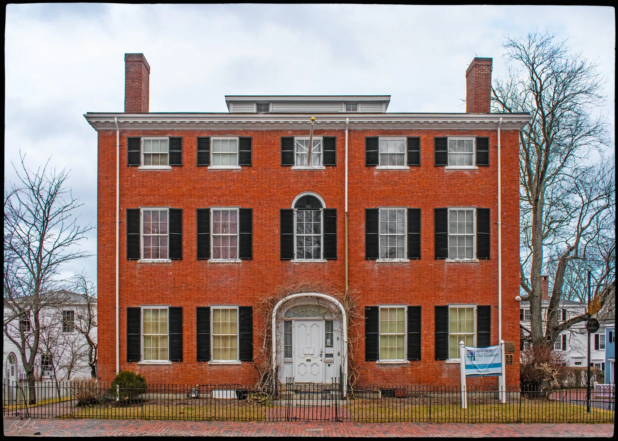
The land on this corner, Currier's 1906 History says, belonged to Richard Pike, who sold it to Jonathan Moulton on October 6, 1803; Moulton's widow Elizabeth sold it to William Hunt on August 1, 1808. Hale, who numbered the house 94 in 1912, puts it in a sentence: “In 1808 William Hunt bought this land and built the house soon afterward.” Hunt was a sea captain, the inventory form says, and died before it was finished. Currier prints the next two deeds: on July 4, 1818, Sarah Hunt, his widow, sold one half of the land and one half of the brick house to John N. Cushing, and on December 17, 1822, as guardian of the children, she sold him the other half. Bayley and Jones's History of the Marine Society of Newburyport, published in 1906, has Captain John Newmarch Cushing admitted to the society in 1804, captured in the brig Polly and taken into Cape François, captured again in 1811 in the ship Hesper coming from Russia with hemp and iron worth seventy-eight thousand dollars, and, once he retired from the sea in 1814, building brigs at a steady rate, the Rapid in 1823, the Pocahontas in 1830, the Keying in 1845. He died January 5, 1849, aged sixty-nine.
His son Caleb came to this town with his parents in 1802, aged two. Currier's “Ould Newbury” of 1896 gives his career: Harvard at thirteen, the bar in 1821, four terms in Congress from 1834, commissioner to China in 1843, a brigadier general in the Mexican War, first mayor of the city in 1851, a justice of the supreme judicial court, attorney general in President Pierce's cabinet, counsel at Geneva in 1872 and minister to Spain. But he did not live here as an adult; his own house is a later stop. Hale says the house stayed with John N. Cushing's family, and in 1912 was the home of his lineal descendants Lawrence B. Cushing and Miss Margaret W. Cushing; the inventory form counts three generations and a hundred and thirty-eight years. Our own research for this site, from a 2025 post, adds the detail of the garden being assembled between 1819 and 1837.
Sources: Currier, History of Newburyport, vol. 1 (1906), p. 337 · Hale, Old Newburyport Houses (1912), p. 43 · Bayley and Jones, History of the Marine Society (1906), pp. 363–364 · Currier, “Ould Newbury” (1896), ch. "Caleb Cushing" · MACRIS inventory form · oldnbpt.com research
Walk · a few stepsCross Fruit Street and stop in front of the next house along, on your left: the three-storey clapboarded house with the fanlight and the roof balustrade, number 96. look: The balustrade is the only one left of three nearly identical ones that stood on this block, the inventory form says; the Greek porticos were added later.
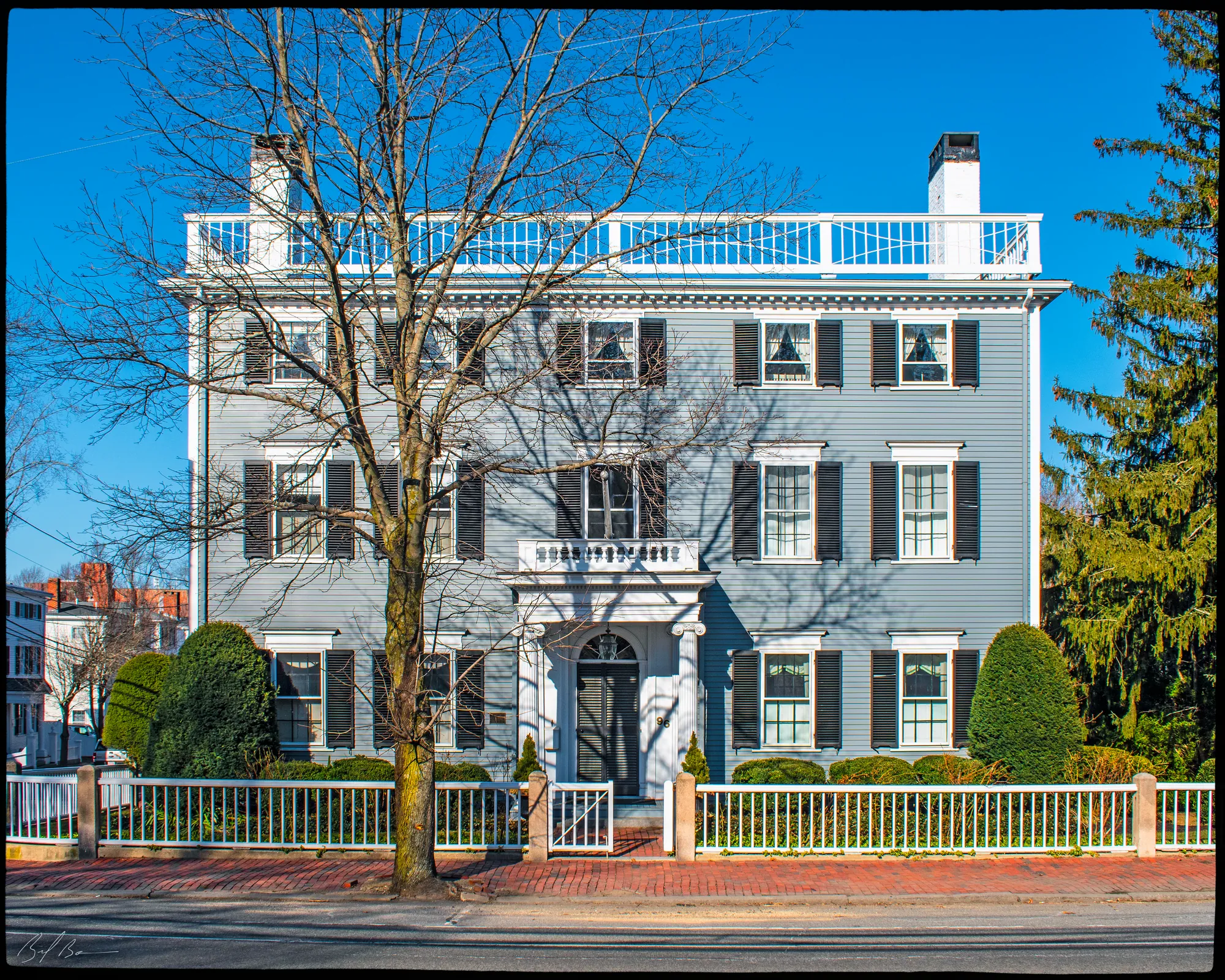
Currier's 1906 History, in its chapter on the streets, says that on March 18, 1801, Benjamin Wyatt sold Stephen Holland the land on this corner of High and Fruit Streets; Holland mortgaged it to Moses Brown and William Woart and afterwards to Ebenezer Wheelwright, and on June 21, 1824, sold the land with the buildings on it to Green Sanborn. Hale calls it the Nelson–Wheelwright House and says Holland “subsequently built the house.” Bayley and Jones's Marine Society history has Captain Stephen Holland admitted in 1795, commanding the brigs Four Sisters and Columbia and the ship Rising Empire, and dying at Bangor in October 1842. The inventory form says Wyatt took seven hundred and forty-seven dollars and ninety-three cents for the lot. Currier lists the owners after Sanborn, John Harrod, Sarah Winslow Marquand, John Wills and Richard Fowler, down to June 10, 1839, when Fowler sold to Mary Nelson, widow of Jeremiah Nelson. The second volume of Currier's History has Nelson's life: born in Rowley in 1768, Dartmouth in 1790, a dry-goods store on State Street in 1793, chairman of the selectmen at the time of the great fire of 1811, and six terms in Congress between 1805 and 1833, where he sat alongside Daniel Webster. He died in 1838; it was the widow who bought this house, and Currier says she owned and occupied it until her death on February 1, 1882. Hale's list carries it to Dr. Henry B. Wheelwright in 1886, and in 1912 it was the home of his widow.
Sources: Currier, History of Newburyport, vol. 1 (1906), pp. 335–337 · Hale, Old Newburyport Houses (1912), p. 45 · Bayley and Jones, History of the Marine Society (1906), p. 357 · Currier, History of Newburyport, vol. 2 (1909), pp. 473–476 · MACRIS inventory form
Walk · 80 yardsNow cross High Street. Use the crossing here at Fruit Street, then turn right and walk back up the far side about 80 yards, toward State Street. The three-storey house on your left, roughly opposite 102–104, is 89–91. You are now on the side of the street that was Newbury until 1851.
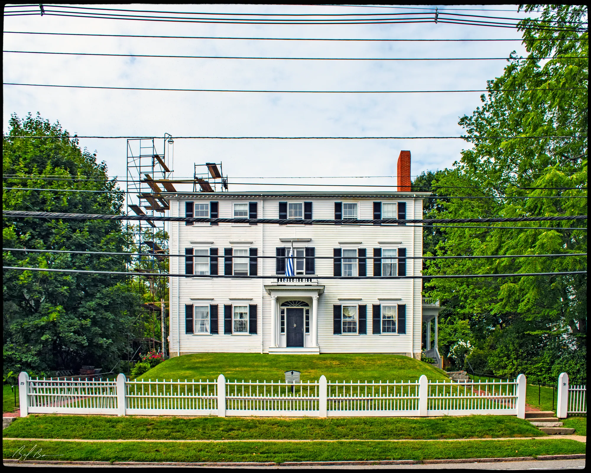
Hale photographed the garden behind this house for his book and called it the Moulton House. His note is short: the land was bought by Joseph Moulton and his son William in 1809, the house was built by them soon afterward, and it “has remained continuously in this family and is now the home of their lineal descendants.” The inventory form dates it to about 1810 and says nothing more, and the histories are silent on the house, though the Marine Society records in Bayley and Jones are full of Moultons, including a Captain Jonathan Moulton whose widow was on the society's relief list from 1811. Whether he was kin to the Joseph and William who built here the books do not say. Hale thought enough of the house to compare the Knapp mansion at 47 High Street, which you will see later, to it.
Sources: Hale, Old Newburyport Houses (1912), p. 40 · MACRIS inventory form · Bayley and Jones, History of the Marine Society (1906), p. 117
Walk · 80 yardsWalk back down this side, away from State Street, a short way. The gambrel-roofed house next along on your left is 87. look: A Georgian roof on a house of 1799, with a Greek Doric porch added later; Hale lived here himself in his last years.
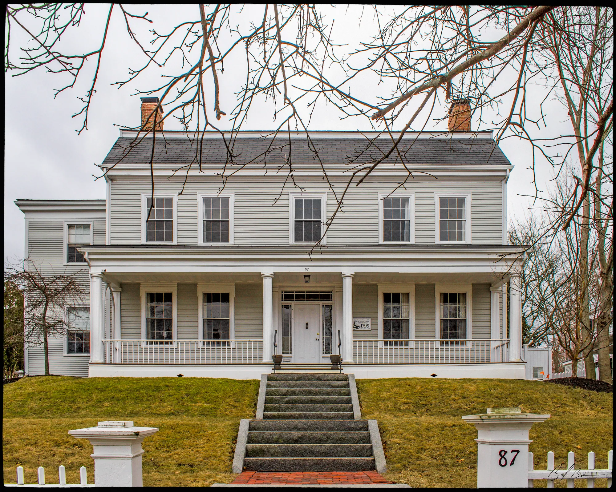
Hale's entry reads: “This land was acquired by Ebenezer Greenleaf, Jr., in 1795 and the house built a few years later, believed to have been in 1799. It remained in this family until 1839 when bought by Albert Wood,” whose daughter Miss Mary L. Wood was living here in 1912. The inventory form explains the roof: the gambrel, which usually means a mid-eighteenth-century house, persisted in Newburyport into the nineteenth. Albert Wood, it says, owned the steamer Decatur, built by Stephen Jackman Jr., which made her first run to Boston on April 21, 1845; Currier's History of Newbury of 1902 lists two coastal steamers, the Decatur and the Ohio, among Jackman's vessels. Then comes the nicest turn in the story. The house passed from the Woods to Katharine D. Hale in 1926, and from 1930 until his death in 1945 it belonged to Albert Hale, the man whose 1912 book this walk keeps quoting. That part is from the inventory form and our own research for this site; Hale, naturally, could not have known it when he wrote the house up.
Sources: Hale, Old Newburyport Houses (1912), p. 42 · MACRIS inventory form · Currier, History of Newbury (1902), p. 491 · oldnbpt.com research
Walk · a few stepsA few steps further down the same side. The brick building with the two Greek Revival doorways and the cupola, opposite the head of Fruit Street, is the old Newburyport Academy, now 83-85. look: Federal splayed lintels on the windows, a Greek Revival cornice, porticos and cupola from 1842: two periods on one front.
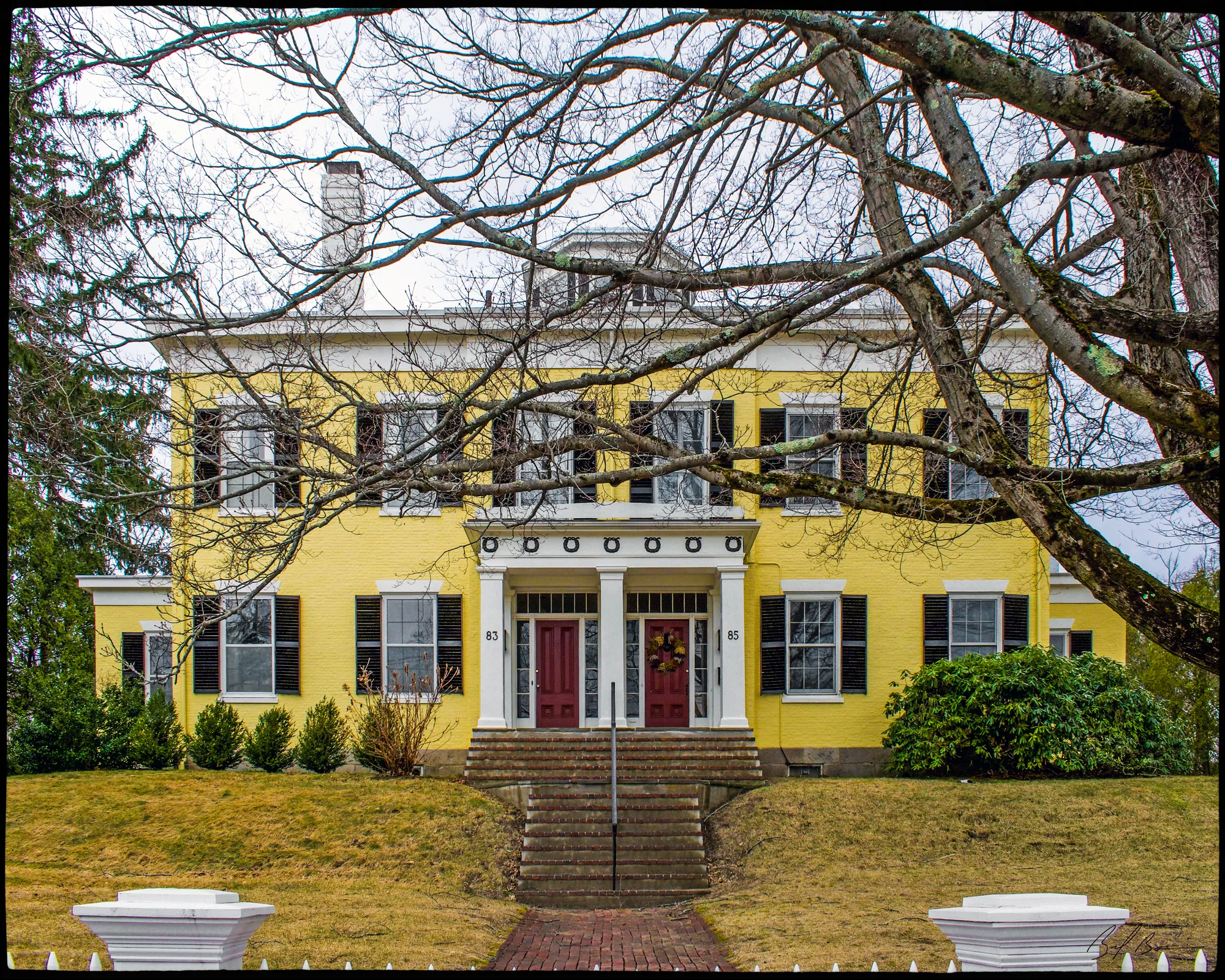
This was a school. Currier's 1906 History says that on June 20, 1807, Joshua Carter, Daniel Dana, James Morse, Richard Pike, Edward Rand, Thomas M. Clark, Samuel A. Otis, Jonathan Gage, William Woart and Edward St. Loe Livermore were incorporated as The Newburyport Academy. “A two-story brick building was erected on High street, opposite the head of Fruit street, and a private school for boys and girls was opened there October 20, 1807,” with Livermore, who lived a few doors down at 79 High, giving the address. Currier follows the teachers: Joseph Dana was preceptor in 1811, Alfred W. Pike and Miss Philippa Call had the boys' and girls' departments in 1825, and in 1840 Elias Nason had a school for young ladies upstairs while Ebenezer Savory taught boys below. The building had other uses on winter evenings. Currier records the Thespian Club playing scenes from Shakespeare in the Academy building in February 1816, and the second volume says the Newburyport Lyceum met from September 1832 in Lyceum hall, on High Street opposite the head of Fruit Street. Mrs. E. Vale Smith's History of Newburyport of 1854 remembered the lectures of those years as so popular that “no hall in the town being large enough to accommodate the numbers who wished to attend,” tickets had to be rationed by a kind of lottery; the Academy or Lyceum Hall, she notes, “has since been altered into a private dwelling.”
That happened in 1842. Currier: “In 1842, the academy building was sold to John Osgood and Charles J. Brockway, and converted into a dwelling house for two families.” Hurd's History of Essex County of 1888 says William Cushing, the mayor of the 1850s and Caleb's half-brother, was fitted for Harvard at Elias Nason's school in this building. The inventory form credits the Greek Revival doorways, the wreath on the portico and the cupola to the conversion, and says Brockway was treasurer of the James Steam Mills.
Sources: Currier, History of Newburyport, vol. 1 (1906), pp. 325–326 · Currier, History of Newburyport, vol. 2 (1909), p. 174 · Smith, History of Newburyport (1854), p. 252 · Hurd, History of Essex County, vol. 2 (1888) · MACRIS inventory form
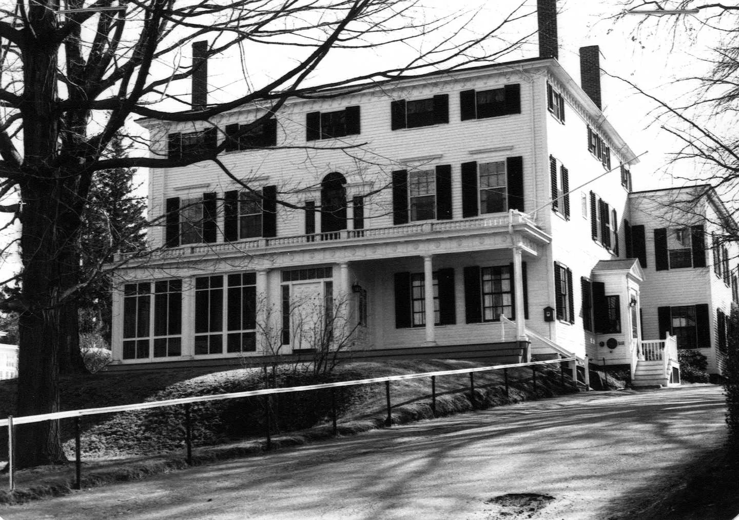
Walk · 130 yardsContinue down this side of High Street about 130 yards. The three-storey house on your left, number 75, was the Old Ladies' Home.
Stop 8 · c. 1797
75 High Street
Ebenezer Stocker–William Wheelwright House
Photo: Massachusetts Historical Commission, MACRIS inventory
Currier's “Ould Newbury” traces this land back to Benjamin Coker's field, and says that in 1700 there were only two houses on the whole upper side of High Street between Frog Pond and Federal Street. Dorcas Noyes sold three acres here to Ebenezer Stocker on May 8, 1797; Stocker sold half of it to Ebenezer Wheelwright in 1800 and, Currier says, “On the other half of this lot Ebenezer Stocker built the house afterward purchased by William Wheelwright, Esq., and now known as the Old Ladies' Home.” Bayley and Jones's Marine Society history has Captain Stocker joining the society in 1780, a banker with Captain William Farris, president of the Marine Insurance Company from 1799 to 1819 and a selectman in 1796 and 1797. Hale, who calls this the Wheelwright House, lists Stocker until 1808 and then a run of owners to the Wheelwright family. The William Wheelwright who bought it was the famous one. “Ould Newbury” gives him a chapter: born in 1798 in the house next door, a sea captain at nineteen, wrecked near the River Plate in 1823, United States consul at Guayaquil, founder of the Pacific Steam Navigation Company in 1838, and the builder of the first railway in South America, from Caldera to Copiapó. “In 1841, he purchased, for the use of his father, mother, and sisters, a dwelling-house on High Street in Newburyport, Mass., which remained in the family for many years.” The second volume of Currier's History says his widow, Martha G. Wheelwright, left the house at her death on August 30, 1888, to the society that ran the Old Ladies' Home, and that apart from alterations at the rear it was then unchanged.
Sources: Currier, “Ould Newbury” (1896), ch. "Watts' Cellar and Frog Pond" · Currier, “Ould Newbury” (1896), ch. "William Wheelwright" · Bayley and Jones, History of the Marine Society (1906), p. 332 · Hale, Old Newburyport Houses (1912), p. 53 · Currier, History of Newburyport, vol. 2 (1909), p. 139
Walk · a few stepsNext door, on your left, is the mansarded house with the cupola and the projecting centre, number 73. look: A Second Empire makeover of about 1860 on a house of 1800: mansard, dormers, bracketed cupola.
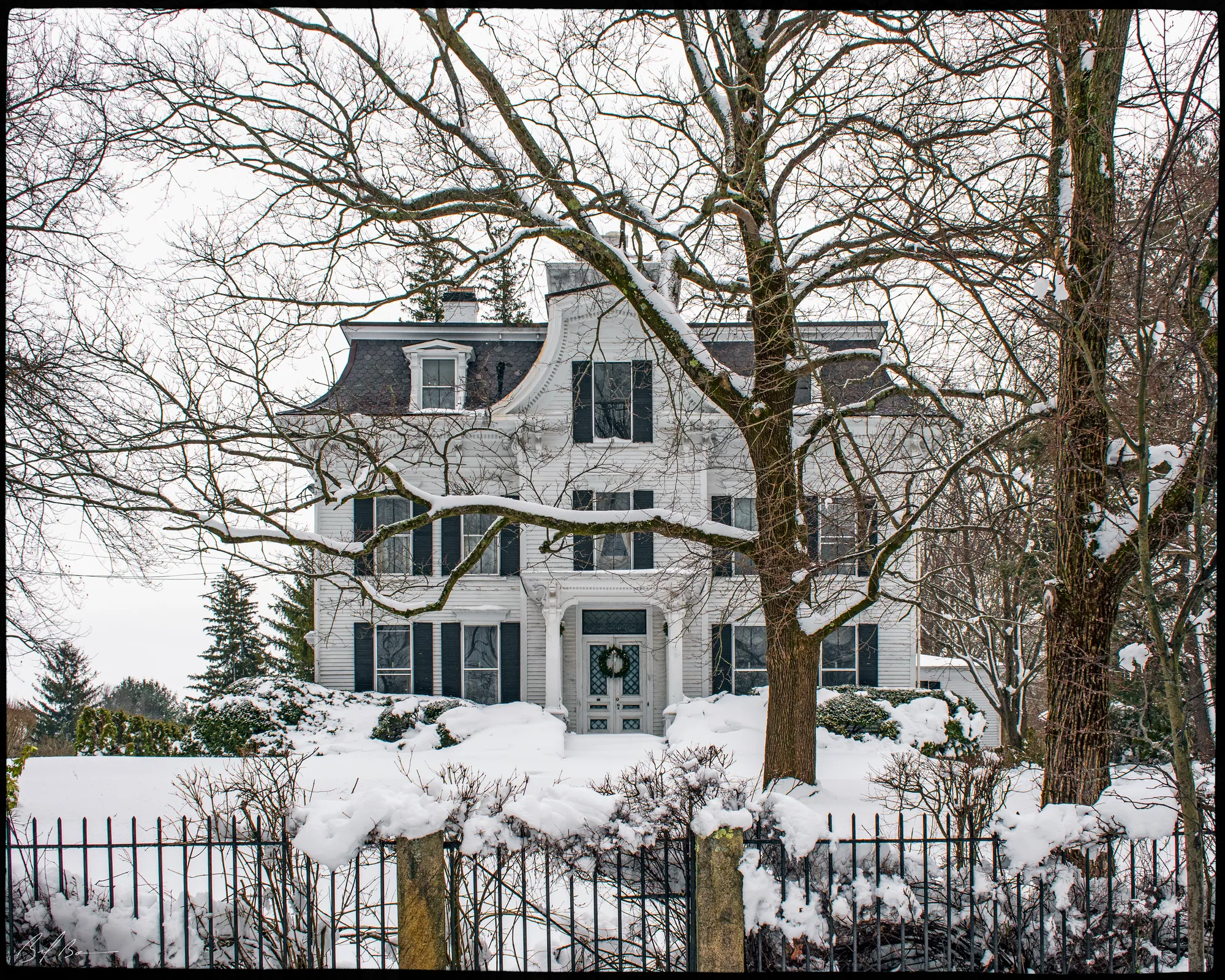
The historian built nothing here, but he lived here. “Ould Newbury” says Ebenezer Wheelwright built a house in 1800 on the acre and a half he had bought from Ebenezer Stocker, and that it was “now owned and occupied by the writer of this sketch,” John J. Currier, who bought it from the heirs of Sarah Chickering on November 10, 1871. Currier gives the deeds in between: the Wheelwrights to Peter LeBreton in 1812, back to Ebenezer Wheelwright in 1813, to James Meyer in 1821, and through Jeremiah Nelson, William Alexander and John Chickering to the Chickering family in 1840. The inventory form says the house was extensively rebuilt about 1860 in the Second Empire style, and that in 1872 it was owned by Currier, part-owner of ships from his father's yard, treasurer of the Bayley Hat Company, mayor in 1879 and author of the histories this walk relies on. Ebenezer Wheelwright, the first owner, was a shipmaster in early life, Currier says, and the father of William Wheelwright, who grew up in this house; Currier's 1906 History also shows him as a man who wanted to change the map. In 1821 the town voted to support a petition to the General Court by Ebenezer Wheelwright and others asking that Newburyport's boundary on this side be pushed out into Newbury, which would have brought his own house into the town; the legislature gave the petitioners leave to withdraw, and tried again in 1828 with the same result. He had to wait for 1851.
Sources: Currier, “Ould Newbury” (1896), ch. "Watts' Cellar and Frog Pond" · Currier, “Ould Newbury” (1896), ch. "William Wheelwright" · MACRIS inventory form · Currier, History of Newburyport, vol. 1 (1906), pp. 203–206
Walk · 130 yardsCarry on down this side for about 130 yards. Federal Street comes down to High Street on the opposite side; a little past it, on your left and set behind its fence, is the terraced house with the two-storey entrance pavilion, number 63. look: The Palladian window over the Ionic portico, the balustrades on roof and pavilion that match the fence, and the “beehive” cornice moulding the inventory form says is standard in Newburyport.
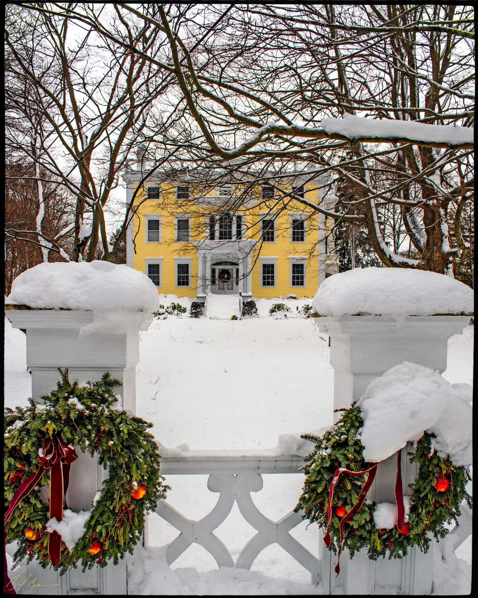
“On the westerly side of High Street, a few rods below the head of Federal Street, stands the house that Caleb Cushing owned and occupied at the time of his death.” That is how “Ould Newbury” opens its chapter on him, and it goes on: the house was built by Richard Pike, who bought five acres here on January 16, 1810, for five thousand dollars, and three or four more acres from Nathaniel Carter. Pike was the man who had owned the Cushing House corner and, with Benjamin Wyatt, the land Fruit Street was cut through; Currier's 1906 History has him among the founders of the Newburyport Library in 1794 and the incorporators of the Academy in 1807. Hurd's History of Essex County says his son, the Reverend John Pike of Rowley, was born in this house in 1815. Pike died in 1827, and after his family and Solomon Haskell, Caleb Cushing bought the house and land on April 27, 1849. Currier is explicit that it was in Newbury then: “This house and land, with other estates in Newbury, were annexed in 1851 to the town of Newburyport,” an act Cushing himself secured in the legislature that year.
The chapter prints a photograph of 1862 with Cushing at the gate and the flag flying over the roof, as it did every day of the war. He sold the house to his brother William in 1868 and bought it back from William's estate in 1877, after Spain. “Once more in the possession of this stately house, the distinguished jurist and statesman lived quietly and peacefully, busy with professional duties until his death, which occurred on the evening of Jan. 2, 1879.” Hale's list ends with Solomon Bachman in 1881, and the inventory form says the house is still called the Pike–Cushing–Bachman House.
Sources: Currier, “Ould Newbury” (1896), ch. "Caleb Cushing" · Currier, History of Newburyport, vol. 1 (1906), pp. 325, 485 · Hurd, History of Essex County, vol. 2 (1888) · Hale, Old Newburyport Houses (1912), p. 56 · MACRIS inventory form
Walk · 240 yardsContinue down this side of High Street about 200 yards, past the foot of Lime Street on the opposite side. Cross High Street at the crossing by Lime Street, so that you are back on the downtown side, and walk on; number 56 is on your left on the corner of Parsons Street.
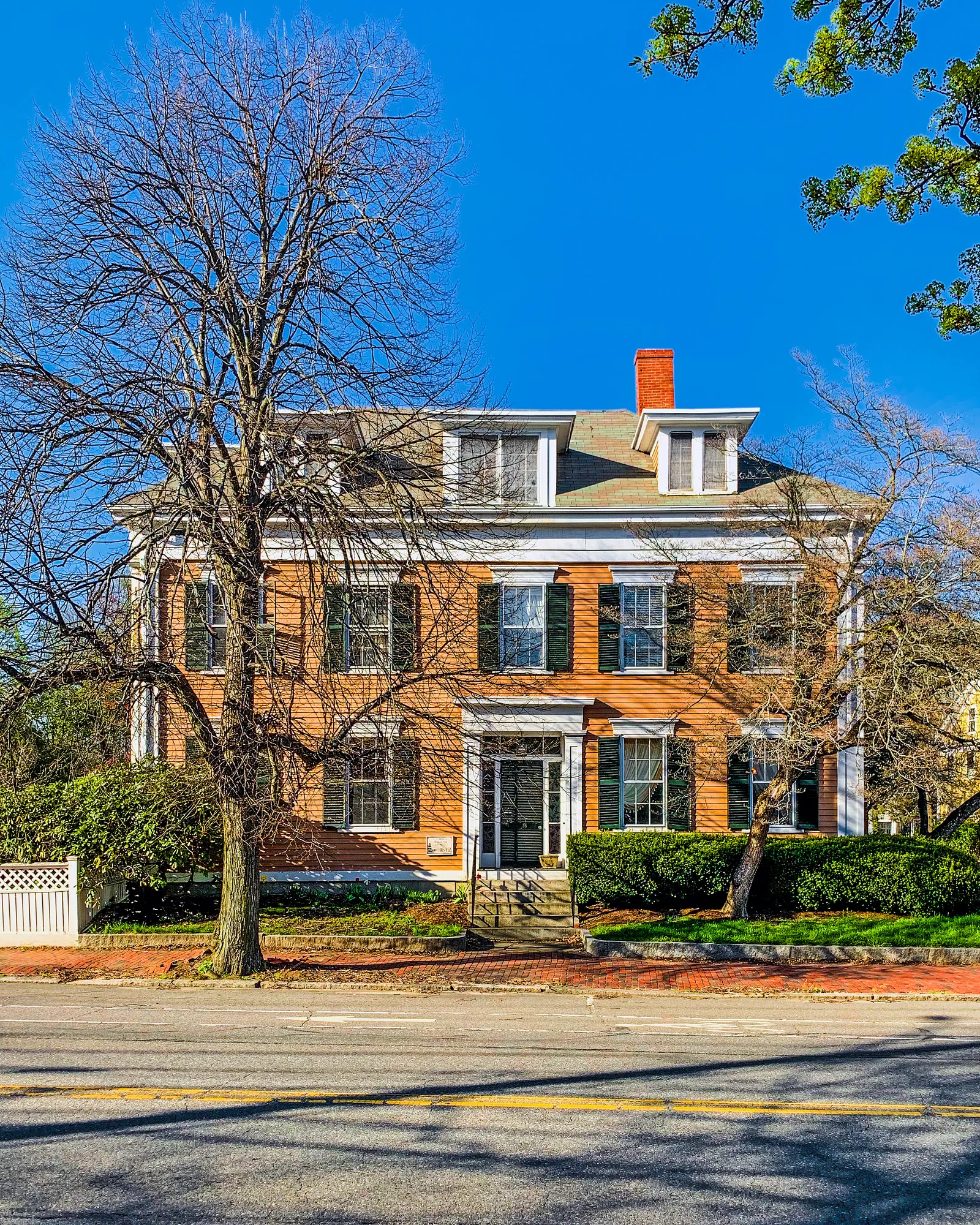
The inventory form is all we have on this one: a Greek Revival house of about 1850. The streets around it have more to say. Currier's 1906 History says the selectmen were asked in 1794 to lay out a street from Norfolk Street, as High Street was then called, down to Lime Street, and that the town accepted the upper end of Lime Street in 1803. The second volume mentions a house built in 1795 by David Coffin on the easterly side of High Street between Lime and Parsons Streets, so the block was being built up before this house arrived. Whoever built number 56 was on the Newburyport side of the line, with Newbury across the road.
Sources: MACRIS inventory form · Currier, History of Newburyport, vol. 1 (1906), pp. 335–336 · Currier, History of Newburyport, vol. 2 (1909), p. 251
Walk · 80 yardsWalk on along the same side for about 80 yards. The side-hall house on your left is 48.
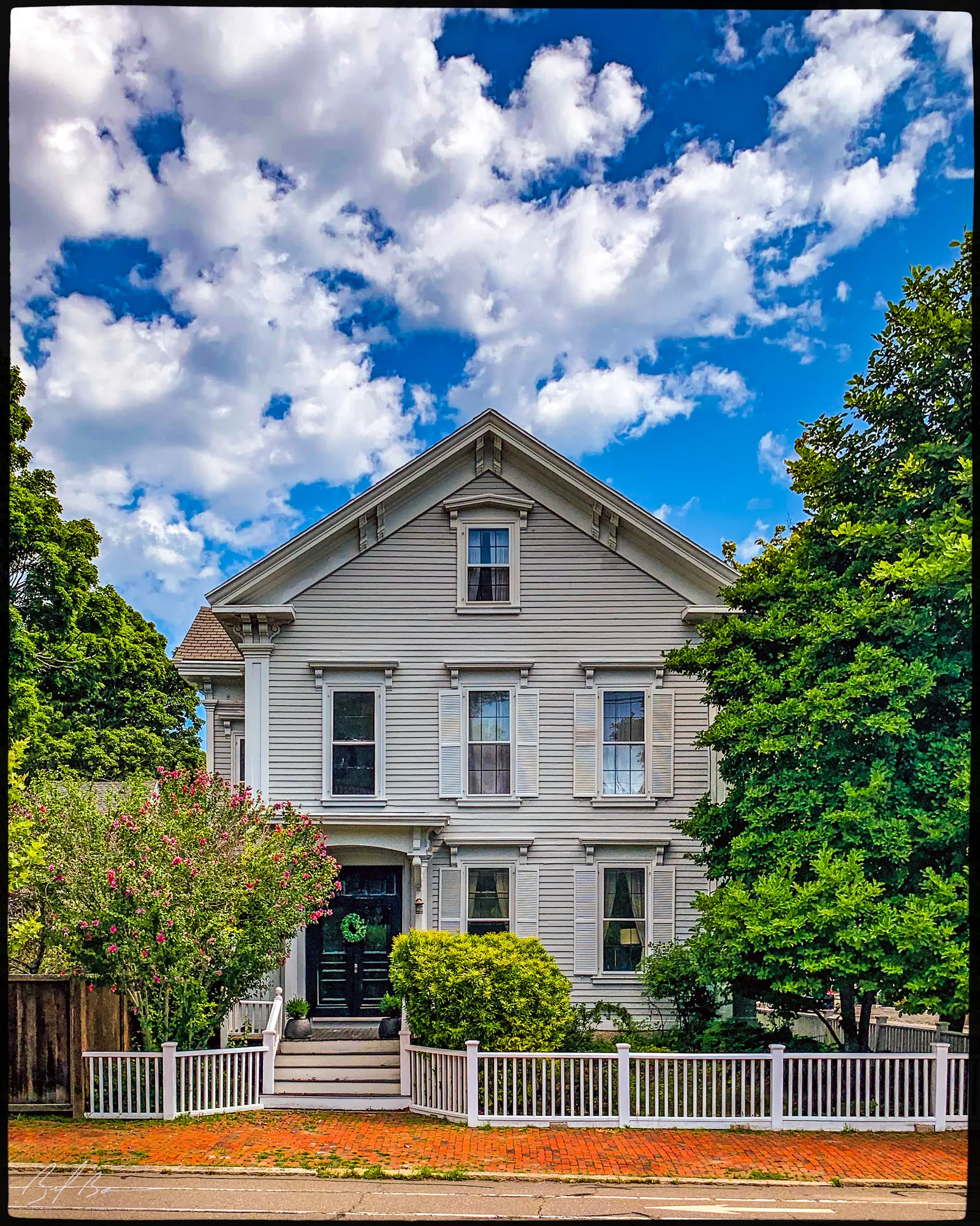
The histories do not mention this house, so the inventory form has to do: a side-hall Italianate house of about 1855. The side-hall plan, with the door at one end of the front rather than the middle, is a mid-century habit, and the three houses on this block, 48, 46 and 42, are a small run of the street's second generation, built after the merchants' square houses and before the Civil War changed the town's fortunes.
Sources: MACRIS inventory form
Walk · a few stepsA few steps on, still on your left, is 46.
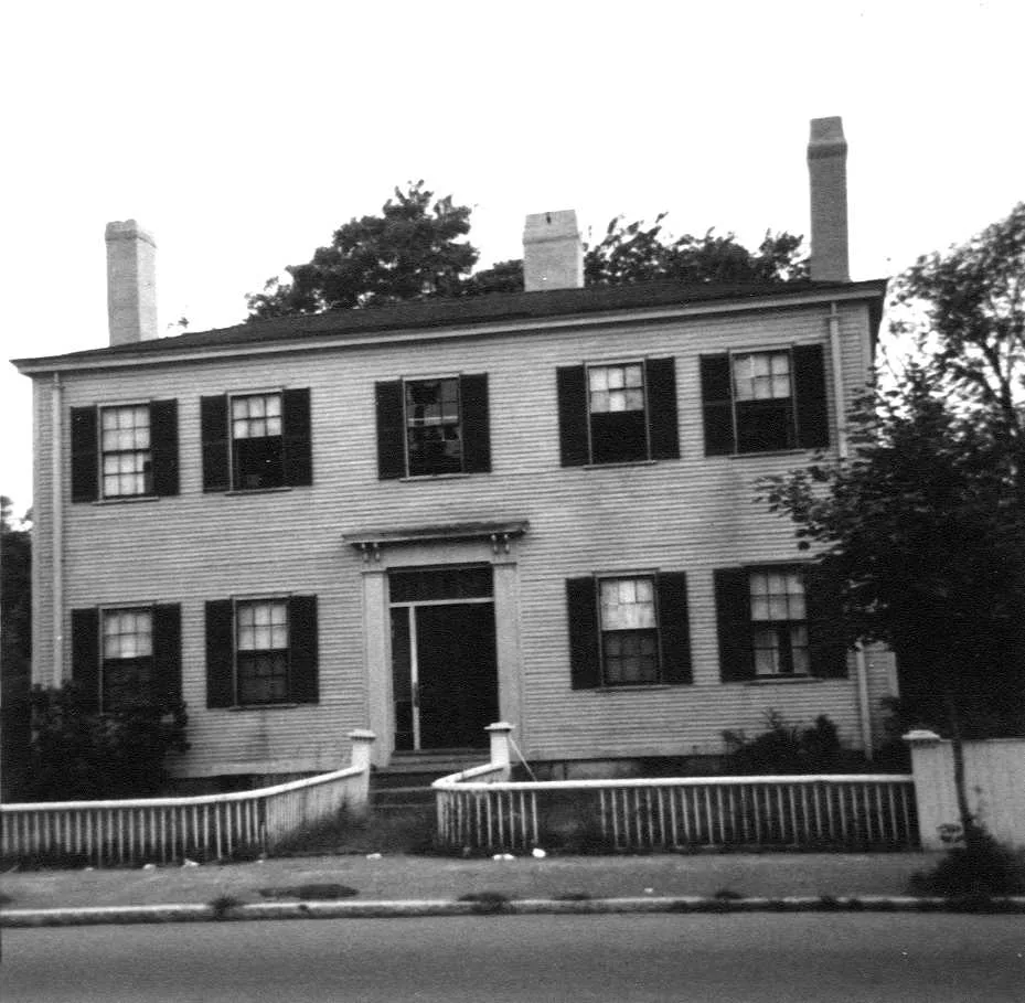
The inventory form dates this one to about 1800 and calls it Federal, which makes it the oldest of the three houses on this short stretch, older than its neighbours on either side. Nothing in the old histories picks it out, so we leave it at that and walk on.
Sources: MACRIS inventory form
Walk · a few stepsA few steps further along, on your left, is 42 High Street.
Stop 14 · c. 1870
42 High Street
The state inventory records this house as an Italianate single-family dwelling of about 1870, inside the National Register district; there is no form to summarize and no page on this site yet. By 1870 the whole street had been Newburyport for nineteen years, and the house belongs to the years when Currier's histories say the shipyards were going quiet and the hat and shoe factories were taking their place.
Sources: MACRIS inventory form
Walk · 480 yardsTurn round and walk back up High Street about 130 yards to the corner of Parsons Street, which comes in on your right. Cross High Street at the corner and go down Coffins Court, the lane directly opposite Parsons Street. Follow it for about 200 yards, then bear left onto the unpaved path and climb about 100 yards to the open top of March's Hill. Stand where you can see out toward the river mouth.
Stop 15
March’s Hill
Mrs. Smith's History of 1854 describes what happened here in the summer of 1813, when British cruisers were taking small vessels off Cape Ann and the Isles of Shoals: “An observatory, furnished with a telescope, was erected on the high ground called Lunt's hill, near the head of South street, for the purpose of watching the movements of vessels off the coast.” Her chronology dates it to July 1813. The second volume of Currier's History says the same thing with the modern name: “An observatory erected on Lunt's hill, in Newbury, now March's hill, Newburyport, was supplied with field-glasses and telescopes for the purpose of watching the movement of vessels approaching the mouth of Merrimack river.” Smith says the Silver Greys, a hundred and ten men of wealth and standing, drilled once a week with musket, bayonet and twenty-four rounds each, and the fire companies built a battery on the Plum Island turnpike; the British never tried a landing. South Street is Bromfield Street now, the next street down, and Currier says it was the town line, so the lookout was just outside Newburyport.
The name is older than the war. In its chapter on the Blue Anchor Tavern, “Ould Newbury” follows Captain John March, who kept the tavern and was granted a ferry over the Merrimack in 1687: the bounds of his estate are vague, but “It is probable, however, that the westerly limit extended to, and perhaps included, the high land that is known as March's hill.” By Currier's day it was the city's place for fireworks: the Fourth of July of 1893, when the Garrison statue was presented, ended with a display here. The inventory form says the hill was given to the city in 1954.
Sources: Smith, History of Newburyport (1854), pp. 202, 398 · Currier, History of Newburyport, vol. 2 (1909), p. 515 · Currier, “Ould Newbury” (1896), ch. "The Blue Anchor Tavern" · Currier, History of Newburyport, vol. 1 (1906), pp. 335, 440 · MACRIS inventory form
Walk · 390 yardsGo back down the path and along Coffins Court to High Street and turn left. About 60 yards along, on your left, behind its fence and terraced garden, is 47. look: The fence and the roof balustrade match, and the fanlight keeps its original tracery; the terraces behind date from the house's first years.
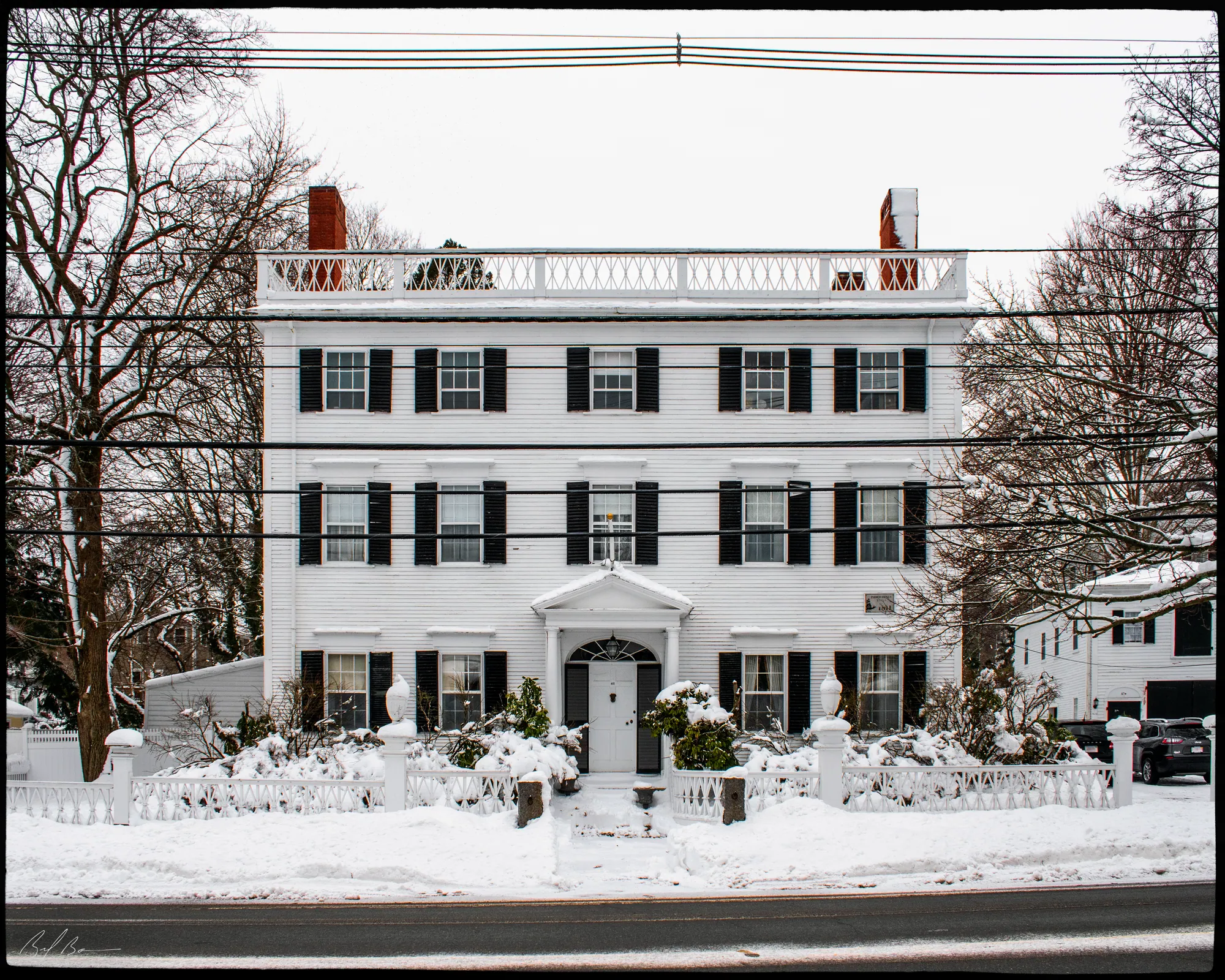
Sarah Anna Emery knew the man who built this. Writing of the War of 1812, when Federalist Newburyport disapproved of privateering but did it anyway, she says: “One of the most active in this business was Capt. Benjamin Pierce, a wealthy and influential citizen, largely interested in shipping. During the war he fitted out several armed vessels at his own expense and tendered them to the government.” She names one of them, the brig Decatur, under Captain William Nichols, and remembers the sound of her guns in July 1812 as she came up the river gay with flags, with two English prizes behind her. Currier's 1906 History gives the Decatur fourteen guns and a hundred and sixty men, fifty-four prisoners landed on September 23, and her capture by the frigate Surprise in January 1813; Hurd's History of Essex County says Pierce was her principal owner, and that he gave the brig Alert to the government outright. Bayley and Jones's Marine Society history has Captain Benjamin Peirce proposed for membership by Captain Stocker in 1802. Emery continues: “After the fire of 1811 Capt. Pierce built the mansion on High street, which after his decease came into the possession of Mrs. Knapp, where she resided until her death.” Hale, who photographed the old garden for his book, says the land was bought in 1809, the house built by Pierce and occupied until his death in 1831, and that the Knapp family kept it until 1898. The inventory form adds Joseph J. Knapp's trade, flour and grain on Ferry Wharf, and his interest in ships from the Currier yard, and says the house still belongs to a descendant of its builder.
Sources: Emery, Reminiscences of a Nonagenarian (1879), p. 276 · Currier, History of Newburyport, vol. 1 (1906), pp. 650–651 · Hurd, History of Essex County, vol. 2 (1888) · Bayley and Jones, History of the Marine Society (1906), pp. 90–91 · Hale, Old Newburyport Houses (1912), p. 60 · MACRIS inventory form
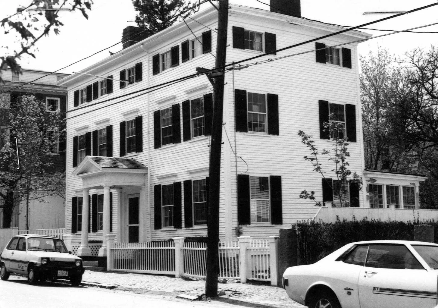
Walk · 560 yardsWalk back up High Street on this side, the ridge side, for about a quarter of a mile, past the Cushing house at 63, the Wheelwright houses and the old Academy. Opposite the Academy, cross High Street at the Fruit Street crossing and turn right down Fruit Street, with the Cushing House garden wall on your right. About 50 yards down, on your left, is 20 Fruit Street.
Stop 17 · c. 1801
20 Fruit Street
Perley Tenney–Capt. Lawrence W. Brown House
Photo: Massachusetts Historical Commission, MACRIS inventory
Currier's 1906 History says “The way from High street to Prospect street was called Fruit street as early as 1801,” though the selectmen did not formally lay it out until May 8, 1826, through land of Green Sanborn and Moses Brown on the one side and John N. Cushing and Daniel Foster on the other. The inventory forms for the houses along it say the whole tract, from High Street to Prospect Street, was sold by Benjamin Balch to Benjamin Wyatt and Richard Pike in 1798, and the street was cut through the middle of it. The form for this house dates it to about 1801 and names Perley Tenney and Captain Lawrence W. Brown; the histories have nothing on either, so the form is all we have. You are now back on the Newburyport side of the old line, on a street of sea captains' houses built in the ten years after 1798.
Sources: Currier, History of Newburyport, vol. 1 (1906), pp. 335–337 · MACRIS inventory form
Walk · a few stepsA few steps further down, on your left, is the three-storey hip-roofed house with the enclosed porch, 16-18, and beside it a driveway leading back to a three-storey brick building. look: The brick building behind the house is where the bank notes were printed.
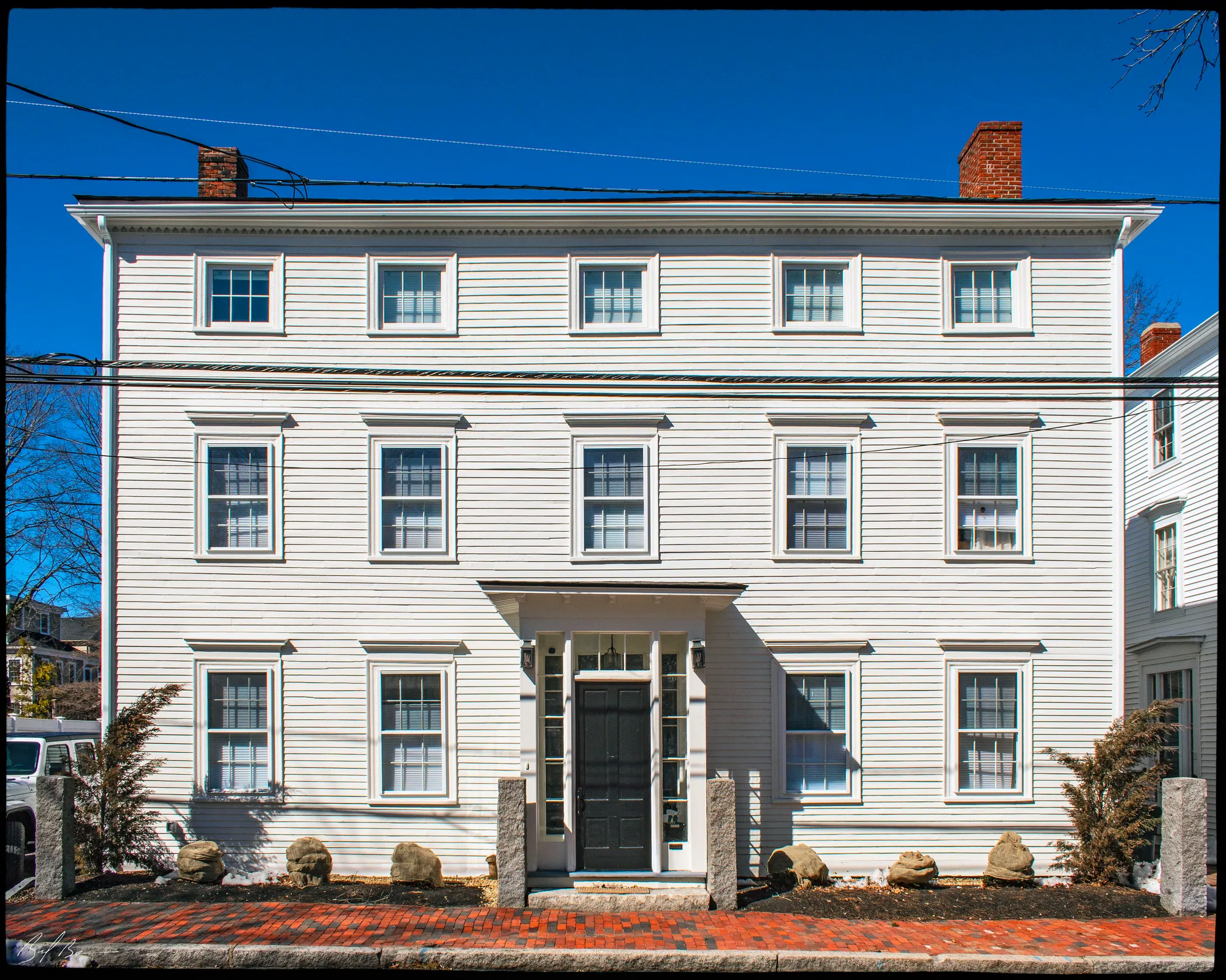
Jacob Perkins lived here. The second volume of Currier's History gives him a long notice: born in Newburyport on July 9, 1766, apprenticed to a goldsmith at twelve, maker of the dies for the Massachusetts copper cent before 1788, inventor in 1795 of a machine that cut and headed nails in one motion, and in 1799 of a way of printing bank notes from hardened steel plates that could not be counterfeited. Currier says he gave a mortgage deed of his house and land on this side of Fruit Street in July 1808, and that “The brick building in which most of these bills were printed is still standing in the rear of the dwelling house No. 18 Fruit street, formerly owned by Jacob Perkins and afterwards by his brother Abraham.” Perkins went to Philadelphia in 1816 and to London in 1819 to sell his plates to the Bank of England; he stayed, supplied the Bank of Ireland, and Currier quotes Sir Rowland Hill on the first postage stamps of 1840 being produced by the process invented by the late Mr. Perkins. He died in London on July 30, 1849. His brother Abraham printed bills here for most of the banks of New England; the Herald of May 20, 1825, Currier says, reminded its readers that “there is more money made in Newburyport than in any other town in the Commonwealth.” After Abraham's death in 1839 the property went to Daniel Silloway and then Daniel S. Poor. The inventory form follows the tenants of the next century, among them the architect Rufus Sargent at number 18 in 1870, and says a later owner gave five thousand bricks from the old printing house to restore the chimney of the Jackman–Willett house in Newbury.
Sources: Currier, History of Newburyport, vol. 2 (1909), pp. 362–371 · MACRIS inventory form
Walk · a few stepsNext door, on your left, is the narrow three-storey house with its gable end to the street, number 14.
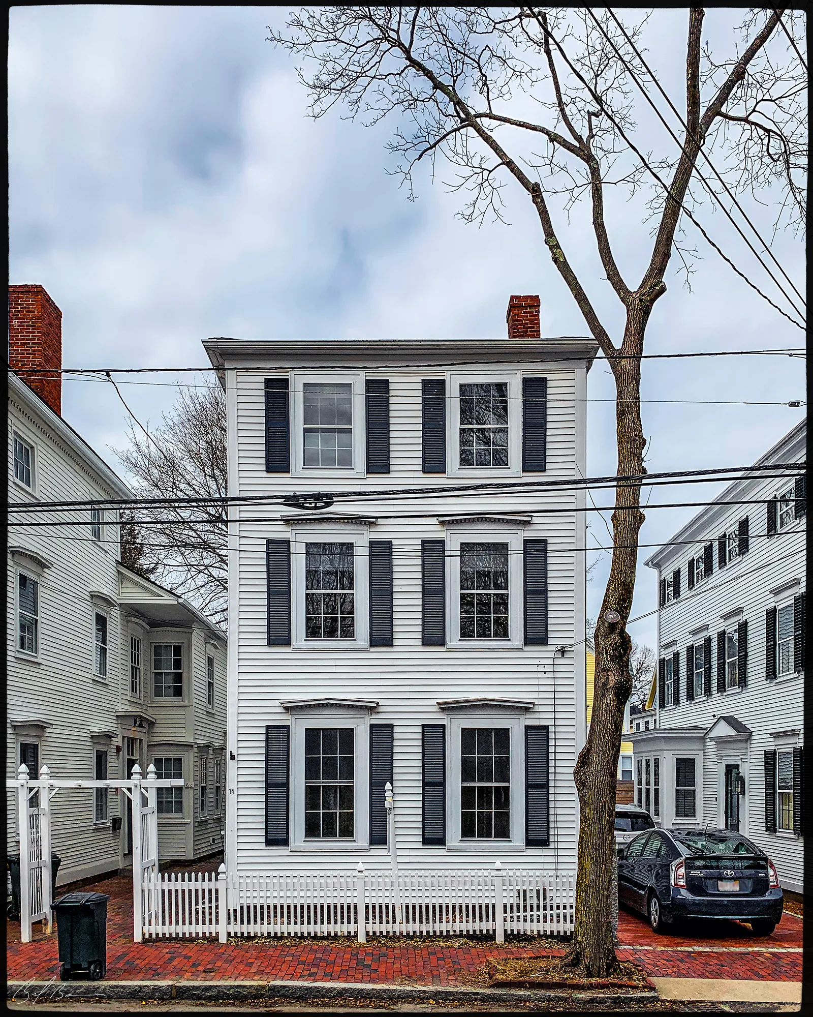
The inventory form says this is one of only two houses on the street built after 1850. Daniel Silloway, a carpenter who had owned the Perkins house next door, is the builder: his wife Isabel bought the land in 1876 and 1877, the house went up soon after, and the lintels on the north side of 16–18 were altered to match the new neighbour. Currier's second volume names the same Daniel Silloway as the buyer of the Perkins property from Abraham Perkins's administrator. The form has the carpenter living here in 1880, aged sixty-six, and dying in January 1896; by 1900 the house was the attorney John Bayley's.
Sources: MACRIS inventory form · Currier, History of Newburyport, vol. 2 (1909), p. 371
Walk · a few stepsNext door again, on your left, is the double house, 10–12.
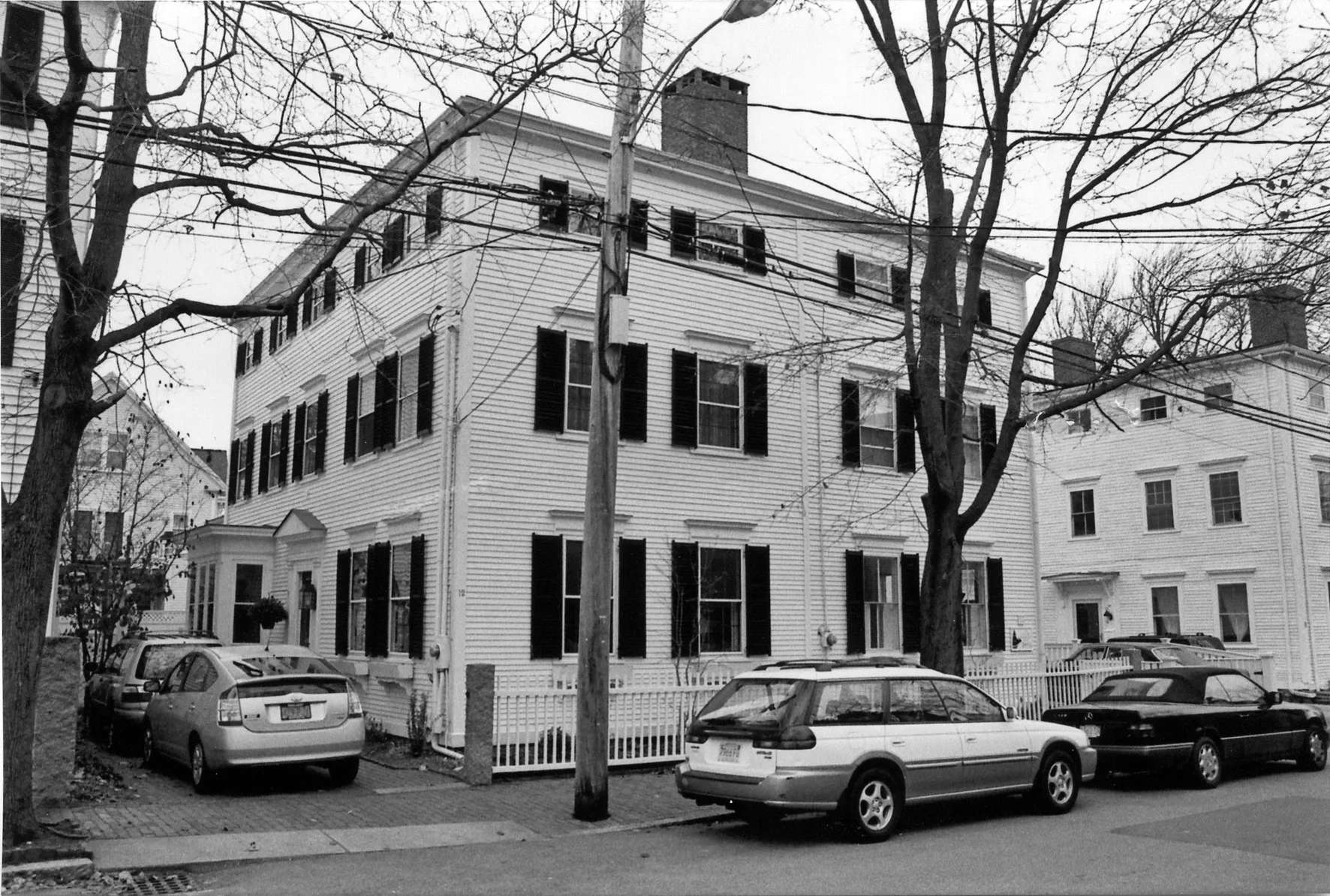
Stop 20 · c. 1805
10–12 Fruit Street
Perley Tenney–Thomas W. Burnham Double House
Photo: Massachusetts Historical Commission, MACRIS inventory
A Federal double house of about 1805, the inventory form says, built by Perley Tenney and later the home of Thomas W. Burnham. The Old South's Origin and Annals of 1896, listing where the church's ministers had lived before it owned a parsonage, says Dr. Stearns, who was pastor for fourteen years from 1835, rented “first living at 10 Fruit street, the present home of Miss Mary C. Burnham, and afterwards at 9 Fruit street,” across the way. That is the only notice the books give it.
Sources: MACRIS inventory form · Origin and Annals of “The Old South” (1896), p. 209
Walk · a few stepsNext door on your left is a second double house, 6–8.
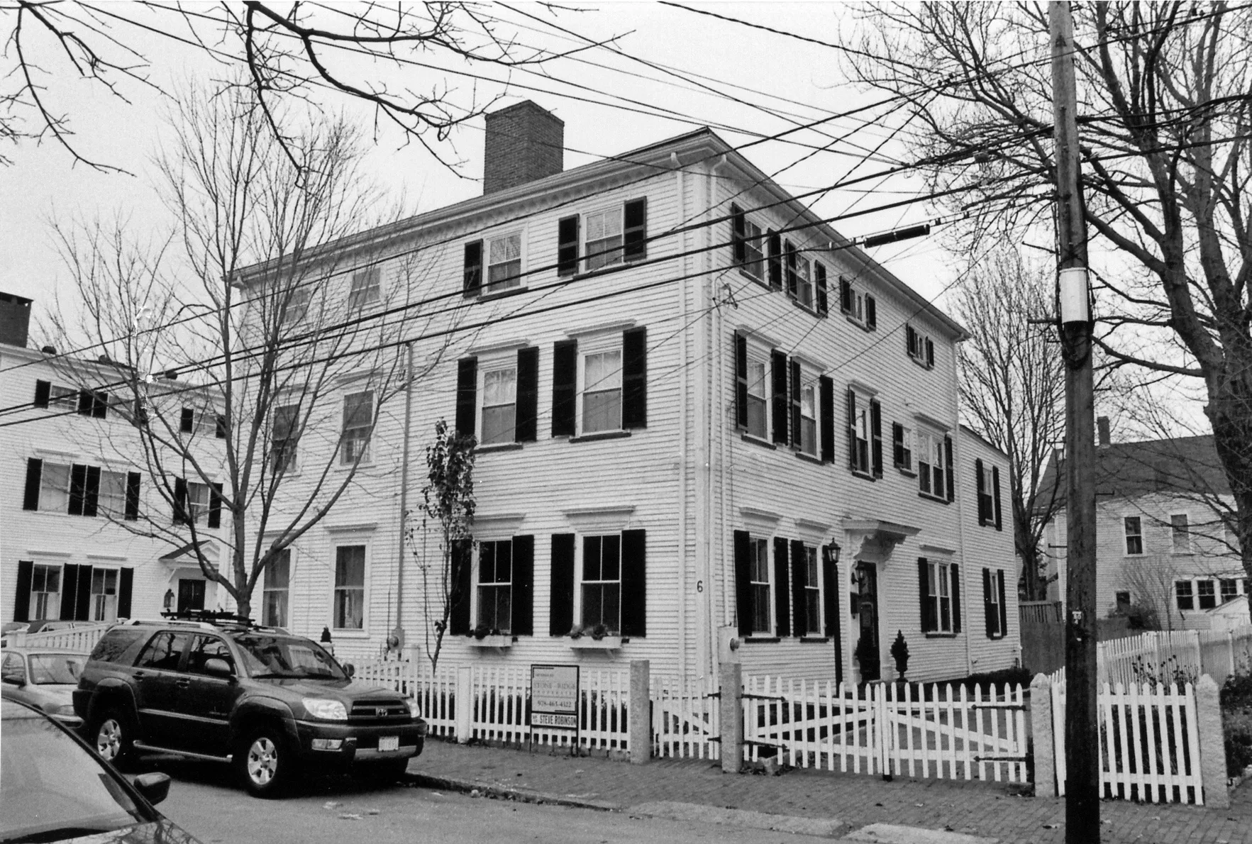
Stop 21 · c. 1805
6–8 Fruit Street
Perley Tenney Double House
Photo: Massachusetts Historical Commission, MACRIS inventory
Another Perley Tenney double house of about 1805, according to the inventory form, which is all we have on it. Two double houses side by side, built by the same man in the same year, look like a small speculation: Tenney building to let or to sell on the new street, in the busy years before the Embargo of 1807 shut the port.
Sources: MACRIS inventory form
Walk · a few stepsA few steps further, on your left at the bottom of the street, on the corner of Prospect Street, is the last double house, 2–4. look: The arcaded cornice under the eaves, which the inventory form says it shares with the Perkins house up the street.
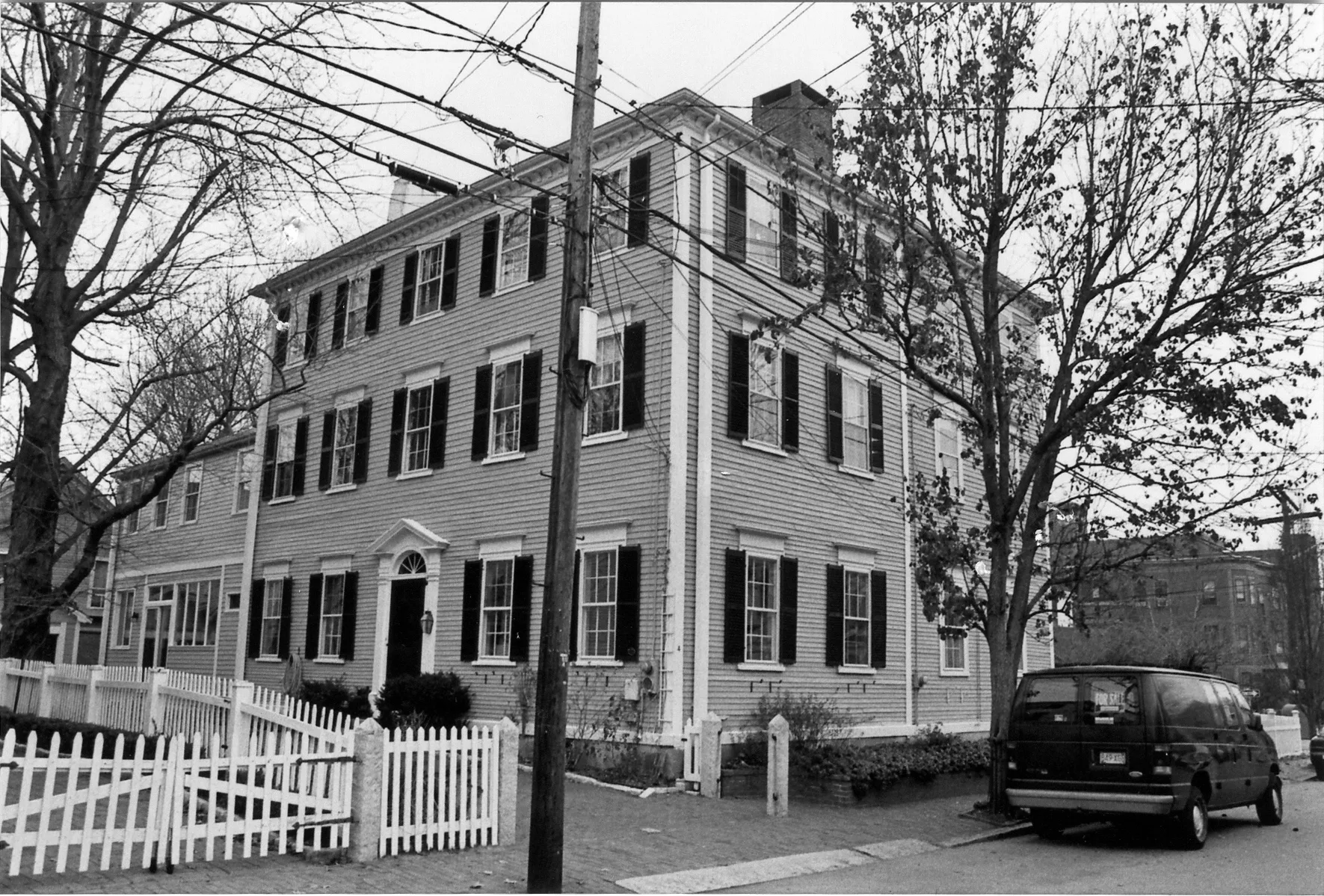
Stop 22 · c. 1807
2–4 Fruit Street
Joseph Noyes IV Double House
Photo: Massachusetts Historical Commission, MACRIS inventory
The inventory form names Joseph Noyes the fourth as builder, in 1807, and from its account of 9 Fruit Street we know a little more: Noyes was a painter who bought the lot across the street from Pike and Wyatt in 1805, built a house there and sold it in 1807, then built this one and lived at number 4 until about 1811. Bayley and Jones's Marine Society history lists a Captain Joseph Noyes, 4th, admitted in 1795 and lost at sea in 1796 in the sloop Nancy, who cannot be the painter of 1807, so the name was in more than one family. Currier's 1906 History says the bottom of Fruit Street was joined to Fair Street in 1846 to make a straight road; that is the junction in front of you.
Sources: MACRIS inventory form · Bayley and Jones, History of the Marine Society (1906), p. 357 · Currier, History of Newburyport, vol. 1 (1906), p. 338
Walk · a few stepsCross Fruit Street here at the corner. The three-storey clapboarded house on the opposite corner of Prospect Street, now on your right as you face back up Fruit Street, is number 1.
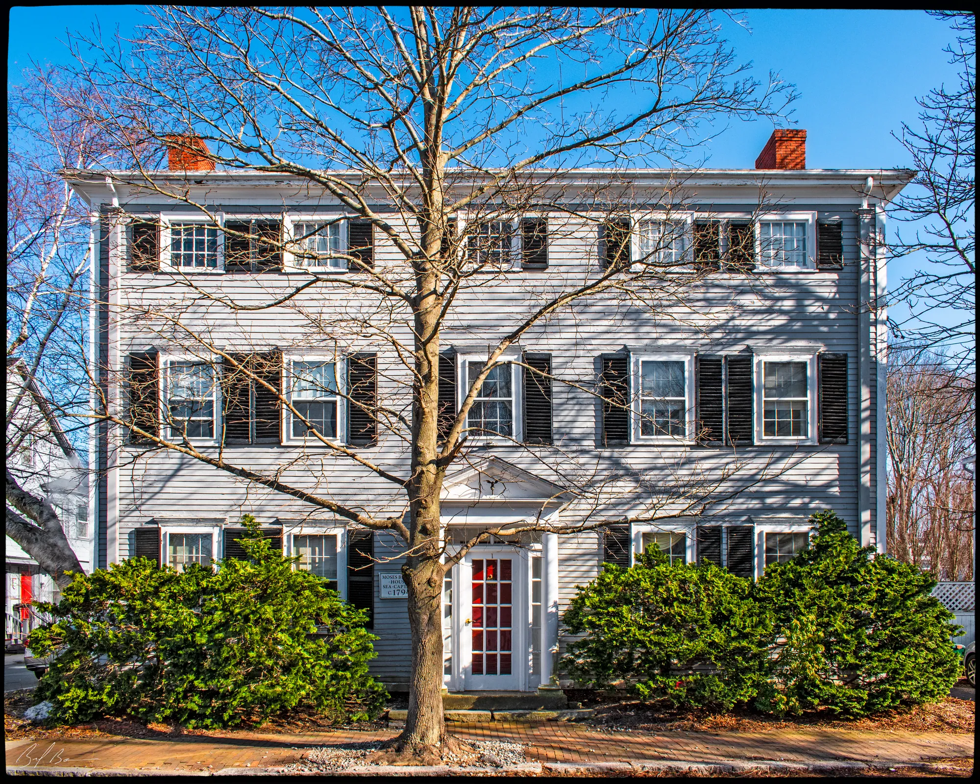
The inventory form believes this house was built in 1794 by Captain Moses Brown, the privateer. Bayley and Jones's Marine Society history prints his life as his great-grandson, Mayor Moses Brown, wrote it: born January 23, 1742, to sea at fifteen, wounded in a fight with two French privateers at nineteen, master of the brig Martha by 1772, home from London in December 1776 to find “the country all in arms.” He commanded the privateer General Arnold on three cruises; Currier's 1906 History quotes his own journal of the first, “The first gun that was fired burst and killed or wounded all my officers,” and prints the British captain's account of the two-hour fight with the Gregson of Liverpool in 1779. In 1798, Bayley says, he was commissioned a captain in the navy and given the Merrimack, the sloop of war the merchants of this town built and lent to the government; Currier's History has him marching a procession of young men to the shipyard on the Fourth of July that year to cheer the carpenters. On his forty-eighth birthday in 1790, at Paramaribo, Captains Wheelwright, Wills and Holland of Newburyport dined with him, which is to say three neighbours from this walk. Bayley gives the end: “on Jan. 1, 1804 being homeward bound from Guadaloupe he was seized with apoplexy, dying at the age of 62 years, in sight of Long Island, where he was buried in the sea.” The form says the house passed to a younger Captain Moses Brown, lost at sea in 1819; Bayley's roll has that captain joining the society in 1804, captured in the schooner Venda in 1813, and lost in 1819 aged thirty-five. Brown women lived here, the form says, until 1923.
Sources: MACRIS inventory form · Bayley and Jones, History of the Marine Society (1906), pp. 325–327, 363 · Currier, History of Newburyport, vol. 1 (1906), pp. 430, 631–633
Walk · a few stepsWalk back up Fruit Street on this side; the next house along on your right is 3. look: The pedimented porch with fluted Doric columns and a triglyph frieze; the inventory form says a photograph of it is in Howells's Architectural Heritage of the Merrimack of 1941.
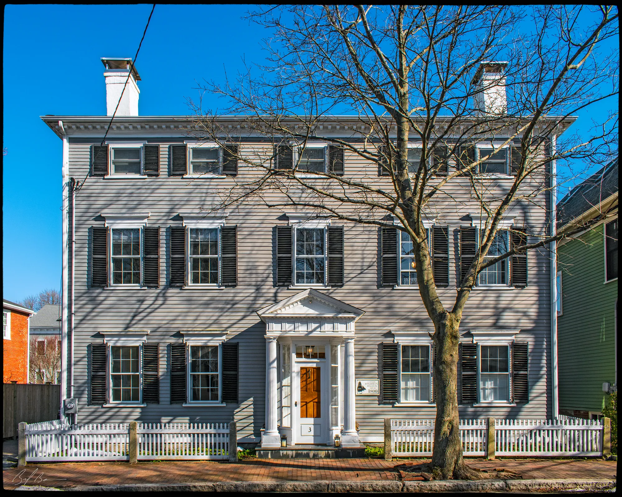
The inventory form prints the deed: on April 16, 1799, Benjamin Wyatt and Richard Pike sold this lot to Captain Jonathan Dalton, mariner, for four hundred and fifty dollars, and the deed already calls Fruit Street “the new street.” Dalton built soon after and did not enjoy it long. Bayley and Jones's Marine Society history has him admitted in November 1799, after a muddle over who was to propose him, and the roll reads “Died at sea, Aug. 8, 1802.” It adds two voyages: his brig Margaret was confiscated by the British, and in January 1799 he brought the brig Atlantic in from Hamburg after seventy-eight days, having lost his mate, Richard Pierce, and a seaman washed overboard. His son sold the house in 1829 to Michael Titcomb, a mastmaker, the form says, and after Titcomb's death the Second Presbyterian Society rented it out; the architect Rufus Sargent lived here in the 1870s before moving across to number 18.
Sources: MACRIS inventory form · Bayley and Jones, History of the Marine Society (1906), pp. 84–85, 360
Walk · a few stepsNext door on your right is the Queen Anne house, number 5.
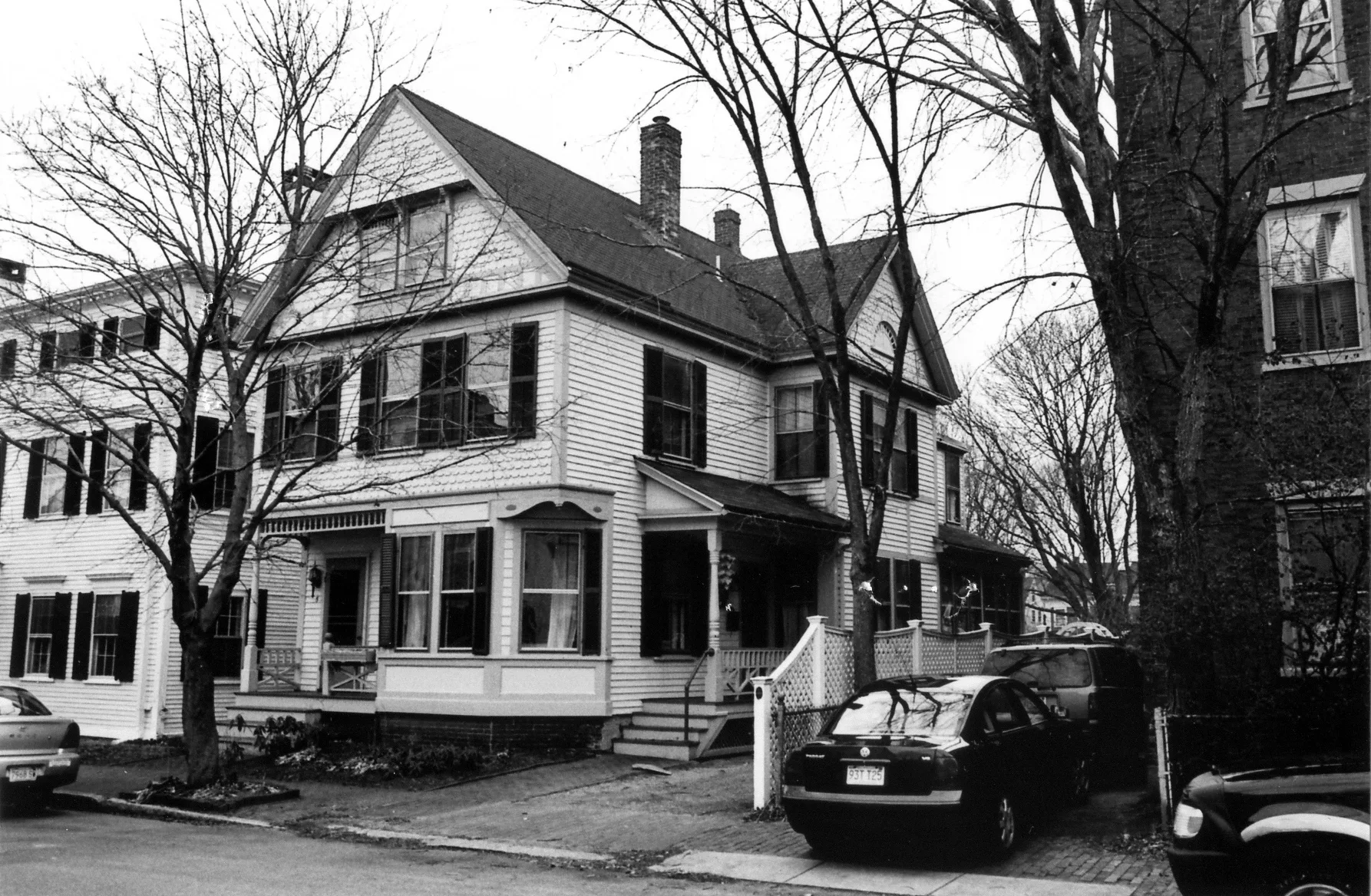
Stop 25 · c. 1891
5 Fruit Street
William H. Safford House
Photo: Massachusetts Historical Commission, MACRIS inventory
The inventory form dates it to about 1891 and names William H. Safford; with 14 across the street it is one of the two houses on Fruit Street built after the Civil War, and it fills what must have been a gap or a garden for ninety years. The histories do not mention it.
Sources: MACRIS inventory form
Walk · a few stepsNext door on your right is 7.
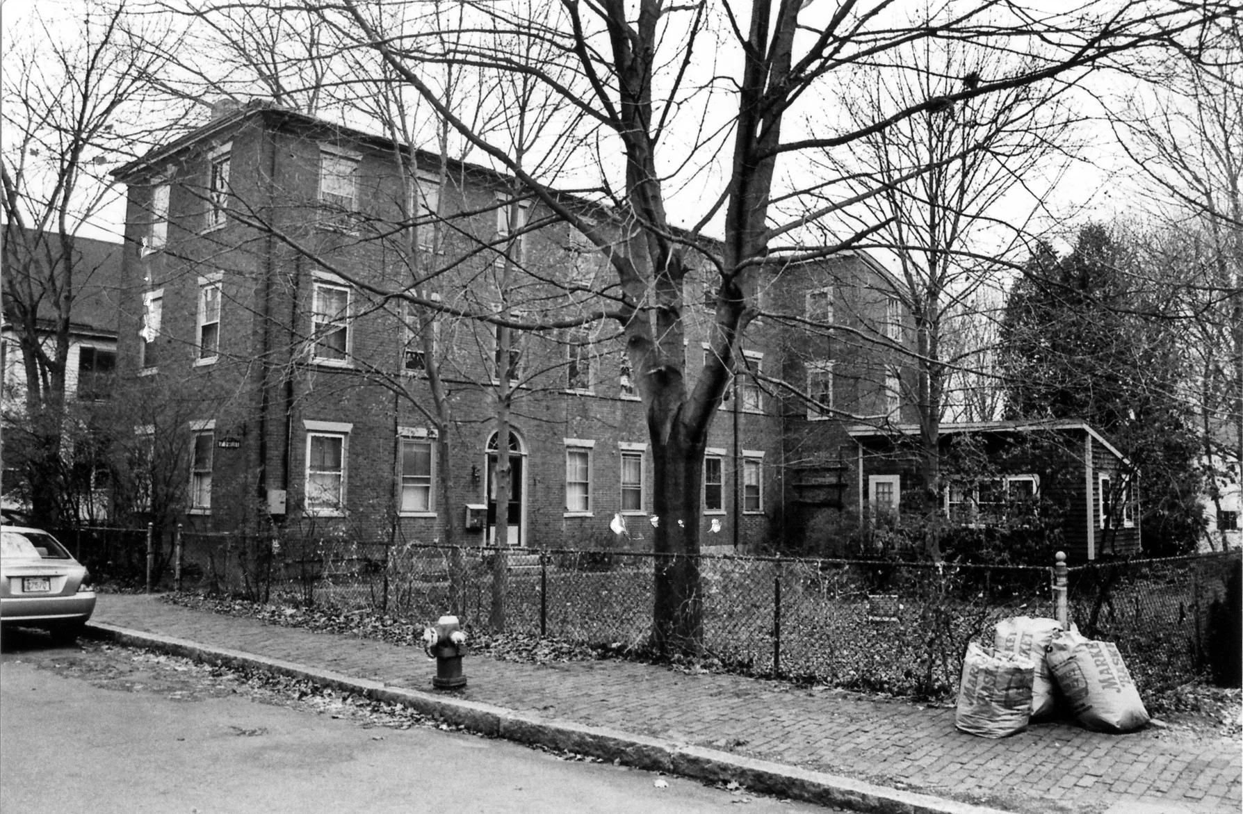
Stop 26 · c. 1810
7 Fruit Street
Anthony Stickney Jones House
Photo: Massachusetts Historical Commission, MACRIS inventory
The inventory form calls this the Anthony Stickney Jones House and dates it to about 1810. Hurd's History of Essex County of 1888 tells us who Dr. Anthony S. Jones was: a great-grandson of Anthony Stickney, the Newbury chaise-maker and captain in the Canada expedition of 1760, and of Dorcas Davenport, Benjamin Franklin's favourite niece, whose engraved likeness of Franklin, inscribed to her, the doctor still owned. His grandfather Anthony Somerby Stickney was a cooper with a shop on Long Wharf and, Hurd says, by contract furnished the timber that went into the hull of the frigate Constitution. Currier's 1906 History has an Anthony S. Jones as collector of the Sunday school society in 1820. How the doctor came to this house the books do not say.
Sources: MACRIS inventory form · Hurd, History of Essex County, vol. 2 (1888) · Currier, History of Newburyport, vol. 1 (1906), p. 331
Walk · a few stepsA few steps on, on your right, is 9.
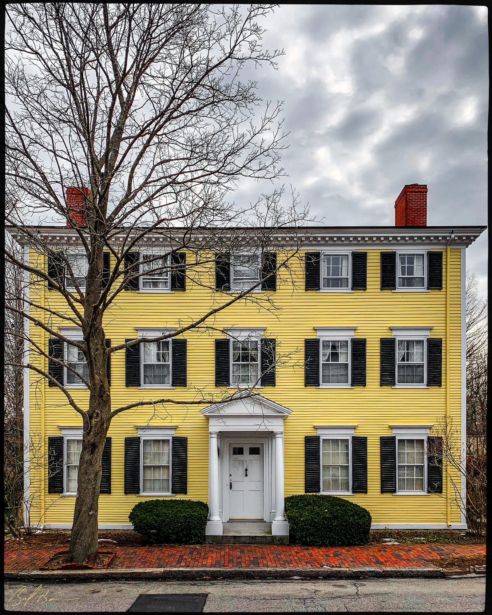
The inventory form says Joseph Noyes the painter bought this lot in 1805 and sold it with a house on it in April 1807 for three thousand five hundred dollars to Peter LeBreton Jr., merchant and son of a shipmaster. Bayley and Jones's Marine Society history has Captain Peter Le Breton Jr. admitted in 1803, secretary of the society from 1815 to 1827, awarded more than eight thousand pounds for the loss of the ship Betsey in 1803, and dead on March 5, 1829, aged fifty. The form traces an odd swap: LeBreton sold this house in 1813, John Wells bought it in 1819, and in 1825 LeBreton took it back in exchange for his house on High Street. Hale's list for the Wills–Richardson House at 71 High Street fits that story from the other end, with Peter LeBreton owning it from 1813 to 1825 and John Wills and his heirs after. LeBreton's family kept this house until 1865, when it went to Susan Brown, whose husband Newman was a coal dealer on Water Street. The Old South annals say Dr. Stearns, the minister, rented it in the 1840s, and that in 1896 it was Dr. John F. Young's; the form has Young buying in 1890.
Sources: MACRIS inventory form · Bayley and Jones, History of the Marine Society (1906), p. 362 · Hale, Old Newburyport Houses (1912), p. 50 · Origin and Annals of “The Old South” (1896), p. 209
Walk · a few stepsA few steps further up, on your right, is 15 Fruit Street, the last stop.
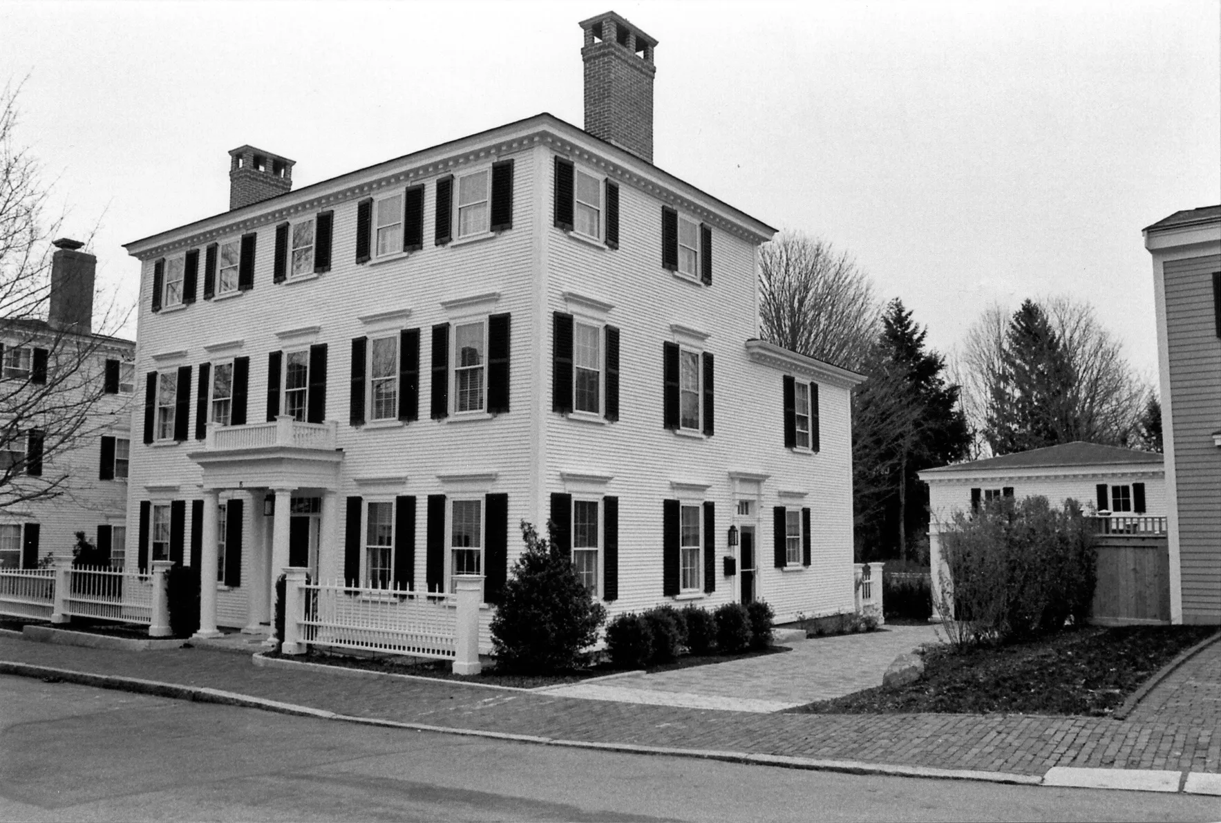
This is the newest house on the walk: the inventory form dates it to about 2004 and calls it Postwar Traditional, a new house built to sit quietly among its Federal neighbours. It stands on the Pike and Wyatt land of 1798 like everything else on the street, and it closes the loop: from here it is sixty yards back up to High Street.
Sources: MACRIS inventory form
Back to the start · 200 yardsWalk up Fruit Street to High Street, about 60 yards, and turn right along the downtown side, past the Cushing House and 102–104. State Street, where you began, is about 130 yards along on your right.
Look back down the street before you leave it. Emery remembered High Street in her childhood as “much more sparsely built than now,” but already “a handsome avenue and a pleasant drive,” and the houses you have passed are the ones that filled it in between 1795 and 1815, when, as Currier's histories show, Newburyport's captains and merchants had the money to build square and three storeys high. For the men on the upper side, Pike, Pierce, Stocker, Wheelwright, the view across the road was of another town until 1851.
Sources for this walk
The script paraphrases and quotes these works, all of them out of copyright, and names each one as it goes. Page numbers are from the editions linked here. Where the script says “our research for this site,” the facts are from the building page it links to.
- John J. Currier, History of Newburyport, Mass., 1764–1905, vol. 1 (Newburyport: the author, 1906). archive.org/details/historyofnewbury01curr
- John J. Currier, History of Newburyport, Mass., 1764–1905, vol. 2 (Newburyport: the author, 1909). archive.org/details/historyofnewbury04curr
- John J. Currier, “Ould Newbury”: Historical and Biographical Sketches (Boston: Damrell & Upham, 1896). archive.org/details/ouldnewburyhisto00curr
- John J. Currier, History of Newbury, Mass., 1635–1902 (Boston: Damrell & Upham, 1902). archive.org/details/historyofnewbury1902curr
- E. Vale Smith, History of Newburyport; from the Earliest Settlement of the Country to the Present Time (Newburyport, 1854). archive.org/details/historyofnewbury00blake
- Sarah Anna Emery, Reminiscences of a Nonagenarian (Newburyport: William H. Huse, 1879). archive.org/details/reminiscencesofn00emer
- Caleb Cushing, The History and Present State of the Town of Newburyport (Newburyport: E. W. Allen, 1826). archive.org/details/historypresentst00cush
- William H. Bayley and Oliver O. Jones, History of the Marine Society of Newburyport, Massachusetts, from Its Incorporation in 1772 to the Year 1906 (Newburyport, 1906). archive.org/details/historyofmarines00baylrich
- Albert Hale, comp., Old Newburyport Houses (Boston: W. B. Clarke Co., 1912). archive.org/details/cu31924015356714
- First Presbyterian Church, Origin and Annals of “The Old South,” First Presbyterian Church and Parish, in Newburyport, Mass., 1746–1896 (Boston: Damrell & Upham, 1896). archive.org/details/originannalsofth00firs
- D. Hamilton Hurd, comp., History of Essex County, Massachusetts, vol. 2 (Philadelphia: J. W. Lewis & Co., 1888). archive.org/details/historyofessexco02hurd
- Massachusetts Historical Commission, Massachusetts Cultural Resource Information System (MACRIS), Newburyport inventory forms. mhc-macris.net
- Biff Bouse, oldnbpt.com building pages (own research from deeds, Sanborn maps and newspapers). oldnbpt.com
More walks: State Street and Market Square · Green Street, Brown Square and Pleasant Street · Federal, Spring and Middle Streets · The Water Street Waterfront · Joppa: The Oldest Houses · Joppa: The Fishing Village · Along the River: The North End Shipyards · The Rail Trail: Mills, Ropewalks and Old Hill · Newburyport in the Civil War · Churchyards and Burying Grounds